Denali National Park encompasses a staggering 9,466 square miles, an area larger than five states (Rhode Island, Delaware, Connecticut, New Jersey and New Hampshire) and Vermont is just 150 square miles larger. However, despite that vastness, Denali NP has only one road that goes into it: 15 miles paved, to Savage River, which is the limit for private vehicles; then an additional 77 miles of unpaved road that is accessible only by buses operated by outfitters, such as Denali Backcountry Adventure, and by the National Park Service. Within Denali NP is the Denali Wilderness which protects the high country of the Alaska Range and covers 3,354 square miles, a little more than one-third of the whole NP. Mount Denali, formerly known as Mount McKinley, is the tallest mountain in North America at 20,310 feet and is in the NP. It has a higher distance between its base and summit than any other mountain in the world, a staggering 18,000 feet.
 |
| Map of Denali NP from Wikipedia. The 92 mile road in starts at the top right in red near the Denali Visitor Center. The first 15 miles of paved road are in red. The remaining 77 miles of unpaved road are in yellow and go southwest. |
 |
| This map of the 92 mile road is also from Wikipedia. |
We visited Alaska in July 2016 and entered Denali NP three times. On Thursday, July 16, we drove from Anchorage to Denali Backcountry Cabins, located at Mile Post 229, 8 miles south of the NP entrance. That is where we spent the next two nights. We drove the 15 miles of paved road into the Savage River late that afternoon and turned around and came back out. We were disappointed because we saw very little wildlife. The next morning, Friday, July 22, we took the bus of Denali Backcountry Adventure to the end of the 92 mile road, ate lunch at the Denali Backcountry Lodge, then drove back out again. The bus left from our cabin at 6:00 a.m. and we got back about 7:00 p.m. We saw several moose, lots of caribou, two separate grizzly bear sightings and dall sheep high up in the mountains. The next morning, Saturday, July 23, we drove 153 miles south to Talkeetna where we took the two hour Grand Denali Tour with Glacier Landing with Talkeetna Air Taxi. We flew around Mount Denali and then landed on Ruth Glacier and spent 15 minutes walking around before we had to fly back to Talkeetna. This flight was one of the highlights of all of our travels. It was amazing.
Some photos of our visit to Denali NP follow:
 |
| Our bus in the foreground. One of the few stops in our day-long journey. |
 |
| The Toklat River. |
 |
| In Kantishna at the end of the 92 mile road. A footbridge over the creek/river to the Denali Backcountry Lodge. |
 |
| Moose in Denali. |
 |
| Porcupine caribou in Denali. |
 |
| Caribou antlers sticking up out of the brush. |
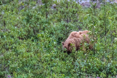 |
| Grizzly bear mother. |
 |
| Grizzly bear cub. |
 |
| Second grizzly sighting. |
 |
| Dall sheep - white specks on the mountain. |
 |
| A cropped view. |
 |
| The Alaska Range from a road outside the park on our way to Talkeetna. |
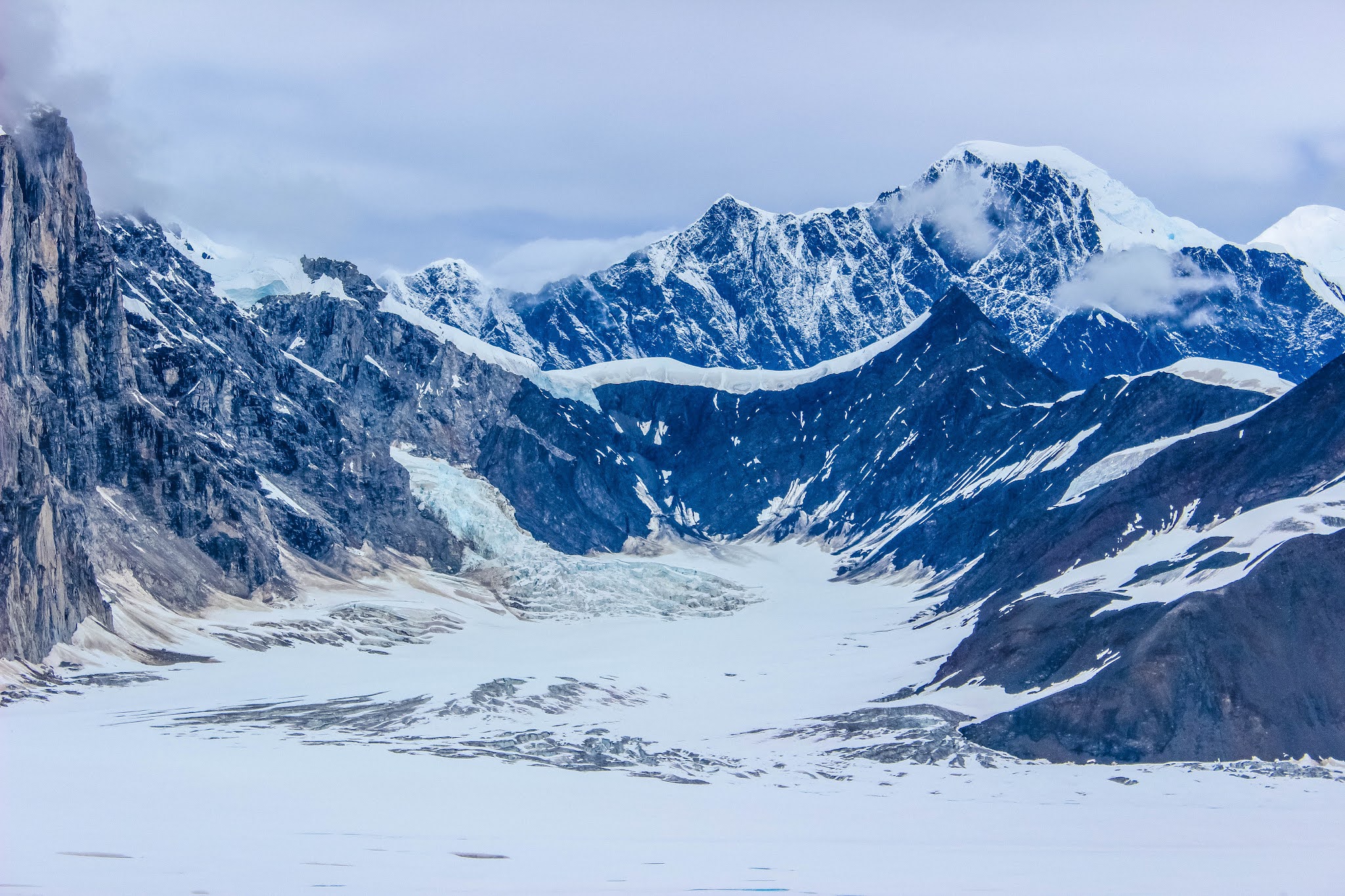
 |
| Flying into the Alaska Range - glaciers on the left and right. |
 |
| Denali was shrouded in clouds, but we were able to get through the cloud layer and see the summit. |
 |
| Our landing on the Ruth Glacier. |
 |
| Another plane on the glacier. |
 |
| Greenery on the way out, back to Talkeetna. |
The vastness and inaccessibility of this national park is hard to wrap your head around. Between taking the only road all the way to the end and the flight into the Alaska Range and around Denali, we did about as much as possible in a short-time frame.


Kind of cool that you can just park on a glacier.
ReplyDeleteThat caribou rack is as big as the animal itself. Great photos. Yes, that landing on Ruth Glacier was definitely one of our Top Twenty Travel Moments. Incredible.
ReplyDeleteGood
ReplyDeleteGreat
ReplyDeleteThis is amazing place. You can wildlife and also enjoy adventures. To explore more we offers alaska denali tours. Visit website to get more details.
ReplyDeleteGood
ReplyDeleteGood
ReplyDelete