Showing posts with label George Q. Cannon: To California in 1849. Show all posts

Sunday, November 21, 2010

GQC: Mojave River to Sycamore Grove

This is a continuation of George Q. Cannon's 1849 journey to California.

December 8, 1849 (Saturday):

Rich Company – Forward Group (Mojave River [Silver Mtn. Road vicinity] to the Cajon Pass):

Charles Rich, with half of the company, started early from Point of Rocks on the Mojave River. After six miles of travel, they crossed the Mojave River near the present town of Oro Grande. They then left the Mojave River and traveled 17 miles to the Cajon Pass where they camped near a spring. There they were met by a wagon loaded with provisions, sent out by Isaac Williams, and were able to re-supply themselves.[1] The wagon was apparently sent as a result of the advance members of the Gruwell-Derr wagon train notifying Isaac Williams that there were many emigrants on the trail in need of supplies.[2]

December 9, 1849 (Sunday):

Rich Company – Forward Group (Cajon Pass to Sycamore Grove):

Charles Rich and the forward part of his company traveled ten miles down the canyon from Cajon Pass over a bad road and camped at Sycamore Grove.[3]

Rich Company – Rear Group (Mojave River [Oro Grande vicinity] to Cajon Pass):

The rear group of the Rich company made an early start for the Cajon Pass. The “ascent was very gradual” and “scarcely perceptible.”[4] The two messes split up. Before reaching the summit, Thomas Whittle’s mess stopped for a few minutes where the snow had completely melted to enjoy the warmth generated by the sun. Henry Bigler took a short nap and dreamed that he was eating bread. When he awoke, he found that his and James Keeler’s last horse, a mare, had given out. They unpacked their mare and “put the pack on a loose mule.” They were then able to get their mare over the summit, but ultimately had to leave her about a mile from camp.[5] Joseph Cain’s mess continued, independent of Whittle’s mess, and met Henry Gibson who told them that Charles Rich and the rest of the forward company had gone ahead and he “had stayed to come back after a saddle they had been obliged to leave yesterday on account of one of their mules giving out.”[6] Gibson told them that they “would find a wagon loaded with provisions at the camping place in the canyon on the other side of the Pass. The wagon had been loaded and set out by a Mr. [Isaac] Williams, for the purpose of selling food to the people who were coming in.” This news “imparted new strength” to them and almost helped them to “forget” their “fatigue.” When Cain’s mess arrived at the camp, “a fire was speedily kindled” and “while the bread was being baked, numerous slices of beef were cut off and broiled.”[7] Whittle’s mess reached camp a little later. To their joy they found the man with the wagon load of provisions and Cain’s mess already baking bread. They helped themselves to some of the bread prepared by Mr. Davis,[8] Williams’ man, and then quickly unpacked and got their cooks preparing supper. Bigler noted that the bread he was eating in his dream was precisely like the bread being offered by Mr. Davis from the wagon.[9] George Q. Cannon noted, “Luckily the flour was unbolted, for had we eaten fine flour as freely as we did that, it might have killed us. I cannot state positively what quantity our mess ate,” but Whittle’s mess, “five in number, bought fifteen pounds of flour, and in the morning had none left for breakfast! Besides the flour, they had eaten a large quantity of meat!”[10]

December 10, 1849 (Monday):

Rich Company – Rear Group (Cajon Pass to Sycamore Grove):

Early in the morning Henry Bigler “went back and brought in the mare” he had left the day before. He “felt” in his “heart to pity the poor animal. There appeared to be something else the matter with her besides fatigue.” She “seemed to be stiff behind and about every 200 yards she would lie down.” He was compelled to leave her behind again. He noted, “Nothing makes me feel more sorrowful than to leave a good faithful animal in the wilderness to perish and die alone!” Later, “after eating a good hearty breakfast” they took up their “line of march traveling down the Canyon.”[11] From the summit of Cajon Pass, at 4,200 feet in elevation, the trail descended rapidly for over a mile and then leveled out as it connected into Crowder Canyon, a tributary of Cajon Creek. The lower two miles of Crowder Canyon were known as the ‘Upper Narrows.’ Particularly the last mile was narrow, windy, steep and rocky. A small stream meanders through the bottom surrounded on either side by lots of trees and other vegetation. Crowder Canyon ends quite dramatically in Cajon Canyon, where the very narrow canyon comes out into a much wider expanse. From there, the trail followed Cajon Creek in Cajon Canyon. Henry Bigler noted crossing “the stream a great many times.” It was very rocky and “the wind blew hard,” making it cold and “remarkably bad traveling.” He noted seeing signs of gold. After ten miles, they camped “on the edge of the Great Valley”[12] at what became known as Sycamore Grove.[13]

December 15, 1849 (Saturday):

Hunt Company (Mojave River [Oro Grande vicinity] to near Cajon Pass):

The Hunt company left the Mojave River. As they “drew near the [Cajon] Pass [they] could see a notch in the Sierra Nevada range.” There “was nothing beyond it higher than the ground [they] stood on and the clouds beyond it looked as though [they] were coming to a jumping off place. As [they] were on a high dry desert dotted here and there with grease brush, [they] camped within three miles of the pass among dwarf cedars as [they] found some bunch grass in a hollow. In the night there came up about twenty men more from those that had taken the cut off.” The first men they talked to would not “tell [them] much about their proceedings [along the trail,] but there was an Irishman among [them] that was overjoyed to see Captain Hunt.” The Irishman told Captain Hunt “that they [had been] in great trouble and…that when they found so many mountains that they could get no farther[,] they began blaming one another for leading them that way.” They were saying, “if they had…followed Capt. Hunt they would have been safe.” The Irishman told Captain Hunt that they would rather have had him there to show them the way “than to have seen the face of God.” By “such expressions” they “found that Captain Hunt would have been looked upon as their Savior[,] not withstanding some of them were so bitter against him when [they] were among them.” Addison Pratt indicated he “could not pity them much as [he] knew their hatred was unfounded.”[14]

December 16, 1849 (Sunday):

Hunt Company (Near Cajon Pass to Crowder Canyon):

“It began to snow about daylight.” By the time the “teams were ready to start the ground was covered with snow” and the snow “was still falling fast.” They started and “soon came to the head of the Cajon Pass.” After “passing over some rough ground,” they “came to a divide” which was “a sharp ridge between two rivers that led into the pass.” The road leading down the ridge was “crooked,” “steep” and difficult to descend, but they were able to get to the bottom of the ridge “without upsetting” their wagons.[15] The snow was still falling fast” and the Hunt company had a “difficult time finding the road.” They continued on until, with the elevation drop, the snow turned into rain. They reached a wash or dry creek bed and “followed down the bed.” In “some places,” water flowing down the wash in times past had left “perpendicular banks” nearly “one hundred feet high.” After traveling down the wash a “few miles” they reached a spring where they were forced to camp. There was “little feed,” but “just below” them “was a very rocky pass,”[16] which later came to be known as the “Upper Narrows” and is now known as Crowder Canyon,[17] which they were going to “have to build a road through.” Further, it was “raining hard” and water “began to run down the creek.” The water “rose so high” that they “were obliged to stay there two days.”[18]

Rich/Hunt Route: The Rich and Hunt company route down Cajon Pass started just east (or left, as you are traveling south) of the current I-15 freeway. However, the route taken in 1849 and the current freeway quickly diverge from each other. At the summit, I-15 turns dramatically to the right and travels west down the canyon. See below.
The Rich/Hunt route continued straight south down the canyon until it reached Crowder Canyon. There is a dirt road which exists today which is very close to the Rich/Hunt route.
It is road 3N45, which begins at the summit and travels sharply south down the mountain until it levels out, crosses over three sets of railroad tracks, and eventually ends at SR 138 in Crowder Canyon.
3N45 can be reached at the summit or north end by taking the Oak Hill Road exit off of I-15 (the last exit before the summit when traveling south). From the overpass drive .6 miles south to the end of the paved road. There, a winding dirt road veers to the left. Take the dirt road for .8 miles. To the right is 3N45, marked by a sign. This is the summit and the road leads quickly down hill from this point. A low clearance two-wheel drive vehicle may be able to make the trip, depending upon the condition of the dirt road. The south end of 3N45 in Crowder Canyon can be reached by taking the SR 138 (Palmdale/Silverwood Lake) exit off I-15. Travel 2.4 miles east (toward Silverwood Lake) from the overpass. The marked dirt road is off to the left.

Alternate Routes: There were a number of other routes through Cajon Pass.

          Mojave River Route. The earliest routes followed by the Spanish Fathers, Jedediah Smith, some of the Santa Fe pack trains and horse thieves followed the Mojave River all the way to its source at Deep Creek at the edge of the San Bernardino Mountains. From there they traveled west down Summit Valley. Some took a route up and over the mountains, known as the Mojave Trail, which dropped down into Cajon Canyon near Devore. Others continued further west through Horsethief Canyon and then through Crowder Canyon.[19] The route followed by the Rich/Hunt companies and other 49ers, although referred to by them as the Old Spanish Trail, was a short-cut, developed at a later time from an even older Old Spanish Trail.

          West Cajon Route. The short-cut route followed by the Rich/Hunt companies from the summit down through Crowder Canyon was too difficult for wagons, so several other wagon routes, further to the west, were developed later. In 1850, William Sanford found an easier route from the summit further west (west of the current I-15). In December 1850, David Cheesman took this route. He indicated that “the route” was “not a bad one, though exceedingly tortuous and with an occasional big rock. Sanford’s teams that we had met on the Mojave had rendered the Canyon passable.” Cheesman describes the beginning of the route:

Once on the Summit, the ridge was so narrow that the fore and hind wheels were on either side. I locked tight both hind wheels of the wagon, took off all but the wheel oxen and started down. For a distance of fifty or sixty feet it was so steep that the cattle and all slid down. After that the descent was gradual.”[20]
This route was taken by the Mormons in 1851 when they came into the San Bernardino Valley to settle San Bernardino. However, they still had to lower their wagons with ropes. In 1853, Sanford found an even easier route for wagons further west. Wagons used these new routes and those traveling by horse or by foot tended to continue to use the shorter Crowder Canyon route.[21] In August 1853, Heap, who took the Crowder Canyon route, made reference to at least one of these trails. He indicated that about ten miles from the Mojave River, traveling toward the Cajon Pass, the road forked. “The left hand fork, which we took, follows the Old Spanish Trail, whilst the other, which had been recently opened by the Mormons, makes a bend to avoid a rough portion of country. They both join again in the Cajon Pass.”[22] These routes joined at the junction of Crowder Canyon and Cajon Creek.[23]

December 17, 1849 (Monday):

Hunt Company (Crowder Canyon):

The Hunt company “explored the mountains about” and “found some very rough and broken country.” They found “some sign of deer,” but “the emigrants before” them “had frightened” all the deer away. “Grease brush” [creosote] grew “very rank and plenty” and on the distant mountains they could see plenty of pine and fir” trees. Addison Pratt concluded that there was likely “gold among the hills” as they found plenty of “granite and quartz.”[24]

December 18, 1849 (Tuesday):

Hunt Company (Crowder Canyon):

The Hunt company stayed in Crowder Canyon and continued to explore the surrounding hills and likely spent time working to better the path through the canyon. The Gruwell-Derr wagon train, now including the two Gruwell’s who had rejoined them with supplies, came up to the same point with the Hunt company in Crowder Canyon and the two groups were “all jammed together in the narrow pass.”

December 19, 1849 (Wednesday):

Hunt Company (Crowder Canyon to Sycamore Grove):

“The wagons started down the canyon.” All of the wagons, except Addison Pratt’s, had to be “lifted and pried to get them up and down” the rocks.[25]
Some of the wagons had to be taken “apart and packed a wheel at a time down over the boulders.” The “axle trees” and other heavy parts of the wagons were slid on “sycamore poles down over the precipices and boulders.”[26]
After getting through the Upper Narrows of Crowder Canyon, they entered into Cajon Pass and began following Cajon Creek. After reaching the Lower Narrows, near Blue Cut, the wagons again had to be taken apart and carried through the canyon.[27] Jefferson Hunt and Addison Pratt “took the horses and some worn out cattle over a spur of mountains” from the Cajon Creek wash below Sycamore Grove, to Sycamore Flats, at the mouth of Lytle Creek Canyon.[28] Pratt described Cajon Creek at this point as “a wide bed of a stream” which was “nearly dry but in the spring of the year, from its appearance, must be a large stream.” The wagons stayed in the Cajon Creek wash and “went around the spur” to meet up with Hunt and Pratt. Cajon Pass to this point was the “roughest place” they “found between Salt Lake and California.”[29]
This was the first group of wagons to cross the Cajon Pass going west.[30]

Crowder Canyon: From the south end of 3N45 in Crowder Canyon, the wash that the Spanish Trail followed is to the right and north of SR 138. After traveling SR 138 west for a short distance the wash crosses the road and continues on the south side. SR 138 parallels the wash for another mile before the wash veers away from the road to the southwest through the lower portion of Crowder Canyon which was known as the Upper Narrows.
The Pacific Crest Trail comes into the Old Spanish Trail about .2 miles south of SR 138 (it paralleled 138 much higher up on the mountain above the wash) and follows it for over a mile through the Upper Narrows. This is a beautiful hike, particularly in the spring or fall when there is water flowing in the creek.
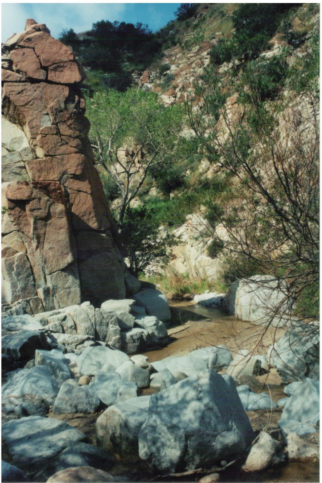
The canyon is full of sharp curves, rock and lots of vegetation.
 The lower end of the Upper Narrows is easier to find. It can be reached by taking the SR 138 (Palmdale/Silverwood Lake) exit off of I-15 toward Lake Silverwood. Turn right on the side road which parallels the freeway on the east side and go past a McDonalds .6 miles to the end of the road. There you will find a white-washed monument with a marble plaque honoring the pioneers that took the Spanish Trail in 1849.[31]
Crowder Canyon is behind the monument to the left. To follow the Spanish Trail further south, continue in the wash underneath the I-15 overpass and follow the creek until it connects into Cajon Creek. Then follow Cajon Creek.

Cajon Creek: Cajon Boulevard follows Cajon Creek for about six miles. Cajon Boulevard can be reached from the I-15 by taking the Cleghorn Road offramp or the Kenwood Road offramp. The site of what was known as the Lower Narrows, now known as Blue Cut, is where the San Andreas fault crosses Cajon Canyon and where exposed bluish rock can be seen from the road. Below, Cajon Creek in the Lower Narrows.
A bronze plaque describing the history of Blue Cut is shaded by trees, about 2.8 miles south of the Cleghorn Road offramp.[32]
In 1850, David Cheesman wrote, “We came to Willow Grove, nine miles from the divide, a good camping place. From this point to Sycamore Grove, two miles from the entrance of Cajon Pass, was down a narrow and rocky gorge to the entrance of the canyon.”[33]

Sycamore Grove. Sycamore Grove is located in Glen Helen Regional Park near Devore. Travelers camped in the hills on both sides of the little pass.[34] Glen Helen Regional Park can be reached by taking the Devore exit off of I-15. At the stop sign, turn left for .1 mile and then turn south on Devore Road and go .8 mile. The road crosses railroad tracks and the Cajon Creek wash. There are two peripherally related historic signs located there.
and
They are to the left of the road just inside the Regional Park.[35] In 1850, David Cheesman wrote, “Sycamore Grove…a most beautiful spot; a small valley dotted with large sycamores and clover nearly waist high. The only drawback was a strong current of wind which set in toward the Canyon.”[36]

December 20, 1849 (Thursday):

Hunt Company (Sycamore Grove to San Bernardino Valley):

The Hunt company continued down a “tolerable road” that sometimes had too much water as they “occasionally [had to stay] in the bed of the creek.”[37] They found “plenty of grass, wild oats were just coming up and birds were singing as in spring[.] The hills [were] covered with s[c]rub oak, that afford[ed] an abundance of acorns.” The acorns “invite[ed] the gri[zz]ly bears out of the mountains, as [they] saw frequent excavations made by [grizzlies] and several skulls of monstrous size.”[38]

ENDNOTES:[1]  Rich, pp. 191-192 (Rich indicates it was 15 miles to the Cajon Pass, but the Mormon Way-Bill indicates it was 17 miles)

[2]  Three days later the same wagon met the Gruwell-Derr and Hunt wagon trains out on the Mojave River with supplies. (Pratt, p. 102)
[3]  Rich
[4]  Farrer
[5]  Bigler; The diarists do not state that their messes split up, but the circumstances told are so different that it is apparent they did split up.
[6]  Farrer; Cannon states that Gibson had come back “to hunt a mule which had strayed off.” Gibson may have been seeking both the saddle and the mule (in hopes that the mule had recuperated enough to travel). There is no indication whether or not the mule found by Bigler was Gibson’s mule, but Bigler was not in the mess that met Gibson..
[7]  Cannon
[8]  Pratt, on December 11, informs us that the man with the wagon is named “Mr. Davis.”
[9]  Bigler
[10]  Cannon
[11]  Bigler, p. 25
[12]  Bigler; Bigler mentioned the distance as 12 miles, but the Mormon Way-Bill lists the distance as 11 ½ miles.
[13]  Spanish Trail Map, pp. 119-121
[14]  Pratt, p. 105
[15]  Pratt
[16]  Pratt
[17]  Haenszel, Arda M. Historical Cajon Pass: A Self-Guided Driving Tour in Three Parts, Redlands: San Bernardino County Museum Association , pp. 2, 9, 11 (1976) (“Historical Cajon Pass”)
[18]  Pratt
[19]  Haenszel, Arda M., “History in the Rock Camp Area,” a chapter in a larger article titled, “Rock Camp, San Bernardino Mountain Archaeological Excavation,” San Bernardino County Museum Association Quarterly, XX:1 (Fall 1972), p. 33 (Rock Camp History); Historical Cajon Pass, pp. 3, 5-8 (Haenzel refers to the alternate route down the Mojave River to Deep Creek and then through Horsethief Canyon as the Spanish Trail. She refers to the short-cut route followed by the 49ers as the Santa Fe to Salt Lake Trail.)
[20]  Cheesman, David W., “By Ox Team From Salt Lake to Los Angeles, 1850,” (a memoir edited by Foy, Mary E.) Historical Society of Southern California: Annual Publication (1930), p. 280 (Cheesman Memoir), , p. 301
[21]  Historical Cajon Pass, p. 9 (Haenzel refers to the Spanish Trail route as the Santa Fe to Salt Lake Trail and to these later routes as the Mormon Trail and Sanford’s Pass.)
[22]  Heap, Gwinn Harris, Central Route to the Pacific: With related material on railroad explorations and Indian affairs by Edward F. Beale, Thomas H. Benton, Kit Carson, and Col. E. A. Hitchcock, and in other documents, 1853-54, ed. Leroy R. Hafen and Ann W. Hafen (Glendale: Arthur H. Clark Company. 1957 (Central Route), p. __
[23]  Historical Cajon Pass, p. 11
[24]  Pratt, p. 106
[25]  Pratt
[26]  Waite
[27]  Waite; Waite indicates they had to take their wagon apart and pack it over both the “upper and lower narrows in the Cajon Pass.” The Lower Narrows are located at Blue Cut, where a bluish rock can be seen in the mountain. This is where the San Andreas fault runs through Cajon Canyon. (Historical Cajon Pass, p. 13)
[28]  Hafen, LeRoy R. and Hafen, Ann W. Journals of Forty-Niners, Salt Lake to Los Angeles: With Diaries and Contemporary Records of Sheldon Young, James S. Brown, Jacob Y. Stover, Charles C. Rich, Addison Pratt, Howard Egan, Henry W. Bigler, and Others, Glendale: Arthur H. Clark. 1954 (49ers), p. 107, n. 126
[29]  Pratt
[30]  Brown; Several wagons had gone through Cajon Pass going east, including a wagon of __________ Davis, a year before, and the wagon of Isaac Williams which had helped the emigrants earlier in the week.
[31]  The plaque on the monument reads: “Santa Fe and Salt Lake Trail 1849: Erected in honor of the brave pioneers of California in 1917 by pioneers. Sheldon Stoddard, Sydney P. Waite, John Brown Jr., George Miller, George M. Cooley, Silas C. Cox, Richard Weir, Jasper N. Corbett.” Sheldon Stoddard was with the Rich company and Sidney Waite was with the Hunt company. The others may have been with the portion of the Hunt company that broke off to take the Walker Pass short-cut and eventually returned to the Spanish Trail.
[32]  Historical Cajon Pass, p. 13
[33]  Cheesman Memoir, p. 301
[34]  Historical Cajon Pass, p. 15
[35]  One sign is a bronze plaque which reads: “Sycamore Grove: This campsite on both the Mojave Trail over the mountains and the Cajon Pass route was probably first seen by Spanish and American travelers in the 1770’s and was noted by them in 1806, 1849 [a reference to the Rich and Hunt companies] and 1850. Michael White, grantee in 1843 of the Muscupiabe Rancho lived near by. The Mormon colony camped in 1851 on either side of this little pass for about four months while Amasa Lyman, Charles Rich, Jefferson Hunt, David Seely and Andrew Lytle negotiated the purchase of the San Bernardino Rancho from the Lugo family.” The other is a wood sign in the shape of the United States. It reads: “U.S. Mormon Battalion Trail: During the Mexican War a detachment of 30 Mormon Battalion soldiers of the United States army left headquarters at Pueblo de Los Angelos on April 12, 1847 to establish a camp, build a fort of logs near this site and “to defend the pass and the ranchos in the vicinity and prevent the passage of hostile Indians.” A few days later in an actual battle 6 Indians were killed, F.T. Mayfield was wounded in the groin and George Chapin was wounded over the eye. This unit of soldiers also built a wagon-road through Cajon Pass known as the Utah or Mormon Road to Las Vegas and Salt Lake.”
[36]  Cheesman Memoir, p. 301-302
[37]  Pratt’s description for December 21 and 22 are confusing. He indicates they traveled 10 miles each day for a total distance of 20 miles, yet the distance between Sycamore Grove and the Cucamonga Ranch was only 11 ½ miles.
[38]  Pratt, p. 107

Wednesday, November 10, 2010

GQC: Mojave River - Barstow to Oro Grande

This is a continuation of George Q. Cannon's 1849 journey to California.

December 4, 1849 (Tuesday):

Rich Company (Mojave River: Barstow to point between Hodge and Helendale):

“Pr[o]visions [were] beginning to be scarce” for the Rich company. It was said that deer were “plentiful” on the Mojave, so “some of the men went ahead to try & kill some deer.”[1] Those that remained behind, including all of those writing journals, “s[e]t off about 8[:00 a.m.], still going up the river.” The mare that Henry Bigler and James Keeler had purchased from Bro. Flake on Cottonwood Creek “lost h[e]r colt” in the morning and had to be “help[ed] up…Bro. Rich advised [Bigler] to leave h[e]r[,] which [he] did at the first water and grass.” Bigler noted, “I real[l]y felt sorrow for the dum[b] br[u]t[e] to be left alone in the wilderness…Bro. Keeler and I have but one animal between us [now] to carry us through, our provisions [are] nearly exhausted!”[2] “It rained pret[t]y freely [during the day] making it very bad traveling.”[3] “At 8[:00] in the night[, they] made camp, tired and hungry and wet,” having traveled 20 miles.[4] Though “unsuccessful” in obtaining deer,[5] the men that “went ahead had made good large fires [which were waiting for them at camp,] for wood was plent[iful].”[6] The fires allowed the men to “dry [their] clothes.” It “ceased raining before [they] went to bed[,] but commenced again towards morning.”[7] “It was cold and disagreeable.”[8]

John C. Fremont noted that when they hooked into the Old Spanish Trail on the Mojave River, they were “careful to take the old camping places of the annual Santa Fe caravans.”[9] It appears that the Rich Company may have been camped at what was later known as “the Cottonwoods,” a place about two miles above (south of) the later Hodge station, which presumably was in the vicinity of present-day Hodge.[10] This is bolstered by George Q. Cannon’s entry for December 5th where he indicates he slept in the tent of an emigrant that did not belong to their company.

December 5, 1849 (Wednesday):

Rich Company (Mojave River: between Hodge and Helendale):

“The rain changed to snow…and the snow continued to fall steadily, [so] it was useless to think of moving.”[11] They “built a shanty of blankets over [their] beds to try to keep them dry.”[12] George Q. “Cannon was quite sick”[13] and stayed under the shanty “the greater part of the day.”[14] They must have shared their camp with some others, as George Q. Cannon states he spent “the night in a tent belonging to Mr. Neal[,] an emigrant.”[15] In the “morning one of the [men in] camp shot an owl and cooked it.” Henry Bigler described [the owl] as “first rate.”[16] George Cannon stated that “hunger gnawed at [their] vitals, and any kind of food would have tasted sweet…Being sick, the privilege of drinking some of the [owl] soup was accorded [to him] as a favor [and it] was the nicest dish of soup [he] had ever tasted.”[17] Cannon stated, “We had scarcely a mouthful of food, our clothing was very scanty and we had no tents to shelter us from the storm. My constant walking had worn out my boots, and for some time I had been compelled to use moccasins; but these were so badly worn that my feet were bare.”[18] Henry Bigler and some other men “went out to hunt deer…Several [deer were] wounded[,] but it snowed and rain[ed] so that they could not be tracked.” While hunting “a heavy snow storm [arose] late in the [e]vening and [Bigler] got lost.” Bigler was beginning to think he would have to spend the night “alone,…all wet and cold,” but “found camp and was in before dark.” Bigler noted, “I felt “gr[a]teful to the Lord for I believe he guided me by his spirit.” In the “evening a footman came in and brought [Bigler’s and Keeler’s] mare. She se[e]med so smart. [Bigler] gave the messenger a dollar for h[e]r” and indicated he would “try…to get h[e]r to the settlements.”[19] Due to their scarce provisions, Charles Rich felt it best to lay over another day and continue to hunt for deer. Thomas Whittle’s and Joseph Cain’s mess “joined together at evening prayers and asked the Lord to bless the hunters on the morrow.”[20] Their circumstances “gave a much greater degree of earnestness and fervor than usual to [their] prayers.”[21]

December 6, 1849 (Thursday):

Rich Company (Mojave River: between Hodge and Helendale):

It snowed throughout the night[22] and continued until mid-morning.[23] Following prayers in the morning, six hunters,[24] including Charles Rich, went out in search of deer. Charles Rich felt “led to go in a certain direction.” He soon found “a good-sized deer…lying dead in the bushes. It was one that had been shot the previous day.” He soon came back to camp carrying the deer on his shoulders.[25] Soon afterwards, other hunters brought in two more deer. The whole camp rejoiced and “felt to return thanks to [their] Heavenly Father for his goodness to [them] in [their time] of need,” as they “were almost out of every kind of provisions.”[26]

December 7, 1849 (Friday):

Rich Company (Mojave River: between Hodge and Helendale to Silver Mtn. Road vicinity):

Henry Bigler and James Keeler woke in the morning to find their mare, the one they had just paid a dollar for two days previous, dead. She had frozen to death. By 10:00 a.m. they had taken up their “line of march.” The snow was melting near the Mojave River and they found the traveling difficult through the soft sand.[27]
After traveling ten miles they “camped in the timber” near the Mojave River which was running on the surface there.
Captain James Flake killed a deer which helped them from a provision standpoint.[28] In the evening Charles Rich “called the company together to consult upon the propriety of part of the Company going ahead & the remainder travel[ing] more slowly & try[ing] to get the weak animals thro[ugh]…Those who went ahead would be able to leave what provisions they had to spare with those who remained.”[29] Rich felt they were within two days travel of the “settlement” and they were safe to travel in smaller groups as there was no sign of Indians. He “thought it was not more than 6 miles to the head of the Mo[j]ave wh[e]re [they] would turn off for the [Cajon] Pass and from th[e]re 20 m[iles] to the Ca[j]on Pass. This could be trav[e]led in one day by the strong animals and the rest” could do it in two days. Thomas Whittle’s mess (including Henry Bigler, and likely James Keeler, Joseph Peck and Peter Hoagland) and Joseph Cain’s mess (including William Farrer, Peter Fife, George Q. Cannon and two others), eleven in all, about half of the company, “volunteered to stay & travel slower[.] It was unanimously agreed that Bro. Rich should go ahead.”[30]

They may have been camping at what was known as "Point of Rocks" near Helendale. It is now in the community known as Silver Lakes.

December 8, 1849 (Saturday):

Rich Company – Forward Group (Mojave River, Silver Mtn. Road vicinity, to the Cajon Pass):

Charles Rich, with half of the company, started early. After six miles of travel, they crossed the Mojave River near the present town of Oro Grande. They then left the Mojave River and traveled toward the Cajon Pass.[31]

Rich Company – Rear Group (Mojave River, Silver Mtn. Road vicinity, to Oro Grande):

After a very cold night, the eleven that elected to continue at a slower pace set out, shortly after Charles Rich and the balance of the company. After traveling six miles they crossed the Mojave River below the present town of Oro Grande and camped “on the opposite side. Grass [was] scarce for [their] animals” but the Mojave was running and quite wide at this point.[32]
John Fremont, five years earlier, described the Mojave near this point as “a clear bold stream, 60 feet wide and several feet deep.” It has a “strange appearance, running between perfectly naked banks of sand. The eye, however, is somewhat relieved by willows, and the beautiful green of the sweet cottonwoods with which it is well wooded.
As we followed along its course, the river, instead of growing constantly larger, gradually dwindled away, as it was absorbed by the sand."[33] During the evening, the two Gruwell brothers that earlier left Mountain Springs to go to the “settlements for provisions,” passed through the camp on their way back to their wagons. It was their wives and families the Rich company encountered on their arrival at the Mojave River. The Gruwell brothers “would not part with any” of their provisions.[34]

The area where the Old Spanish Trail left the Mojave River later had a station owned by A.J. Lane, established in 1852. It was about 12 miles up the Mojave from Point of Rocks and was on the south side of the river. It was also known as the Upper Crossing. David Cheesman indicates that the crossing was “at a point of rock,” also known as the lower narrows.[35] The picture below was taken by David Thompson in 1917. (Photo and text credithttp://pubs.usgs.gov/of/ofr01-245/html/victorville.html )

December 10, 1849 (Monday):

Hunt Company (Mojave River: Barstow to Hodge):

The Hunt company left the Mojave River, in the vicinity of present-day Barstow, and “started across the great bend.” After 15 miles they arrived at the Mojave River again, after dark, a little above the present site of Hodge. The weather was very cold in the evening and the water on the River was frozen several inches deep.[36]

December 11, 1849 (Tuesday):

Hunt Company (Mojave River: Hodge vicinity to between Hodge and Helendale):

Francis Pomeroy decided to leave the Hunt company and go ahead to be with the Rich company. He left early with his three horses.[37] The Hunt company traveled five miles and camped with the Gruwell-Derr wagon train. Along the way, Addison Pratt “traveled through the bottom [of the Mojave] in p[u]rsuit of deer.” The water in the Mojave “sinks and rises several times.” The “bottoms are a mile or two wide [there] and is intermixed with willows and grass until it affords some of the finest range” he had ever seen. However, the deer “had been all routed by those that had gone ahead of [them].” At their campsite, they found a note from Charles Rich “that his company camped [there] two days and hunted,” and had killed 5 deer[38] during the snow storm that had trapped the Hunt company at Alvord Mountain. There was “no running water” in the Mojave, but there was water “in holes” covered with “ice…six inches thick.” Mr. Davis from Williams Ranch had traveled from the Cajon Pass where he had supplied the Rich company and met them there with his wagon “with provisions to sell to those that were in distress. Some fat fresh beef tasted good to” them and presumably “tasted better to those [of the Gruwell-Derr wagon train] that had been living on cattle that were so poor they couldn’t stand alone.”[39]

December 12, 1849 (Wednesday):

Hunt Company (Mojave River: between Hodge and Helendale to Helendale vicinity):

Addison Pratt, Jefferson Hunt and James Brown traveled ahead of the wagons on horseback and Pratt shot a rabbit along the road. After about 8 miles, near the present town of Helendale, they overtook Francis Pomeroy. He had “camped on the other side of the river the night before and saw a number of deer, but killed none.” They had come to “where there was quite a large stream running” and decided to “pitch…camp on the side of it.” Pratt and Brown decided to go deer hunting. At Jefferson Hunt’s suggestion, Pratt left his “double barreled fowling piece” and took Hunt’s “little rifle.” They “crossed the river on old logs.” Pratt “saw a deer standing in an open space in a thicket of willows[,]…drew sight and fired, and the deer dropped in its tracks.” They returned to camp with the deer which “was considered a prize among [them] in these scarce times for provisions.”[40]

They may have been camped at an area later known as “Point of Rocks” which was ¾ mile below the present station of Helendale.[41]

December 13, 1849 (Thursday):

Hunt Company (Mojave River: Helendale vicinity to Oro Grande vicinity):

“As the wagons were starting off,” Addison Pratt “crossed the river to hunt.” He had gone two or three miles when he found himself “in the fork of the river” and the river was rising fast. He decided to get back to the other side as soon as possible, but “found [his] way greatly obstructed by a dense thicket of brush closely interwoven by grapevines…hanging…blue with grapes.” With difficulty, Pratt “forced [his] way through…to the end of them.” The weather had warmed up so that the ice on the river would not always support his weight. So he “pulled off [his] shoes and stockings and went onto the ice bare-foot[,]…breaking through at every third or fourth step, and often scraping [his] shins against the ice.” The water was about 18 inches deep. Then he “came to another thicket of brush and grapevines which [he thought] to be the opposite shore.” However, he came to “a dense mass of tules, about ten feet high when they stood up, but they were bent down about half way and formed a complete mat. As these were impenetrable[, he] took [his] gun in one hand and a stick in the other [and] got upon them…By crawling upon [his] hands and knees with the help of the stick and gun[, he] could crawl along at a very slow rate[.] If [he] attempted to stand [he] immediately sank down among them and so there was no other alternative, but [it was] a tiresome job. When [he] got across [he] was…exhausted.” He “came into another thicket of grapes [and] stop[p]ed and ate some of them and…was much revived…After crossing one or two more thickets [he] came to the main channel of the river and had to pull off [his] pants to wade it and then got back onto the road again.” Pratt noted that there were “plenty of wolves” [coyotes] along the Mojave because the “wolves are fond of grapes.” He often shot at them and “saw traces of blood,” but because he was using “shot in [his] fowling piece,” he only wounded them and had not killed any. When Pratt found the company, about 9 miles from their previous camp, near the present site of Oro Grande, “to [his] great surprise [he] found the wagons camped on the other side” of the Mojave River. He noted that if he had only known they were going to cross the river, “it would have saved [him] all that trouble” of crossing the river earlier. Here the Mojave was “all in one channel” and “clear and pure running over a sand bottom.” From this point they intended to leave the Mojave River and travel to the Cajon Pass. Because it was a “long drive to the next grass” they decided to “lay by” there a day.

December 14, 1849 (Friday):

Hunt Company (Mojave River: Oro Grande vicinity):

They traveled up the Mojave River in search of gold as it was “reported there had been some found there,” but none was found. They did see a “large buck deer,” which they did not get a shot at and lots of sign of rabbits.[42]

ENDNOTES:
[1]  Farrer, p. 216

[2]  Bigler, p. 22; The mare was purchased jointly by Bigler and Keeler on October 12 for $20 down and a $100 note, with interest to be paid after returning (Bigler, p. 2); In this entry Bigler refers to “the mare of Bro. John Smiths.” This is because Father Smith’s deal with Bigler was “to [pay] all the expense of fitting me out for the gold mines, and after arriving there I am to be saving and prudent and after all the expenses was paid I am to have half the gold.” (Great Basin Kingdom, pp. 73-74 [citing Bigler Journal, Book A])
[3]  Farrer, p. 216
[4]  Bigler, p. 22; Farrer (p. 216) and Rich (p. 191) both confirm the 20 mile estimate.
[5]  Cannon, p. 37
[6]  Bigler, p. 22
[7]  Farrer, p. 216
[8]  Rich, p. 191
[9]  Hafen, LeRoy R. and Hafen, Ann W. Old Spanish Trail, Sante Fe to Los Angeles: With Extracts from Contemporary Records Including Diaries of Antonio Armijo and Orville Pratt, Vol. 1. Glendale: Arthur H. Clark. 1954 (Spanish Trail Extracts), p. 287-288
[10]  Mecham, G. Frank, “The Old Trail,” (Reprint from the Pioneer Cabin News, San Bernardino Society of California Pioneers, 1968) Once Upon A Desert, Barstow: Mojave River Valley Museum Association, 1976 (The Old Trail), p. 20; Hafen states that Fremont camped in the vicinity of the railroad station at Hodge, about 12 miles from Barstow. Fremont stated it was 20 miles from where they reached the Mojave at Oro Grande. (Spanish Trail Extracts, p. 288)
[11]  Cannon, p. 37-38
[12]  Farrer, p. 216
[13]  Bigler, p. 23
[14]  Cannon, pp. 37-38
[15]  Landon, Michael N. (editor), The Journals of George Q. Cannon, Volume 1, To California in ’49 (Deseret Book Company, Salt Lake City, Utah: 1999), p. 70 (Landon).
[16]  Bigler, p. 23
[17]  Cannon, pp. 37-38
[18]  Cannon, pp. 37-38; A year previously, Orville Pratt, also at the Mojave River, echoed similar sentiments: “Never until now have I really known what suffering is. My feet are blistered from walking full 30 miles yesterday over the burning sand and flint rocks. Boots are all worn out – coat and pants tattered from riding 2 miles through the mesquite – shirt filthy with five weeks constant wear in the dirt - and to complete the compliment of misery (as if a burning sun and hard riding by day, laying upon the ground between horse blankets at night, to say nothing of the food, not sufficient) in addition to all else, my body is literally alive with vermin! This would seem almost incredible at home, but it is too true that not only I am annoyed with body lice, but every man in my company is precisely in the same way!” Spanish Trail Extracts, p. 357.
[19]  Bigler, p. 23 (Bigler referred to the horse as “Bro. Smith’s mare,” which, as indicated previously, was because Father John Smith was responsible to outfit him and would apparently be paying for the horse.)
[20]  Bigler, p. 23; Thomas Whittle’s mess consisted of five individuals, including Henry Bigler and likely also James Keeler (who shared horses and a wagon with Bigler), Joseph Peck (who initially shared a wagon with Whittle) and Peter Hoagland (who also initially shared a wagon with Whittle). Joseph Cain’s mess consisted of six individuals, including William Farrer, Peter Fife and George Cannon.
[21]  Cannon, p. 38
[22]  Cannon, p. 38
[23]  Bigler states it quit snowing in the “morning” (p. 23) and Farrer stated it ceased “during forenoon.” (pp. 216-217)
[24]  Bigler, p. 23
[25]  Cannon, p. 38
[26]  Farrer, pp. 216-217
[27]  Bigler, pp. 23-24; Farrer states “the night was very cold.” (p. 217)
[28]  Rich, p. 191
[29]  Farrer, p. 217
[30]  Farrer, p. 217 (Farrer indicates that Bro. Whittle’s mess and his volunteered, thereby indicating Farrer was in Bro. Cain’s mess); Bigler states that his mess and Bro. Cain’s mess volunteered, thereby indicating Bigler was in Whittle’s mess (pp. 23-24); Bigler and Keeler initially shared a wagon and then shared horses, making it likely that they were in the same mess; Whittle initially shared a wagon with Joseph Peck and Peter Hoagland, making it likely they were in the same mess; Cannon indicated that 11 were in the slow group and on December 9 indicated that the other mess was five in number, thereby indicating he was in a mess with six people (p. 38-39); Farrer indicated on October 19 that Peter Fife was in his mess. Further, on that date, Farrer indicated that Capt. Flake went ahead with 8 other men leaving 11 men behind, likely the same 11. (pp. 195-197);
[31]  Rich, pp. 191-192 (Rich indicates it was 15 miles to the Cajon Pass, but the Mormon Way-Bill indicates it was 17 miles)
[32]  Bigler, p. 24
[33]  Spanish Trail Extracts, pp. 287-288
[34]  Farrer, p. 217 (Addison Pratt identifies them as the Gruwell brothers the next day when they met them near present day Barstow. Farrer refers to them as “some of the men who had been sent to the settlements for provisions by the wagons short of provisions”)
[35]  The Old Trail, p. 20; Hafen states it was opposite the site of Oro Grande, about six miles northwest of Victorville. (Spanish Trail Extracts, p. 287, n. 4); Cheesman, David W., “By Ox Team From Salt Lake to Los Angeles, 1850,” (a memoir edited by Foy, Mary E.) Historical Society of Southern California: Annual Publication (1930), p. 280 (Cheesman Memoir), p. 301; Marenczuk, Wesley "The Story of Oro Grande" found at the website of route66ca.org. on November 10, 2010.
[37]  Pratt, p. 102
[38]  See entry for December 19 where Pomeroy arrives at Williams Ranch with 4 horses. He may have picked up another horse along the way, such as Henry Bigler’s horse left the day before near the Cajon Pass.
[39]  The number of deer killed by the Rich company was actually 3.
[40]  Pratt; Isaac Williams sent out Davis in response to the appeal taken by the advance party of the Gruwell – Derr wagon train. Hafen, LeRoy R. and Hafen, Ann W. Journals of Forty-Niners, Salt Lake to Los Angeles: With Diaries and Contemporary Records of Sheldon Young, James S. Brown, Jacob Y. Stover, Charles C. Rich, Addison Pratt, Howard Egan, Henry W. Bigler, and Others, Glendale: Arthur H. Clark. 1954 (49ers), p. 102, n. 121.
[41]  Pratt, pp. 102-103; Pratt refers to Brown as Rowan., but as indicated earlier, it is likely a referance to Brown.
[42]  The Old Trail, p. 20
[43]  Pratt, pp. 104-105

Tuesday, November 9, 2010

GQC: Mojave River - Fork of the Roads to Barstow

This is a continuation of George Q. Cannon’s 1849 journey to California.

December 3, 1849 (Monday):

Rich Company (Mojave River: Fork of Roads to Barstow):

At Mojave River Forks on the Mojave River, Henry Bigler “went out to hunt the horses before breakfast [and] came across a [grape] patch[, with grapes] as sweet as r[ai]sons.” He ate until he found himself sick.[1] “There was considerable timber…& an abundance of grass,” but “there was no running water in the bed of [the Mojave.] What water [they] had [they] found standing in pools.”[2] They also found “about a dozen wagons camped there,”[3] with “some men with their wives and children.”[4] “They were in distress[,] some of them had been out of bre[a]dstuff for 6 weeks. They were living on their cattle that gave out.” One of the wagons “had a woman and 10 children” and another wagon had a “woman and 11 children,” the “families of two brothers[,] one or both of them [being] Methodist preachers [named] Gru[w]ell. They [were] from Iowa and…known to be in [a] mob party that burned some barns and stacks of grain that belonged to some of the [Saints in Iowa].” While “they were in…Utah [V]alley[,]” they were “told” that men “were in persuit of them[,] to take their lives[,] and the two [Gruwell brothers] fled as Soloman says the wicked do.” It “was a pitiful sight to see these poor haggard women and children,”[5] so the Rich company, though they “had but little flour [themselves,] let them have what flour [they] could spare.”[6] At 1:00 p.m. the Rich company “left camp, traveled up the [Mojave] River for [about 15 miles] and camped for the night”[7] just east of present-day Barstow. George Q. Cannon said it was "round the point of a Red Butte." The Mojave “was a considerable…stream at this place.”[8] Charles Rich noted that they had “but little to eat.”[9]

December 5, 1849 (Wednesday):

Hunt Company (Alvord Mountain to 6 Miles Southwest):

The Hunt company and its wagons were considerably behind George Q. Cannon and the Rich company of packers. Addison Pratt, James Brown, Hiram Blackwell and Francis Pomeroy of the Hunt company, although behind the Rich company, were ahead of the rest of the Hunt company in a wagon below the summit of Alvord Mountain. At “4 o’clock a.m. Captain Hunt hallooed to [them] and called for a cup of coffee. He seemed to be chilled to the bone, so [they] stirred the fire and got him something to eat.”[10] Captain Hunt “revived again, said the snow had fallen 18 inches deep on the wagons and they were in a bad fix[.] The snow had melted and run down by the wagons until [the] cattle had plenty to drink[,] but there was nothing for them to eat.[11] Captain Hunt “told [them that] all [of] the teams would make the [ridge], but” that they should “have a good fire [ready], for some of the men would be chilled nearly to death. Then he directed [them] to go ahead until [they] found feed for the stock.”[12] As Pratt, Brown, Blackwell and Pomeroy were getting “ready to start off[,] Mr. Swan came up driving a pony he had picked up on the road[.] He was much chilled[.]” They “gave him some hot coffee and bread and he revived. [They] left him to gather sticks and keep a fire until the other wagons came up. Capt[ain] Hunt went on with [Pratt and his wagon].” After leaving the canyon they went “into a desert that was crusted over with gravel[…] In dry weather [the ground] was hard and smooth[,] but the rain and snow had softened it until [they] sank into it half [a] leg deep. This made heavy work for [their] jaded cattle[.] After [they] crossed this flat [they] came on to a sort of bench covered with sagebrush and among it some bunch grass. Here [they] went into camp” having gone a distance of 6 miles. Around 3:00 p.m. they “saw all the wagons coming”[13] “down the slope of the mountain.”[14] “Capt[ain] Hunt went back to meet them.” Some of the cattle had been left back in the snow and “Mr. Lawderwaper had gone back after them.”[15]

December 6, 1849 (Thursday):

Hunt Company (6 Miles Southwest of Alvord Mountain to Fork of the Roads on the Mojave River):

The Hunt company started for the Mojave River, 12 to 13 miles away.[16] They passed some wagons that had been left by the Gruwell-Derr wagon train “and soon overtook an old Dutchman who was dragging a chest.” The Dutchman indicated to them that he was part of the Gruwell-Derr wagon train that was now camped on the Mojave River. His team had given out and his was one of the abandoned wagons they had just passed. He had come back from the Mojave to obtain the chest. About 4:00 p.m. the Hunt company reached the Mojave River and “found plenty of grass” and “wild grapes and water standing in holes,” but no water “in the bed of the river.” They also found the wagons of the Gruwell-Derr wagon train camped there and “gave them a little bread,” although they, themselves, “were nearly out.”[17] James Brown noted that upon reaching the Mojave River, he “felt as pleased as a man liberated from a life sentence in a dungeon, for we had reason to feel assured that we would succeed in our journey.”[18]

This area on the Mojave River is known as the “Fork of Roads” and is about four miles east of the present town of Yermo, just south of Interstate 15[19] and east of Minneola Road. Hafen states that it is about nine miles below (east of) Daggett. It is an area where a submerged clay reef retards the sub-surface flow of water in the Mojave and brings it to the surface, producing a tract of native verdure.[20]

December 7, 1849 (Friday):

Hunt Company (Fork of the Roads on the Mojave River):

The Hunt company rested at the Mojave River for the day. Addison Pratt shot two rabbits.[21]

December 8, 1849 (Saturday):

Hunt Company (Mojave River: Fork of Roads to west of Daggett):

Addison Pratt left the rest of the wagon train to walk up the dry Mojave River bed in search of deer, but he found none. They traveled about eleven miles to the vicinity of the current U.S.M.C. Logistics Base, east of Barstow, where they camped. There they found some running water in the Mojave River and some wild ducks and raccoon tracks.[22]

Sixteen years later, from 1865 to 1872, a trading post was established in this area by Lafayette Mecham, the first post after reaching the Mojave.[23] It was known as the Fish Ponds, now the location of the Marine Corps Supply Center, Nebo.[24]

December 9, 1849 (Sunday):

Hunt Company (Mojave River: west of Daggett to Barstow vicinity):

The Hunt company traveled five miles and camped in the vicinity of present-day Barstow, where the Mojave River “took a broad bend to the right.” They camped as there would be no water for the next 15 miles. The Gruwell-Derr wagon train had joined them at this spot and were met by the two Gruwells who “came to their families. They left Salt Lake Valley in a fright, had taken the northern route to Upper California, had gone down the coast to Pueblo de Los Angeles, then up the Cajon Pass.” Addison Pratt speculated that they must have been “chagrined at meeting Brother Henry Rollins” who was ahead with Brother Rich “and was their supposed enemy.” The Gruwells “said they had suffered very much on the northern route” and “told of seeing 500 head of dead cattle in sight of each other” and that “water was so scarce they drank cattles blood.”[25] They were also met by “about twenty footmen,” with “packs on their backs, half starved.” These men were “part of the company who had taken the cut off” at the “Rim of the Basin” near Headwaters Wash and informed the Hunt company that “they had left the wagons in great distress” and “thought some would starve.” The “new arrivals [told the Hunt company] that when [they] parted from them they were sorry for us.” But now, James Brown pointed out, “we were more sorry for them than they had been for us.”[26]

Years later, Ellis Miller built a trading post at this site to supply travelers with food and other items. The Mojave flowed extensively enough above ground in this area to have Cottonwood trees, fresh drinking water and animal forage. Because of the abundant wild grape vines growing on the banks of the Mojave, Miller called his place Grapevine. In 1880, Robert Waterman located and developed a silver mine about three miles north of Grapevine and a little community developed at Grapevine, including a store owned by Waterman. The railroads passed nearby and the name of the area came to be known as Waterman’s Station, displacing the name Grapevine. Later, the price of silver plunged, the Waterman Mine closed and the Waterman community declined and was absorbed into the Santa Fe Railroad headquarters developing in the Mojave River bottom area. This site took the name Barstow, from the middle name of William Barstow Strong, the pioneer president of the Santa Fe organization.

ENDNOTES:
[1]  Bigler, p. 22

[2]  Farrer, p. 216
[3]  Pratt, p. 100 (Pratt saw them three days later, but his descriptions which tend to be more detailed, are used)
[4]  Cannon, p. 37
[5]  Pratt, p. 100; Farrrer indicates the emigrants “had been living the last 4 or 5 weeks upon beef.” (p. 216); J.D. Gruwell stated the following: “It being late in the season we concluded to winter at Utah Fort but learning that the Mormons were about to attack us we broke camp and with a Mexican guide took the south route for Los Angeles which was the pioneer train over that route.” (Gruwell, p. 54)
[6]  Cannon, p. 37
[7]  Bigler, p. 22; Rich confirmed the distance as 12 miles (p. 191) as did Farrer (p. 216) The distances and locations along the Mojave River are more difficult to pinpoint because of the inconsistencies between the Mormon Way-Bill and the diarists and the lack of geographic landmarks to pinpoint specific places. The Mormon Way-Bill (based on the rodometer) lists the distance traveled along the Mojave as 51 ½ miles. Addison Pratt lists the distance as 53 miles and the diarists in the Rich company list the distance as 47 or 48 miles. They had at least two common camping spots along the Mojave. The first known spot was between Hodge and Helendale where the Rich company camped on December 4th and the Hunt Company camped on December 11th. From this point to the second known joint camping spot, near Oro Grande, Rich diarists give a distance of 16 miles and Addison Pratt gives a distance of 17 miles, nearly identical. As the Rich group estimated low and Pratt estimated high, I estimate the distance at 16 ½ miles. On the first leg of the trip to the first known joint camping spot, Rich diarists list a distance of 32 miles and Pratt lists the distance as 36 miles. Given the 16.5 miles for the second leg, the first leg would be 35 miles to equal the distance given by the Mormon Way-Bill. Pratt indicates the Hunt company camped on December 9th near Barstow, where the trail left the river near the bend of the river. On December 10th, they traveled overland to meet up with the river again about 15 miles distant, near the town of Hodge. It was then five miles on December 11th to the first joint camping spot. It was a 20 mile day for the Rich company to reach that spot on December 4th, which would be consistent with Pratt’s estimate for the two days if the Rich company camped at Barstow on December 3rd. That would be the logical point as the trail left the river there and was the last water for 15 miles. Therefore, it appears that the Rich mileage for the first day was understated. Instead of 12 miles, it would have been about 15 miles. The Pratt mileage would have been 15 miles for the two day period of December 8th and 9th, giving the two companies a third joint camping spot at Barstow which appears probable.
[8]  Farrer, p. 216
[9]  Rich, p. 191
[10]  Brown, pp. 125-127
[11]  Pratt, pp. 98-99
[12]  Brown, pp. 125-127
[13]  Pratt, pp. 98-99
[14]  Brown, pp. 125-127
[15]  Pratt, pp. 98-99
[16]  Pratt states the Mojave was 12 miles distant. (p. 100); The Mormon Way-Bill lists the distance between Bitter Springs and the Mojave as 30 ¾ miles. It was about 12 miles to the summit of Alvord Mountain and about another 6 miles to where they camped, leaving a distance of about 12 ¾ miles for this day.
[17]  Pratt, p. 100
[18]  Brown, p. 127
[19]  Spanish Trail Map, p. 110; The trail came to the Mojave River a few miles east of Calico Mountain and was known as the Lower Crossing. It was seven miles down river from Camp Cady, a military post established in 1860 for protection of the trail from Indian attacks. (Mecham, G. Frank, “The Old Trail,” (Reprint from the Pioneer Cabin News, San Bernardino Society of California Pioneers, 1968) Once Upon A Desert, Barstow: Mojave River Valley Museum Association, 1976 (The Old Trail), p. 20)
[20]  Spanish Trail Extracts, p. 288
[21]  Pratt, p. 100
[22]  Pratt, p. 101
[23]  Salisbury, Alice, “Early Map Names for Barstow,” (Barstow Womens Club 1963-1964) Once Upon A Desert, Barstow: Mojave River Valley Museum Association, 1976 (Barstow Names), p. 202
[24]  The Old Trail, p. 20
[25]  Pratt
[26]  Brown and Pratt
[27]  Barstow Names, p. 202; The Old Trail, p. 20

Monday, November 8, 2010

GQC: Cottonwood Spring to Mountain Springs

This is a continuation of George Q. Cannon’s 1849 journey to California. On the morning of Saturday, November 23, 1849, both the Rich company of packers and the Hunt wagon train left Cottonwood Spring. East of the spring they followed the trail through a gap in the hill.
A closer look at the road up to the gap.
From the gap, looking back, Blue Diamond is among the trees and a water tank holding spring water is in the center of the picture. Cottonwood Spring is just to the right of and below the water tank.
After following the trail and looking back, the Spring Mountains are still evident in the background.
Looking ahead, they headed toward a wash going up the mountain toward Mountain Springs. The wash is just to the right (west) of the modern highway.
The wash is in the foreground, looking south toward Mountain Springs.
The traveled three miles[1] and went up a sandy, rocky stream bed[2] to the grass found by Charles Rich the evening before. There was a “weak spring of water affording sufficient to supply Capt Hunts Co.” and the packers[3] and plenty of grass which was “dry and yellow, but [the] cattle filled themselves.”[4] Henry Bigler spent most of the day hunting jack rabbits but did not get a shot.[5] “Bro. Emmet had a blacksmith bellow and some tools along [and some of the men] went about shoeing the barefooted cattle.”[6] The Mormon Way-Bill, published in 1851, as a help to emigrants going to California, recommended that all cattle be shod for the journey.[7] It also gave distances between various points from Salt Lake to Los Angeles. The distances were based on mileage readings from the rodometer attached to Addison Pratt’s wagon on this trip.

The next day, November 25, 1849, on a “fine pleasant morning” the packers and the wagon train continued their “rough” travel[8] up the rocky stream bed. The beautiful Spring Mountains were ahead of them.
As they gained altitude and got further south, more of the Spring Mountains opened up to them
and the got a glimpse of Red Rock Canyon.
Looking back (northeast), they could see the hills above Cottonwood Spring and the area of modern-day Las Vegas in the distance.
Approaching the Spring Mountains.
The canyon through the Spring Mountains becomes evident.
From the modern road, looking back, Las Vegas becomes more visible.
As they traveled higher and got through the canyon, things began to open up. Looking back.
From near the summit, looking back.
The summit at Mountain Springs is at an elevation of 5,502 feet.[9] On their left hand “were high mountains of solid rock.”[10] The picture below was taken in November 1997.
The next picture was taken in November 2010 when it was clear and no snow was on the mountains.
A short distance beyond the summit, to the right of the road on a “grassy ridge,”[11] 8 ¾ miles from where they camped the night before,[12] they found what is today called Mountain Springs.[13] They called it “Cedar Springs” because of the abundance of cedar. They camped there and used the cedar for firewood.[14] Mountain Springs was a small spring that came out of the hill, ran a little way, and sank into the ground.[15] There was “rather poor pasturage for [the] animals[,] having all been eaten off,” but they “found some good feed on the side of a mountain about ¾ mile from camp.”[16] This was at another spring which oozes out of the side of the mountain, north of the spring on the road.[17] At Mountain Springs they found a note left by the advance party of the Gruwell-Derr wagon train that had passed through a week previously. The note requested that Mr. Dallas (whom the Hunt wagon train passed at the Muddy River[18]) come ahead as soon as possible, as their wagon train was starving. They “had seen things that made [their] blood run cold. They had killed several oxen and had sent some men to the settlements for provisions.” Captain Hunt estimated that those men would have to travel 220 miles to get to the first settlement, which was the Williams Ranch near present day Chino, California.[19] Addison Pratt described some “large kilns [near Mountain Springs], where the Indians burn their pottery wares, as these hills are clayey, and from the number and size of their kilns I expect the business is carried on at times with some energy.”[20] The “kilns” were large pits surrounded by a high ring of burned out rocks. Rather than pottery kilns, the pits were actually used by the Indians to roast mescal cactus. The Indians would dig a hole, put in heated rocks and mescal cactus to roast. The next time they would remove the rocks used before, which had lost their power to retain heat, and put more rocks in the pit to heat the cactus. Over time the pit would be surrounded by a high ring of rocks.[21] Henry Bigler stood guard for the night.[22]

In his 1848 journal, Orville Pratt referred to Mountain Springs as Paiute Spring.[23] In 1850, David Cheesman stated in his journal: “From Cottonwood Springs to Mountain Springs a distance of 12 miles. The road to this Spring was good. We passed to the summit up a gravelly canyon of excellent grade. It was a remarkably smooth road.”[24]

I visited Mountain Springs on November 28, 1997. There was a small dusting of snow on the ground and it was quite cool. There is a bronze Nevada State Historical Marker located on State Route 160 at Mountain Springs Summit.[25] In the area between Blue Diamond and Mountain Springs I saw a number of wild horses. I visited Mountain Springs again in November 2010 and got some more pictures of the area. The following picture was north of Mountain Springs.
To the west, snow-capped Mount Charleston is visible.
To the southwest, the canyon that will lead them to the Pahrump Valley is visible. 
To the south, a closer smaller mountain.

ENDNOTES:
[1]  Farrer, p. 213; Rich, p. 190; Pratt, p. 92. Bigler states the distance was 4 miles (Bigler, p. 19)

[2]  Crampton, C. Gregory, and Madsen, Steven K. In Search of the Spanish Trail: Santa Fe to Los Angeles, 1829-1848, Layton: Gibbs M. Smith. 1994 (Spanish Trail Map), p. 93
[3]  Farrer, p. 213
[4]  Pratt, p. 92
[5]  Bigler, p. 19
[6]  Pratt, p. 92
[7]  Hafen, LeRoy R. and Hafen, Ann W. Journals of Forty-Niners, Salt Lake to Los Angeles: With Diaries and Contemporary Records of Sheldon Young, James S. Brown, Jacob Y. Stover, Charles C. Rich, Addison Pratt, Howard Egan, Henry W. Bigler, and Others, Glendale: Arthur H. Clark. 1954 (49ers), pp. 321-323
[8]  Farrer, p. 213
[9]  Spanish Trail Map, p. 93
[10]  Pratt, p. 92-93
[11]  Bigler, p. 19; Farrer, p. 213
[12]  Bigler, p. 19 (who states it was according to the rodometer). Rich (p. 190) and Pratt (p. 92-93) both state that they traveled 10 miles.
[13]  Spanish Trail Map, p. 93
[14]  Rich (p. 190) and Pratt (p. 92-93) both refer to the spring as “cedar springs” and Bigler (p. 19) and Farrer (p. 213) refer to the abundance of cedar which they used as firewood.
[15]  Pratt, p. 92-93
[16]  Farrer, p. 213
[17]  49ers, p. 213 n. 80 (there are now several springs there, most of which developed at the time of the San Francisco earthquake in 1906)
[18]  Pratt, p. 87
[19]  Bigler, p. 19; 49ers, p. 166 n. 41; Addison Pratt, two days later on November 27th, indicates they “had seen before we got here [Resting Spring], some wagons that had been left by those ahead of us, and also a note left for Dallas stating that they were short of provisions and were in great distress, were living on the cattle that gave out.” (pp. 93-94) This was presumably the same note two days before, and not a second note.
[20]  Pratt, p. 92
[21]  49ers, p. 92 n. 100
[22]  Bigler, p. 19
[23]  Spanish Trail Extracts, p. 356
[24]  Cheesman, David W., “By Ox Team From Salt Lake to Los Angeles, 1850,” (a memoir edited by Foy, Mary E.) Historical Society of Southern California: Annual Publication (1930), p. 280, p. 295
[25]  It is a general commemoration of the Old Spanish Trail, identical to the one located in Blue Diamond, and says nothing specific about Mountain Springs. However, several miles below Mountain Springs, on State Route 160, there is a faded sign which specifically discusses the importance of Mountain Springs. The marker reads: “"This portion of the Old Spanish Trail was discovered in January, 1830, by Antonio Armijo during his first trip from Santa Fe to Los Angeles. The springs just north of this marker provided excellent water and fed meadows of luxuriant grass for draft animals. Two days were required to travel between Las Vegas and Mountain Springs Pass. The trip was broken at Cottonwood Springs, the site of Blue Diamond, where an early start was usually made in order to climb the pass by nightfall. Early travelers often referred to the area as Paiute Springs, but the present title has been used for over a century. The altitude made Mountain Springs one of the favorite camping spots on the Trail."