Mount Democrat (as seen from Mount Bross),
just outside Alma, Colorado, in the Mosquito Range, has an elevation of 14,148 feet, and is ranked 28th in height of Colorado's 53 fourteeners (as seen from Mount Cameron).
On Friday, August 27, 2010, I climbed it, and several other nearby peaks, with Sam and Andrew. We started from the Kite Lake Trailhead,
at an elevation of 12,000 feet, which is 6 miles up a dirtroad from Alma (the road as seen from Mount Democrat),
which is itself at over 10,600 feet, about the height of Mount San Bernardino back home. The night before, we stayed in a hotel in Frisco. As we'd gotten little sleep the night before, in preparation to leave for Colorado, we slept in until about 7:00 a.m., then got some breakfast at McDonald's and drove to Alma. We didn't start our hike until 9:20 a.m., much later than my preferred starting time. There were about 20 cars in the dirt parking lot and most of the hikers had already started. The setting is quite dramatic. Kite Lake is in a horseshoe shaped valley surrounded by fourteeners. Mount Democrat is on the left,
Mount Cameron is straight ahead,
and hides Mount Lincoln which is right behind it, and Mount Bross is to its right.
None of the summits are visible, except perhaps Cameron. Bross is closed to hiking because it is on private land and the owners are currently refusing access. We started out walking past Kite Lake, which is near the parking lot.
From above, it is obvious that the name of the lake comes from its shape. The trail then makes its way toward the saddle between Mount Democrat and Mount Cameron. On the way up, there is evidence of mining, including wood from demolished buildings and an orange stain following a water course which is an indicator of iron, copper, or some other mineral that was mined there.
We heard the whistling of a marmot and pretty soon were among a profusion of large white rocks, stacked on top of each other. That pretty much sums up Mount Democrat, one big pile of large rocks.
The mountain looks quite different, depending upon where you are viewing it from. Viewed from the Bross ridge, it looks quite steep and menacing.
As you don't really see the summit until you get quite close to it, it just seems like an endless profusion of stacked rocks, sometimes more rounded, sometimes steeper.
Virtually every step you take is on rock.
Sometimes the steps are large and energy sapping, sometimes they are on relatively smooth and small rocks.
Attention is required as it would be very easy to misstep and twist an ankle. At the Democrat/Cameron saddle,
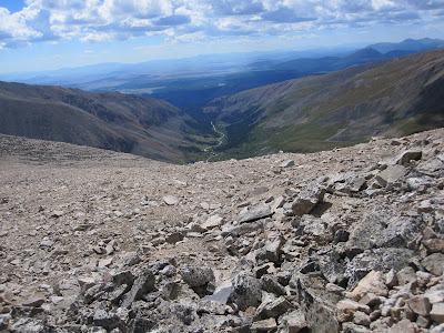
there was a pretty good wind whipping through and I was anxious to keep moving. We got a view into another valley and of some other mountains beyond.
From the saddle, the trail went up more steeply, with smaller switchbacks. There was very little exposure concern, just an endless array of rocks.
We arrived at the summit some time after 11:00 a.m. There was a beautiful view looking out the valley we'd driven up from Alma,
of the jagged ridge on the side opposite the one we hiked up,
of Quandary and Lincoln Peaks and across the valley toward Mount Bross, which was more rounded and less dramatic. Andrew called Judy on his cellphone and we enjoyed an apple and some water. We got to the peak after some other hikers had left
and were joined by another couple soon after we arrived. It was a beautiful day, the weather was nice, but not too warm, and I loved just being in the presence of Andrew and Sam. After spending a little time on the summit, perhaps 20 minutes or so, we headed down the way we came up, to the Democrat/Cameron saddle, then began our hike up to Mount Cameron, the subject of a later post.


I like this last picture--the sky, the clouds, the boys' expressions--picture perfect! Congrats on another good climb.
ReplyDeleteThe sky is a different color up there, isn't it? So beautiful.
ReplyDeletehttp://www.apeuropeanlahs.org/images/friedrich2.jpg
ReplyDeleteIf I hadn't wandered into the photo of sam looking into the valley, it would have looked just like this!