Monday, September 2, 2024

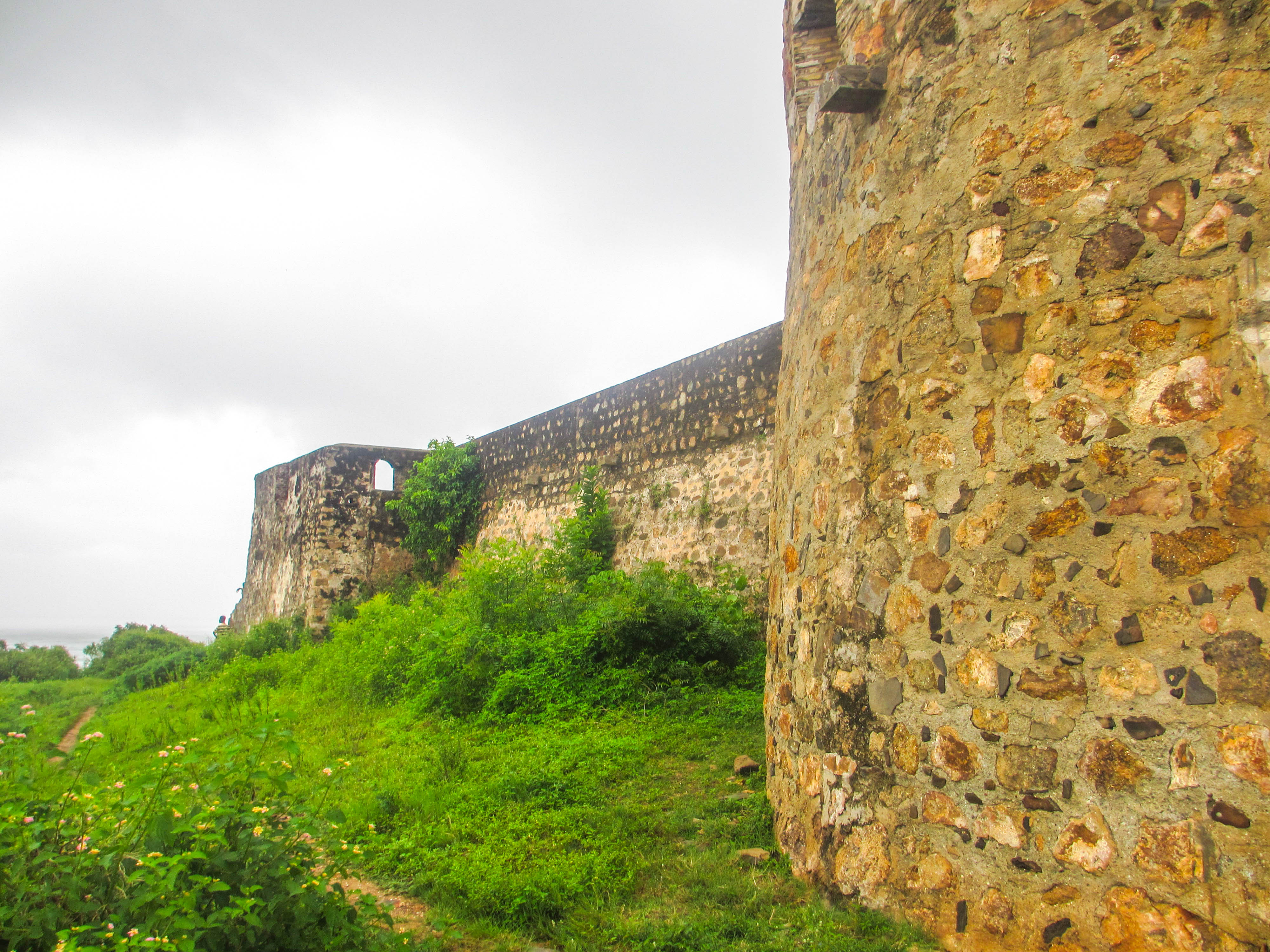
Fort Amsterdam - Ghana

This is a continuation of a series on Captain George Cannon. For the initial post and an index, go here. George Cannon and the ship Eliza may have been involved in an incident described hereafter while in the roads at Anomabu. This incident has been referenced in three books I’m aware of, one in passing, one with more detail and one with substantially more detail. All three sources interpret the incident differently and give somewhat different facts. I don’t have access to the original source material, so I have put the events together in a way that makes the most sense to me, based primarily on the most detailed reference, with some added facts from one of the other references. I visited Anomabu Fort and Fort Amsterdam with Judy and my cousin and his wife, Russ and Shelley Cannon, in 2014. 

On, or shortly before, April 9, 1791 an Anomabu Fort canoe was carrying a load of firewood to the ship Betty[1] anchored in Anomabu Road. The canoe overturned in the surf and the firewood washed up on the beach. The canoemen righted the canoe and came back to the beach to retrieve the firewood, but at the same time, boys from the town were also grabbing the firewood. The bomboy, a Fante employee of the fort, who was charged with supervising the loading and unloading of canoes at the beach, watched over the canoe and did nothing to stop the boys grabbing the wood. Sergeant Swann, a British soldier from the Fort who was watching, ordered the bomboy to leave the canoe and stop the boys from stealing the wood. The bomboy refused, stating that the canoe was more valuable than the wood. So Sergeant Swann struck the bomboy and drew blood. It happened to be a fetish day, sacred to the Fante, and striking the bomboy on that day in that fashion was a sacrilege. So the bomboy contacted his bendefoe company, the Fante militia, and they consulted priests who put a fetish on the gates of the fort, forbidding anyone from going into or out of the fort. [Fetish men and women were priests or priestesses that were oracles for the gods. They were consulted about major events. A fetish could be a tied bag with gold, single beads, little shells or teeth of an animal. A fetish on a door would bar anyone from entering.][2]

This, in effect, initiated a palaver. [Palavers brought together parties in a dispute which they tried to resolve by talking to each other. Anomabu had a Palaver House like other towns on the Gold Coast.][3] A crowd subsequently gathered at the fort to throw stones at the soldiers and forced them to stay inside.

Amoony Coomah, chief caboceer of Anomabu, heard of this incident and sent his heir along with the head of the bendefoe soldiers, Cobea, to settle things. They arrived at the fort to find Governor Thomas Miles was absent. A Mr. Tower was in charge in his place. The Fante delegation demanded that Tower give compensation to the town to resolve the palaver. Governor Miles, who had been at another fort conducting business, returned during these discussions and was angry that a palaver had been initiated in his absence. So he panyarred these Fante men (took them hostage) and demanded that Amoony Coomah pay two bullocks as a fine for the Fante initiating the palaver while he was away. [Panyarring was a seizure of goods or people by an aggrieved party in a dispute. The goods or people were held until the dispute was resolved or payment was made. It differed from pawning because it was not a consensual agreement. It was sometimes a means to force a palaver. This was done by both the English and the Africans.][4] Then Governor Miles had the fort guns loaded and turned on the town of Anomabu. The Fishing Town pynins offered two pawns to settle the dispute and have the panyarred men released, but Miles refused.

The Fante in Anomabu sought the protection of the nearby town of Agah, two miles to the east on the coast. [Agah was the governing town of the Fante.] The people of Agah sheltered the people of Anomabu and in an attempt to force the palaver, panyarred two fort canoes carrying 22 slaves to British ships in the Road.

So Miles asked the captains of the British ships in the Road for help. In addition to the Eliza with her eight crew members, other ships that may have been in the the Anomabu roads at the time were: (a) the Young Hero, 80 tons, out of Liverpool, also owned by John Dawson, the owner of the Eliza, and captained by John Ainsworth with 14 crew; (b) the Maria, out of London, also owned by John Dawson, with an unknown captain and number of crew; (c) the Thomas, 228 tons, out of Liverpool, also owned by John Dawson and captained by William Quarrier with 31 crew; (d) the Molly, 279 tons, out of Liverpool, with 35 crew; (e) the John, 128 tons and out of London, captained by Patrick Ryan and an unknown number of crew; (f) the Fly, 143 tons, out of London, captained by Richard Coley with an unknown number of crew; (g) the Mermaid, 96 tons, out of Bristol, captained by Mungo Wright with 17 crew; (h) the Dragon, 45 tons, out of Bristol, captained by John Scasbrick, with 11 crew; and (i) the Jupiter, 296 tons, out of Bristol, captained by John Smith, with 42 crew.

Captain John Smith of the ship Jupiter sent 20 of his 42 seamen to the fort to help defend it. Then, without consulting the governor or council at Cape Coast, Governor Miles ordered the destruction of Agah.

Thomas Eagles, a British merchant, had a factory in Agah operated out of the largest building in town, a two story white-washed building built on a hill. Captain Fraser and Thomas Owens, the captain and mate of the ship Mercury, happened to be meeting with Eagles when guns from the ship Betty opened fire on Agah. It appeared to them that the Betty was using the factory as their target. They rushed to move goods from the upper floor to the lower floor when the guns from Anomabu Fort also began firing. Cannon shot was peppering the upper floor. Eagles and his Agah workers, along with the men from the Mercury, got the goods moved from the upper floor of the factory, but the people of Agah would not allow them to remove the goods from the building, thinking that as long as Eagles had property in town, Governor Miles would not burn it. However, the firing on Agah continued intermittently through the night from the fort and from the Betty.

The next morning, April 10th, Governor Miles sent soldiers from Anomabu Fort, assisted by sailors from British ships, marching toward Agah, two miles along the beach. As they neared Agah they were ambushed by the Fante of Agah who were hiding behind a pond near the approach to the town. Fighting ensued. During the fight, the British soldiers and sailors set fire to Agah. Two of the British were killed, others were wounded, and four sailors from the ship Betty were captured by the Fante and held as prisoners. A number of Fante were also wounded, including sons of Coffee Dansu, the leading caboceer of Agah, and Yellow Joe, an important gold-taker in Anomabu.

Around noon, the men from the Mercury, who had been with Eagles in his factory, fled east along the beach to the Dutch Fort Amsterdam. Captain Fraser had five slaves and a box with 30 ounces of gold and papers. Another Englishman, a Mr. Drysdale, tried making his way to Fort Amsterdam through the bush and was captured by the Fante. He was stripped naked and beaten and bruised very badly before the governor of Fort Amsterdam intervened and was able to get him to the fort.

The British soldiers and sailors returned to Anomabu from Agah and started looting the town of Anomabu. They also started digging up Fante graves to search for valuables. The Fante believed that the dead carried the wealth buried with them into the after-life and this desecration really inflamed the Fante.

Some time after the looting stopped and the soldiers and sailors returned to the fort and their ships, Governor Miles allowed four men out of the fort and they were captured and killed by the Fante. Amoony Coomah indicated that the Fante would no longer deal with Governor Miles and also determined that if they could capture him, they would take him into the interior and force him to suffer a painful death.

An investigation was launched by Governor William Roberts of Cape Coast Castle and the CMTA council. Governor Miles was eventually condemned for refusing the offer of the Fishing Town pynins to settle the dispute and for using seamen from the ships. The desecration of the Fante graves was particularly criticized. Miles was dismissed from his post. Thomas Eagles estimated his losses at £1,700 to £1,800.


However, the dismissal of Miles did not end the palaver and trade stood at a standstill. The British sent additional troops and guns to Anomabu in July 1792. The British did not redeem the four sailors from the Betty, held by the Fante, until 1794. The palaver was not settled until 1795 when 15 caboceers from Anomabu and Agah and the CMTA Council met. The British had to pay large sums and agree to resume the customary payments as part of the settlement.[5]

We visited the Gold Coast in 2014 and stopped at the Dutch Fort Amsterdam. Fort Amsterdam is on a hill overlooking the ocean. Some locals joined us and added some additional local flavor to our photos. 
Fort Amsterdam on the top of the hill.

Walking up the hill to Fort Amsterdam. Russ, myself and a young local. 


The ground floor inside the fort. 


The upper level.


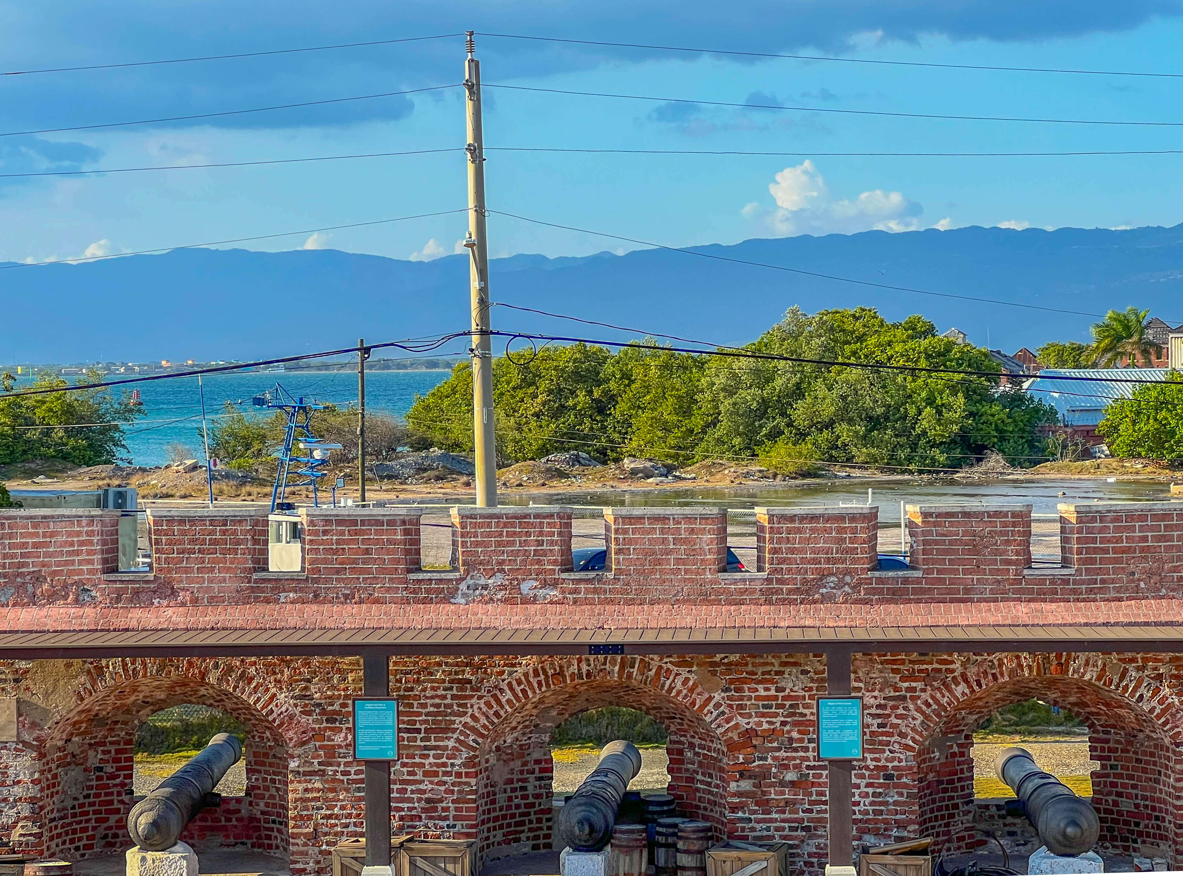
Guns on the upper level. 


The coast on the northeast side with lots of canoes from one gun portal. 


The coast on the east side.

The coast on the southwest side.

[1] The ship Betty (or Betsy?) does not show up in the slave trade database. As noted, four of its crew were panyarred for three years and it probably never did deliver any slaves to the Caribbean.

[2] Negroes are Masters, p. 26

[3] Negroes are Masters, pp. 20-21

[4] Negroes are Masters, p. 31

[5] Negroes are Masters, pp. 215-220; Rebecca Shumway, The Fante and the Transatlantic Slave Trade, pp. 84-86; Door of No Return, p. 191. 


Sunday, August 25, 2024

Captain George Cannon in Jamaica

In February 2023, Judy and I went with a cousin of mine, Chad Cannon, to Jamaica, to gain more insight into Captain George Cannon, my third great grandfather. 

The earliest visit by George Cannon to Jamaica was on the ship Eliza, his first voyage on a slave ship, when he was age 23. The Eliza left Liverpool on March 22, 1790, stopped in Lisbon, then visited Cape Coast Castle and Anomabu on the Gold Coast of what is now Ghana, to purchase enslaved people. The 1st and 2nd mates on the Eliza died in Africa and George likely became 2nd mate. The Eliza left Cape Coast on March 13, 1792, almost two years after leaving Liverpool, and landed in Falmouth, Jamaica on April 30, 1792. The Eliza unloaded 119 enslaved people, including 61 men, 40 women, 11 boys and 7 girls, who were likely sold at auction in Falmouth. 

Falmouth is on the north coast of Jamaica, 18 miles east of Montego Bay, another port, and is the chief town and capital of the parish of Trelawny. Trelawny Parish is named after William Trelawny, who was governor of Jamaica between 1767 and 1772 (the year he died). Trelawny helped to found Falmouth in 1769 at a place called Martha Brae Point. It was named after the town of Falmouth in Cornwall, England, where Trelawny was born. In 1781 Falmouth had 8 to 10 houses and by 1793, shortly after George left, Falmouth had 150 dwellings and was growing rapidly. Trelawny Parish had a large number of plantations that produced sugar and rum and relied heavily on enslaved labor. It became a central hub in the slave trade. George was there in the early stages. Every structure we could find that was close to the time he visited post-dated his visit. 
This is a relatively recent map of Falmouth which now has a port for cruise ships and is dramatically larger than when George visited. 
We tried to get close to the port, but it is closed off by fencing. The first photo below is of the north berth and the second photo is of the south berth. I couldn't find anything which showed the port earlier, but I presume the slave port was in the same location. 


An ocean view a few miles west of Falmouth docks. 
Five years after George visited, in 1798, the Falmouth Water Company was chartered to supply fresh water to the town and to the ships in the harbor. Water from the Martha Brae River was carried by a series of aqueducts and stored in a circular stone reservoir in the town square. The square became known as Water Square. Water was then pumped to the nearby houses and to the docks so that ships could replenish their fresh water supply. Falmouth was the first town in Jamaica to have running water and got it before New York City. In 1952 the use of the reservoir was discontinued due to use of new electric pumps and a new plant. The reservoir was demolished in 1954 and replaced by a small circular garden and fountain. At the time George was in Falmouth, the square was known as Market Square and the markets where enslaved Africans were sold took place there. The main street is now known as Market Street. 
An enlarged section of first map above shows where Water Square is located in relation to the port (the blue dot near the lower left end of the photo).  
Water Square when we visited. 
St. Peter's Anglican Church was the first church in Trelawny Parish and is the oldest public building in Falmouth. It was built using local limestone and bricks imported from Liverpool on land donated by Edward Barrett, a local planter. Construction began in 1794, a year after George visited, and was completed two years later. We were not able to get inside, but the furniture in the church is made of local mahogany. 


Judy and Chad in front of St. Peter's. 
A sugar plantation, with a huge home known as the Greenwood Great House, existed when George visited Falmouth, although it is unlikely George would have visited it. It is located on a hill 7.4 miles from Water Square in the direction of Montego Bay. It was built in the 1780s by Richard Barrett, who owned over 84,000 acres and had over 2,000 enslaved people. It is one of the best preserved Jamaican great houses of the plantation era as the vast majority of the great houses, over 200, were razed during the slave revolt of 1831. We visited it to get a feel for a slave plantation home. It is in St. James Parish, very close to the border with Trelawny Parish, and is equidistant from Falmouth and Montego Bay (which is the capital of St. James Parish). 
A view from the back of the house where we parked our car. 

The inside furnishings reveal the staggering wealth that the Barretts had. 

Below is a view from a window on the top floor toward the ocean. Falmouth is off to the right and Montego Bay is off to the left; neither can be seen in the photo. 

After selling enslaved people at auction, sugar and rum were likely the commodities that Captain Cannon obtained in Jamaica to take on his ships back to Liverpool. We visited Worthy Park Estate, a sugar plantation with a rum distillery in Lluidas Vale, St. Catherine Parish, to get a feel for the sugar cane fields and rum production. Worthy Park was one of the earliest sugar and rum producers in Jamaica. It is in central Jamaica, 33 miles northeast of Kingston, which is on the southern coast, and 70 miles southeast of Falmouth. The initial land upon which Worthy Park exists, was 840 acres granted to Lt. Frances Price in 1670 for his services to Cromwell during Cromwell's invasion and capture of Jamaica from the Spanish in 1665. Price patented the name "Worthy Park." Commercial production of cane and sugar began in 1720 and the production of rum started in 1741. The plantation grew to over 10,000 acres. Molasses, which is used to produce rum, is extracted from a sugar factory on the property. In 1793, about the time George Cannon first visited Jamaica, Worthy Park had about 300 slaves and was producing more than 250 hogsheads of sugar a year. A hogshead was a barrel with sugar weighing the same amount as 64 pounds of water. A gallon of water weighs 8.34 pounds, so a hogshead would be 533.76 pounds of sugar. 250 hogsheads would be  133,440 pounds of sugar. About the same time, Worthy Park was producing about 100 puncheons of rum a year. At about 110 gallons per puncheon, that was about 11,000 gallons of rum at 75% alcohol by volume (see "Searching for the Invisible Man: Slaves and Plantation Life in Jamaica" by Michael Craton, Harvard University Press). 
A road through a sugar cane field on Worthy Park Estate. 

Sugar cane from the side of the road.

Sugar cane is still harvested by hand. It is then collected on large carts and taken by tractor to the sugar factory. 


Worthy Park uses a relatively new copper-pot still made in Scotland, but it is the same method it used in the 18th century. 

Judy and me below the still. 

Wooden barrels are used to age the rum. 

Modern product on pallets.

On November 7, 1798, Captain Cannon, the captain of the ship Iris, visited the Court of Vice Admiralty for Jamaica in St. Jago de la Vega, also called Santiago de la Vega, the capital of Jamaica. It is now known as Spanish Town. It was a distance of more than 15 miles northwest of Kingston. Captain Cannon was with Captain William Burke of the ship North America and John Hill, a mariner from the ship Uncle Toby, two ships that the Iris had captured as prizes and escorted to Kingston. Each provided John Fraser, a commissioner, various documents and sworn statements to help the court determine whether the North America and the Uncle Toby were legal prizes of the Iris. George Cuthbert, the sole judge of the Court of Vice Admiralty of Jamaica made rulings on the two ships. On January 19, 1799, Cuthbert determined that the Uncle Toby was not a lawful prize and it was discharged. On January 24, 1799, the judge determined that the North America and her cargo were lawful prizes. 

We visited Spanish Town after much consideration. The U.S. State Department labeled Spanish Town as Level 4, "Do Not Travel," U.S. Embassy personnel are not allowed to travel into a Level 4 area. I contacted a researcher I'd used in Jamaica about it and she said it was like going into bad parts of Los Angeles. Be smart and you'll be fine. Don't go there at night. We went and had no problem. 
The Rodney Memorial commissioned in 1783 to honor Admiral Lord Rodney who defeated Admiral du Grasse of the French fleet in 1782 in the Battle of Saints. This saved Jamaica from a French invasion. I'm pretty certain that Captain Cannon would have visited this memorial. 


A cannon in front of the Rodney memorial. 

Old King's House was built in 1762 and was the official residence of the governor of Jamaica for over 100 years, including the time when George Cannon was there. It was almost entirely destroyed by fire in 1925 and all that exists is the front facade. 

I'm not sure where the Court of Vice Admiralty for Jamaica was exactly, but it was somewhere on this square. The statue of Admiral Lord Rodney is in the front of the building straight ahead, which is now the Jamaica Archives, and the Old King's House is just to the left. 

Captain Cannon spent 39 days in Jamaica after he landed in Falmouth in 1792. He left Jamaica on June 8, 1792, very likely with a cargo of sugar and/or rum and traveled to New York in the U.S. From there, the Eliza traveled back to the Gold Coast of Africa, visiting Anomabu and Cape Coast Castle, for more enslaved Africans, and sailed back to Jamaica, arriving in Port Royal on May 7, 1793, with 167 enslaved persons, 55 females and 112 males.
Advertisement in the Port Royal Gazette dated May 8, 1793. 167 Gold-Coast Negroes for sale. 
About five years later, George Cannon, as captain of the ship Iris, landed in Port Royal somewhere between  November 4 and 7, 1798. 
Captain Cannon kept a logbook of the Iris voyages. 

The cover page of the logbook. 

Sample pages from the logbook.
He was accompanied by his two prizes, the North America and the Uncle Toby. The Iris had 414 enslaved persons onboard obtained in Bonny, in what is now Nigeria. On November 9, the Iris crew signed an agreement turning custody of the North America and the Uncle Toby to Richard Lake, Abraham Alexandre Lindo and Richard Lake, Jr. of Lindo, Lake and Company. This agreement was given to Commissioner John Fraser when Captain Cannon visited him on November 15. Captain Cannon paid someone to pilot the North America from Port Royal to Kingston to the private wharf owned by Lindo, Lake and Company. An expense paid by Captain Cannon was "negro hire removing the ship from the upper part of the harbor to the places of sale." 
An ad in the Port Royal Gazette on November 30, 1798, indicating that the Iris, with Geo. Cannan, Master, was going to depart with a convoy around the 11th of January. 

After 3 months and 8 days in Jamaica, the Iris, with Captain Cannon and five other crew member, sailed on February 12, 1799. On March 5, the North America and its contents were sold at auction. On April 12, Captain Cannon landed in Liverpool and was discharged from the Iris. 

Less than three months later, Captain Cannon left Liverpool on the Iris. It obtained enslaved persons in Angola. On August 9, 1800, the Iris landed at Port Royal again with 408 enslaved persons. 
Ad in the Port Royal Gazette for sale of 409 negroes from the Ship Iris, George Cannon, Master, from Angola. 
About October 10, 1800, the Iris sailed from Kingston for Liverpool with a cargo of 80 hhd (hogsheads) of sugar (about 42,701 pounds). The Iris was leaking and had to return to the wharf of Lindo and Lake. At the wharf, some of the sugar was stolen and the hogshead casks were in such poor condition that they had to be repackaged into new casks, only filling 66 hogsheads (they lost 7,473 pounds of sugar). It appears that Captain Cannon took passage on a different ship back to Liverpool where he arrived on November 14, 1800.
The Royal Gazette on October 17, 1800. The repaired Iris is sailing for London with Stephen Robson as Master. 
Kingston harbor is the seventh largest natural harbor in the world. It is 9.9 miles long and 2 miles wide. On the north side of the harbor is Kingston and on the east and south side is a thin strip (or spit) of sand called the Palisadoes which protects the harbor. In 1655 Oliver Cromwell captured Jamaica with a group that included William Penn and the buccaneer Henry Morgan. The British constructed a fort at the end of the Palisadoes, which separates Kingston Harbor from the Caribbean, to protect the new acquisition. They initially called it Passage Fort, then when finished, Fort Cromwell. After the restoration of the monarchy in 1660 under Charles II (Charles I was executed), it was renamed Fort Charles. Port Royal was a town near the end of the Palisadoes next to Fort Charles which had a harbor for ships. On June 7, 1692 what has been estimated as a 7.5 magnitude earthquake on the Richter scale hit Jamaica and it and the subsequent tsunami devastated the Palisadoes. Much of the population of infrastructure on the Palisadoes was destroyed and Kingston, which had been an agricultural area, was born as a city after the earthquake to house survivors. By 1716 Kingston became the largest city and the center of trade in Jamaica. Wealthy merchants started moving their homes from above their businesses a little north. By 1780 Kingston had a population of 11,000 and the merchants lobbied to have the capital moved from Spanish Town to Kingston because of the commercial activity. In 1788 Kingston had a population of 25,000, about a tenth of the overall population on Jamaica. One in four people in Kingston was white, two out of five were free, and three out of five were black and enslaved. 

Fort Charles was heavily damaged in the 1692 earthquake and it sank by a meter. In 1735 new wharves and storehouses were built at Port Royal and housing for officers of the Yard. Over the next 30 years cooperages, workshops, sawpits and accommodation's, including a canteen for the crews of ships, were built. In 1765 it had 104 guns and a garrison of 500 men. We flew into Norman Manly Airport, which is on the Palisadoes, just a 10 minute drive from Port Royal. We checked into our hotel in Port Royal, then drove to Fort Charles, a short drive.  

A map of the Palisadoes and Kingston. I believe the map was at Fort Charles. Fort Charles is at the bottom left at the tip of the Palisadoes. I believe the darkened land on the north side of the Palisadoes was land that sunk in the earthquake. 

A little closer view. 

Fort Charles at the end of the Palisadoes. 

This is an 1827 map of Port Royal that was in the Greenwood Great House, showing positioning before and after the earthquake and tsunami. 

A close-up of Fort Charles in 1827.

A close-up of Port Royal.


From the upper deck of Fort Charles and looking north toward Kingston and the mountains behind it. 

A cropped view looking toward Kingston. 

Outside of Fort Charles to the south, looking north. 
We stopped at St. Peter's Church, the only other building that I could find that existed at the time Captain Cannon visited. It was closed, so we could only look from outside the locked church yard. 


The best views we got of Kingston from the Palisadoes was from our hotel, the Grand Hotel Excelsior Port Royal. We were on the north side of the Palisadoes and had an unobstructed view. 
This photo was taken at night before I went to bed, from the back of the hotel property. The lights of Kingston stand out. 

A similar view in the morning. 
Chad was able to stay a day or two longer than us and he visited the Kingston wharf. He identified and visited Lindo street named after the Lindos who Captain Cannon worked with.

Chad's photo of Lindo Street. 

Chad's photos of warehouses at Lindo's wharf.