Kenai Fjords National Park covers 1,047 square miles of a portion of the east side of the Kenai Peninsula and off-shore islands. 51% of Kenai Fjords NP is covered by ice because it contains a portion of the Harding Icefield, which receives 60 feet of snow each year, and has created up to 40 glaciers. The fjords are glacial valleys created by the glaciers and submerged below the ocean by rising seas and land subsidence.
 |
| Map of Kenai Fjords NP from Wikipedia. |
 |
| A screenshot from Google Maps showing the Kenai Peninsula (which includes Kenai, Homer and Seward) south of Anchorage. |
 |
| A closer view of Google Maps. |
We drove into Seward on Monday, July 20, 2016 and set out at 9:00 a.m. on Tuesday morning the 20th on the
Major Marine 8.5 hour Northwestern Fjord Cruise, the cruise that went furthest into the NP. The cruise started in Seward which is at the head of Resurrection Bay.
Resurrection Bay which is about 18 miles long and up to 5 miles wide, was named by Alexandr Baranov who retreated into the bay during a bad storm which subsided on Easter Sunday, thus the name. About 35 miles south of Seward we stopped briefly off the
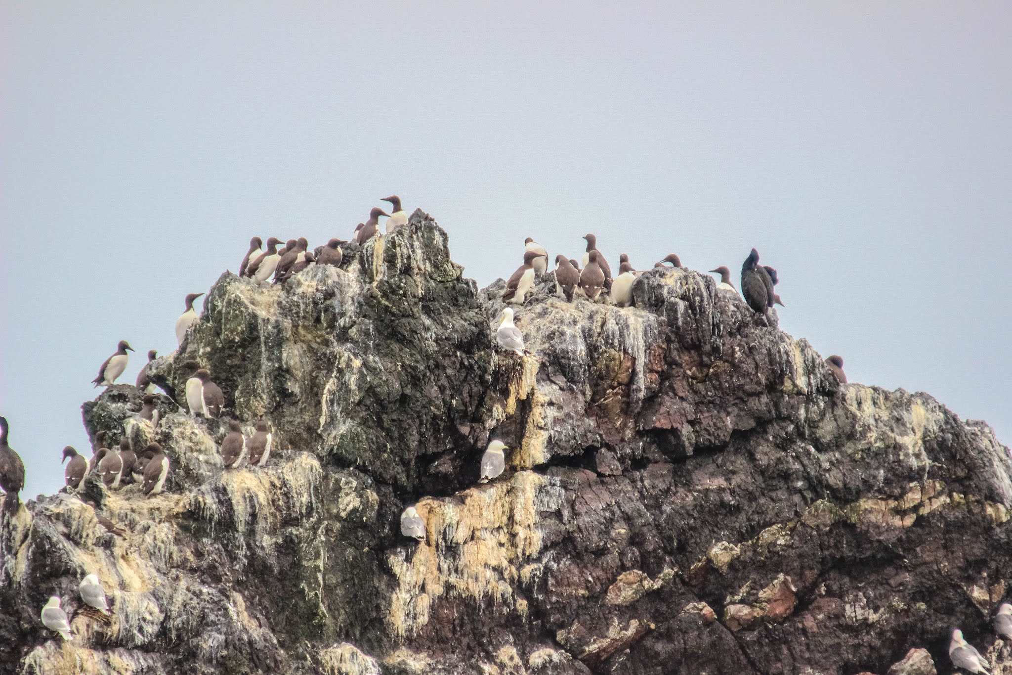
Chiswell Islands to see a small rookery of endangered Steller sea lions. The Chiswell Islands are uninhabited and part of the Alaska Martime National Wildlife Refuge. They provide nesting sites for horned puffins, tufted puffins, black-legged kittiwakes and various auklets. From the Chiswell Islands we went through Dora Passage and then northwest up the Granite Passage, between Granite Island and Harris Peninsula, into Harris Bay, then Northwestern Fjord and at the end of it, Northwestern Glacier (note that Northwestern Glacier is still very far north of the southern reaches of the NP). Northwestern Glacier extends 7.4 miles from the Harding Icefield on the southeastern side to the Northwestern Fjord. It was named for Northwestern University in Evanston, Illinois. Harris Bay is named after Abram W. Harris who was president of Northwestern University from 1906 to 1916. There must have been Northwestern grads on the U.S. Geological Survey team that did the naming. We also stopped to look at
Ogive Glacier, named after
alternating bands of black and white on some glaciers from seasonal re-freezing. Ogive is on the western shore of Northwestern Fjord, south of Northwestern Glacier. We also stopped to view
Anchor Glacier on the western shore of Northwestern Fjord at the head of Harris Bay, further south of Ogive Glacier. On the way back, we mostly followed the same route, except a little eastward, more out into the Gulf of Alaska, and we got caught in heavy 8 and 9 foot swells which had the boat really rocking. About a third of the passengers got really sick, including Judy, which took most of the enjoyment out of the trip for her. I fortunately did not get sick and loved this interesting way of exploring the NP. We got back about 5:30 p.m.
 |
| The map from Major Marine Tours. The cruise we took followed the blue dotted line up to the end of Northwestern Fjord. |
Photos of the trip into Kenai Fjords NP are as follows:
 |
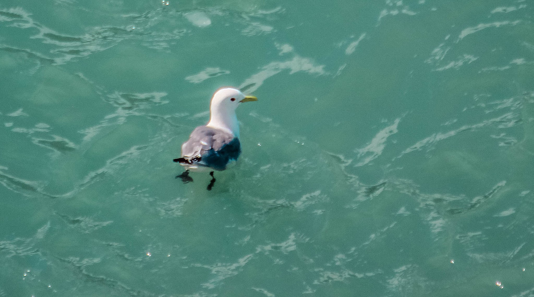
| A bald eagle we saw in Resurrection Bay near Seward. |
 |
| Sea otters in Resurrection Bay. The second picture hints at one of the otters being extremely aggressive toward the other one evincing expressions of concern from some of the passengers. |
 |
| Harbor seals on rocks near the western edge of Resurrection Bay. They camouflage so well with the rocks that we kept noticing more the more we looked. |
 |
| A mountain goat parent and child on the steep western side of Resurrection Bay. |
 |
| We followed a humpback whale and got views of its blow-hole and fins. |
 |
| Horned puffins on the edge of Resurrection Bay. |
 |
| A tufted puffin in Resurrection Bay. |
 |
| One of the Chiswell Islands with Steller sea lions basking on the rocks near the ocean. |
 |
| Bear Glacier in Resurrection Bay. |
 |
| Northwestern Glacier. We watched it calve into the fjord. |
 |
| I believe this is Anchor Glacier. |
 |
| Harbor seals on floating ice beyond Northwestern Glacier. We saw lots of seals on floating ice throughout Northwestern Fjord, one of my favorite things about this excursion. |
 |
| The Chiswell Islands on our way back as the weather gets more testy and the swells start to increase. |
We saw a great variety of wildlife, some gorgeous glaciers close-up and saw a part of the world otherwise very difficult to get-to.