In June 2019 we spent several days in Iceland and saw some beautiful natural landmarks. Rather than spend much time on any one, I'm going to briefly describe each one, provide a photo or two, and then move on.
Thingvallavatn Lake is the largest natural lake in Iceland and the Eurasian and North American tectonic plates meet beneath it.
 |
| This photo is from the southern edge, looking north. |
 |
| This photo is from near the same place, but looking more west. |
Thingvellir National Park is near the far north end of Thingvallavatn Lake. Here the boundary between the North American and Eurasian tectonic plates is clearly visible.
 |
| A fissure, or gap in the plates, I'm not sure which, in the foreground and the lake in the background. |
 |
| A fissure line evidenced by tall bands of rock. |
 |
| A small stream in the area. |
Gullfoss (golden waterfall) is northeast of Thingvallavatn Lake on the Hvita River. It has two stages: the first drop of 36 feet over a three-step staircase, then the second drop of 69 feet into a crevice that is 105 feet deep. The crevice is 66 feet wide and goes for 1.6 miles. It carries 4,900 cubit feet of water, per second, in the summer.
 |
| Gullfoss Waterfall |
 |
| The first drop. |
 |
| The second drop into the crevice. |
Faxifoss (horse mane waterfall) was much smaller, southwest of Gullfoss, but still beautiful. It had a 23 foot drop and was about 260 feet wide. It also had salmon steps along the left side of it.
 |
| Flaxifoss with the salmon steps to the left side. |
 |
| People to the bottom left give perspective. |
About three-quarters of the way from Reykjavik to Vik, the southernmost point of Iceland, we encountered Seljalandsfoss, a 197 foot tall waterfall, that we were able to walk behind.
 |
| A front view of Seljalandsfoss. |
 |
| From behind. |
 |
| From an overlook to the side. |
Further along the road to Vik, we encountered Skogafoss (Forest Falls), which also has a 197 foot drop but is much wider and has much more volume than Seljalandsfoss. We couldn't get too close to Skogafoss without really getting wet because of the spray.
 |
| This was about as close as I could get without completely drenching myself and camera. |
Getting closer to Vik, we turned off to hike to Solheimajokull Glacier, an outlet glacier of the Myrdalsjokull Icecap, Iceland's fourth largest icecap. It was about a 20 minute walk from the parking area, evidence of the melting glacier which has receded dramatically.
 |
| From a distance we could see the icecap behind the glacier. |
 |
| As we got closer, the view of the icecap faded and we saw a large lagoon full of glacier melt water. |
 |
| People to the far right give perspective to the size of the glacier front. |
 |
| A man standing on some glacial silt in front of the front wall. |
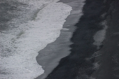
Near Vik, the southernmost point in Iceland, we went to Reynisfjara, a black sand beach, and saw Reynisdrangar, 220 foot tall basalt towers in the distance.
We drove a little bit and came to Halsanefshellir, a triangular peak with a base of basalt which reminded me of Hallgrimskirkja in Reykjavik, or I guess really, Hallgrimskirkja appeared modeled after this site.
We drove a little more to a plateau which holds the Dyrholaey Lighthouse. From there we could see a massive stone arch extending out from the plateau and got a beautiful view of black Reynisfjara Beach.


Nice summary. The best thing about Iceland (other than its food) is its waterfalls.
ReplyDelete