Cimarron National Grassland is the largest area of public land in the state of Kansas. It encompasses 108,176 acres, mostly in Morton County but extending a little bit eastward into Stevens County, in the southwest corner of the state near the borders with Colorado and Oklahoma. It is mostly shortgrass prairie with sand sagebrush and groves of cottonwood and other trees near the Cimarron River which flows mostly underground two to four feet.
 |
| Great plains yucca found near Point of the Rocks Ponds. |
 |
| Brown-spined prickly pear found near Point of the Rocks Ponds. |
 |
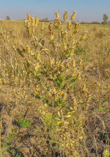
| Bractless blazingstar, flowering above and dried out above that, near Point of the Rocks Ponds. |
 |
| Little bluestem |
During the Dust Bowl of the 1930s, Morton County was the most devastated county in the U.S. The federal government purchased the land from bankrupt farmers and restored the original prairie. Cimarron National Grassland was created in 1960.
 |
| Sand sagebrush near Middle Spring. |
 |
| Closer view of sand sagebrush leaves. |
 |
| Leaves of the Siberian elm near Middle Spring. |
 |
| Judy near a Siberian elm. |
 |
| An eastern cottonwood tree near Middle Spring. |
 |
| Leaves of the eastern cottonwood. |
Hunting of whitetail deer, pronghorn, prairie chicken, quail, pheasant, prairie dog and jackrabbit is allowed and occasionally elk when the reintroduced herd of 50 elk needs to be thinned. It is listed by the American Birding Association as one of the top places in the U.S. for birding as 345 species of bird can be found there.
Point of Rocks Ponds is a set of man-made canals, presumably using Cimarron River water, stocked in the winter with trout and channel catfish in the summer for fishing. This is the most highly fished area in Kansas.
 |
| Our rental car and the shortgrass prairie is visible in the background. These man-made channels are flanked by bulrushes. |
23 miles of the Santa Fe Trail run through it.
 |
| Markers like this show the route of the Santa Fe Trail. Trees in the background show where the Cimarron River is located. |
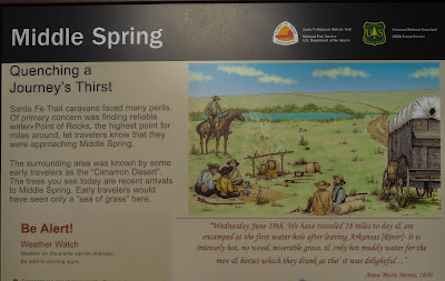
Middle Spring was only one of three reliable sources of water along the 150 mile long Cimarron Cutoff of the Santa Fe Trail and virtually every merchant wagon trail used it as a camping spot. No water was visible when we visited Middle Spring and I assume the water table is probably lower now.
 |
| From a point just east of Middle Spring, looking toward the Cimarron River in the background (revealed by the line of trees). The photo also reveals many acres of shortgrass prairie. |
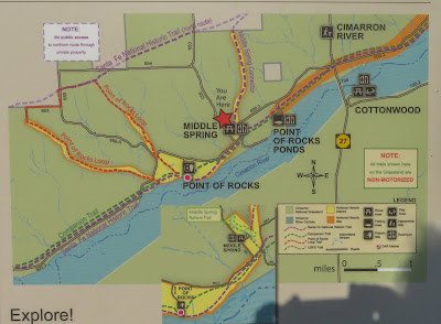
A Santa Fe Trail marker is nearby as is Point of Rocks, a rock outcrop overlooking the Cimarron River Valley which was an important landmark for travelers.
 |
| I believe this rendition is inaccurate because it shows the Cimarron River running. What made Middle Spring attractive, which is nearby, is that the water was above-ground. |
 |
| Point of Rocks is the third highest point in Kansas (we visited the high point, Mount Sunflower, earlier on our trip). |
 |
| The Cimarron River runs underground and the trees are an indication of where the river and riverbed are located. |
Jedediah Smith, the mountain man who was the first U.S. citizen to traverse the Mojave Desert, the Great Basin Desert and the Sierra Nevada Mountains, was killed by Comanches in 1831 in or near this area in what is now southwestern Kansas.
In my prior post on the
Pawnee National Grassland I noted that I was disappointed in the lack of what appeared to be grassland. It seemed mostly like farms dotting the landscape. Cimarron National Grassland is very different. The prairie there seems very open and goes for miles. I would have enjoyed more time to explore it, particularly at different times of the day with an opportunity to see some of the wildlife.


I didn't realize this was the heart of the Dustbowl devastation. They've done a remarkable job of restoring the grasslands--a true environmental victory.
ReplyDelete