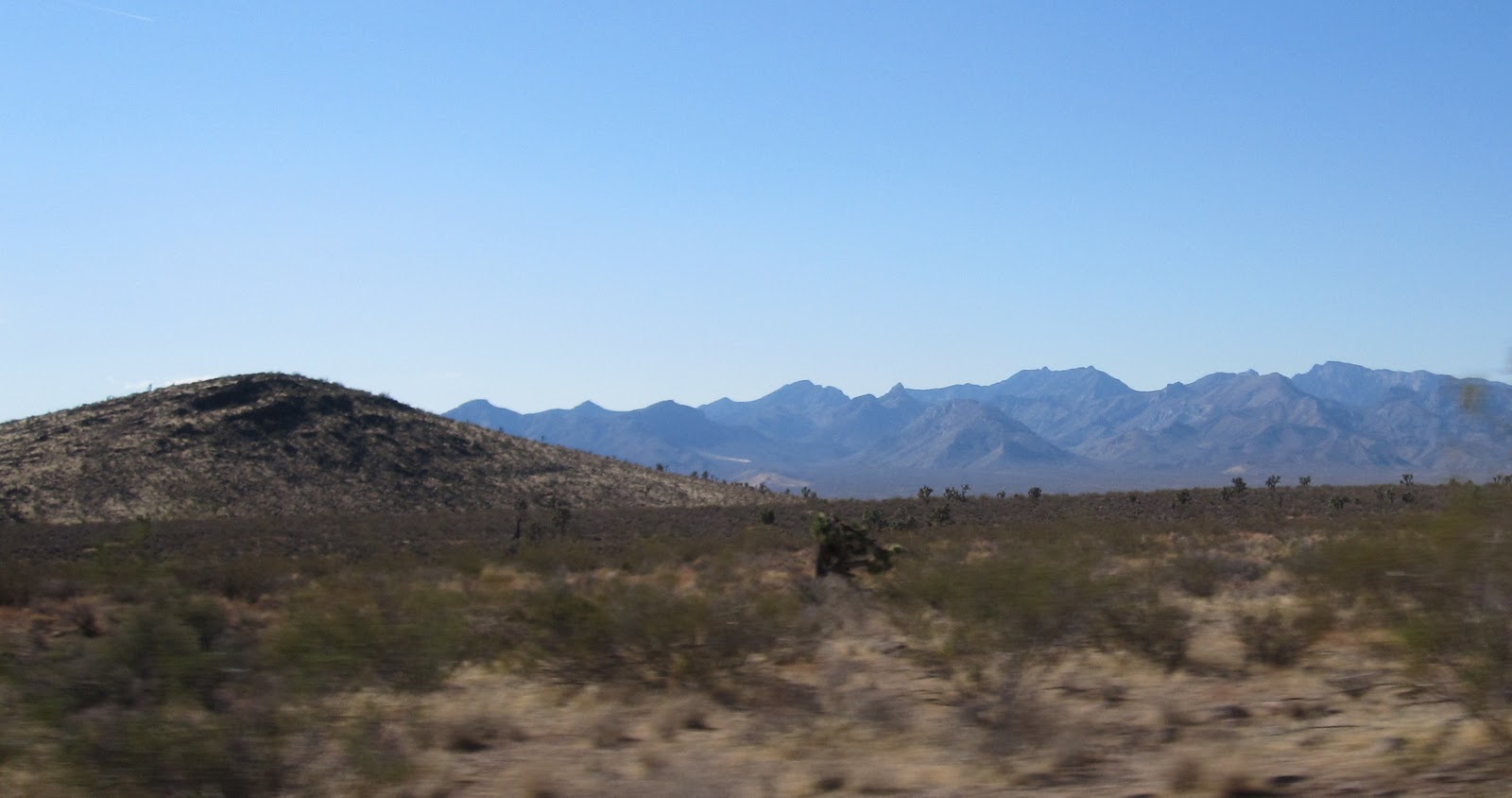
Wednesday, November 3, 2010

GQC: Muddy River to Las Vegas Springs


November 20, 1849 (Tuesday)

Rich and Hunt Companies (Muddy River near Moapa to 23 miles up the California Wash):

The Hunt and Rich companies, familiar with the “long desert” they had “to cross,” thought it best to” travel during “the night so that” their “cattle would not suffer” as “much thirst as they would in the daytime.[1] Consequently,” they “had everything arranged” before hand and at “noon” left the Muddy and “started up” the California Wash “that led” them “out into the desert. On one side” was “a sort of barrier prepared by the Indians” from which the Indians “attacked” the first “pack company” that “passed” through earlier that fall. “The first part” of the “road was sandy” and thereafter got better.[2] James Brown, George Q. Cannon and Henry Rollins left early with Captain Hunt to scout out the trail. About 12 miles from the Muddy they “found some small pools of water”[3] “near the road” to the left.[4] James Brown and George Cannon stayed behind to guide the Rich company “to it, while Captain Hunt and Henry Rollins went ahead in search of more pools of water.”[5] After the Rich company had obtained water from the pools, sometime after dark,[6] Cannon and Brown “stayed” behind as “guides for the wagon train,” which was still behind. When the wagon “train arrived,” Cannon and Brown “turned them off to the water” and then “had to dip water with cups,” to fill buckets and then “water the stock from buckets.”[7] “The moon shone brightly and made it pleasant traveling.”[8] 23 miles from the Muddy (11 miles from the last water), still following the California Wash, Captain Hunt and Henry Rollins found a “good spot of grass” about a mile to the right (west) of the road. Another 1 ½ miles further to the right, they found “water among some bushes” in “puddles from the last rain,”[9] about midway between Crystal Lake and Dry Lake.[10] The Rich company arrived about 10:00 p.m. and camped near the grass.[11] The Hunt company arrived about 2:00 a.m. and camped. Addison Pratt acknowledged that the “last rains” helped “facilitate” their “crossing” of the “desert very much.”[12]

Today, the California Crossing is identified by two Spanish Trail markers, one on each side of the Muddy River. The marker on the north side of the Muddy can be found by taking the Glendale exit off the I-15, then turning onto SR 168 toward Moapa. Just after crossing the bridge over the Muddy, turn left on to the first dirt road. There are a number of dirt roads in the vicinity, so veer towards the left and get on the dirt road that follows the north side of the railroad tracks. The Spanish Trail marker is about four miles from SR 168. The same road can be accessed at Moapa Siding off of SR 78; it is the dirt road to the right just after crossing the railroad tracks. The Spanish Trail marker on the south side of the Muddy can be accessed by taking exit 88 off of the I-15 onto SR 78 heading north. The marker is to the right as the road turns to the left down a hill above a dairy. The banks of the Muddy at this spot are very steep and it is unknown whether the Muddy was like that then, and if so, how they were able to get the wagons and horses across the River. When I visited over ten years ago, the banks of the Muddy River near the California Crossing were choked by tamarisk. At that time there was a project to eradicate the tamarisk and plant 50 to 60 mesquite trees per acre. I don’t know what impact, if any, the project had at the site. Nevada Historical Marker 139 is located in California Wash on I-15, at the Ute Interchange, and discusses the Journey of Death.

Solomon Nunes Carvalho, who was with John C. Fremont, described the route up through the California Wash as “a loose stony ravine, with much sand; it was very heavy travelling, and our animals moved through it with a great deal of difficulty. We travelled thus for eleven miles, and then gradually ascended the table land, on a harder and better road.”[13]

November 21, 1849 (Wednesday)

Rich and Hunt Companies (California Wash to Las Vegas Creek):

At 10:00 a.m. they started[14] and continued a “gradual ascent” for about 12 miles. They then began to descend over a “rough rocky road” for a “few miles” until they reached “a bottom.”[15] “Several horses gave out,” including the horses of Sheldon Stoddard and John Dixon. After traveling along the bottom[16] they came to and passed over “a wide mud flat covered with mesquite trees.” Past the mud flat[17] they came upon a large area of grass nourished by the waters of Las Vegas Creek. Addison Pratt and Jefferson Hunt had gone ahead of the wagons with the packers. Pratt “heard someone ahead cry out, ‘A hare.’” He “looked ahead and saw a hare at the top of his speed coming nearly in a parallel line with the road.” When the rabbit “came on a line” with Pratt, Pratt “gave him a shot that keeled him over.” As “provisions were getting low,” it was their object to “get all the wild game” they could. Pratt gathered up the rabbit and carried it with him until they arrived at Las Vegas Creek[18] about sunset, where they camped. Pratt stated that Las Vegas Creek “rises from some large springs and runs down through a large valley, covered with immense quantities of good grass. This would support a great number of cattle, and the soil appears to be very rich.” Pratt “soon had” the rabbit “roasted” and as he, Brother Hunt and Brother Rich “were picking his bones, Brother Hunt said, “‘This…is a sort of God send, for the wagons will not be up with us until midnight and we could get nothing to eat until they came.’ However, the wagons arrived earlier than expected, about 10:00 p.m. and Hunt and Pratt were then able to eat more supper.[19] They traveled over 29 miles for the day.[20]

The Spanish Trail followed the California Wash for 27 miles and then crossed broken country for about 12 miles to the present site of Nellis Air Force Base, on the edge of Las Vegas Valley.[21] Water from the Las Vegas springs formed a creek about three feet wide and fifteen inches deep and flowed about three miles to the vicinity of the Old Las Vegas Mormon Fort. There the waters of the creek fanned out over the floor of the Las Vegas Valley, creating meadows which were 2 ½ miles long and ½ mile wide.[22] Below, an early picture of Las Vegas Creek and the meadows, found in the Old Las Vegas Mormon Fort Visitor's Center.
There was also a forest of mesquite, on some flats immediately east of the site of the fort, which supplied travelers with firewood.[23] It appears that the Hunt and Rich Companies camped in the vicinity of the Old Mormon Fort[24] which was established about six years later.

Carvalho described Las Vegas Creek as the “narrow stream of deliciously cool water, which distributes itself about half a mile further down in a verdant meadow bottom covered with good grass.”[25] Orville Pratt, who was on the Old Spanish Trail the year before (1848) and later became a justice of the Oregon Supreme Court, called Las Vegas Creek “the finest stream of water…for its size, I ever saw. The valley is extensive and I doubt not would, by the aid of irrigation, be highly productive. There is water enough in this rapid little stream to propel a grist mill with a dragger run of stones! And, oh! Such water. It comes, too, like an oasis in the desert, just at the termination of a 50 mile stretch without a drop of water or a spear of grass. Pah Eutahs here in great numbers, but they run from us like wild deer.”[26] Below, an early picture of Las Vegas Creek, from around 1903 or so.
Another early picture of Las Vegas Creek.
The site of the Old Mormon Fort is located in Las Vegas on the southeast corner of Washington and Las Vegas Boulevard. For the most part, the Las Vegas Creek bed has been rechanneled or covered over with concrete.[27] Below, the re-created creek in the Old Mormon Fort.
Just above the Mormon Fort, along Veterans Memorial Drive, the creek can still be seen (at least that was the case in 1997), although it rarely has water in it.
November 22, 1849 (Thursday)

Rich and Hunt Companies (Las Vegas Creek to Las Vegas Springs):

“As there was good feed” there, Brother Rich decided they should stay where they were “and let the animals recruit.” Later, he changed his mind and determined to travel to the head of Las Vegas Creek[28] “a few miles ahead.” It “was known that there was good grass” near “several warm springs.”[29] They traveled five miles up Las Vegas Creek to Las Vegas Springs where they camped.[30] Addison Pratt described “the head” of Las Vegas Creek as “a curiosity.” They “found the water running in tolerable streams, from several of” the springs. The springs “were filled with[in] six or eight feet of the surface with quicksand and this was kept in perpetual motion, caused by the sand settling back into the channel and stopping the water until it had gathered force enough to burst its way through the sand, and as the water did not come to the surface at the same point, at such time, it kept the sand continually rolling and shifting from side to side in grand commotion.”[31] At the springs they “began to see the sacrifices of property made by” the members of the Gruwell-Derr wagon train ahead of them. Members of that train had “lightened their wagons of clothing and feather beds. There were piles of goose feathers and down lying in heaps.” It appeared from what was left behind that they were having trouble.[32]

The descriptions of other travelers along the Old Spanish Trail help give us a clearer picture of what the Las Vegas Springs were like. On May 3, 1844, John C. Fremont described the head of Las Vegas Creek as follows: “Two narrow streams of clear water, four or five feet deep, gush suddenly, with a quick current, from two singularly large springs;…The taste of the water is good, but rather too warm to be agreeable; the temperature being 71 degrees in the one, and 73 degrees in the other. They, however, afforded a delightful bathing place.”[33] A number of years later, a Mormon missionary named George W. Bean, described the springs as follows: “The water of the springs is very clear; they are from 20 to 30 feet in diameter, and at a depth of two feet the white sand bubbles all over as tho’ it was the bottom, but upon wading in there is no foundation there. It has been sounded to a depth of 60 feet, without finding bottom; and a person cannot sink to the armpits on account of the strong upward rush of the water.”[34] Below, an old photo of Big Spring.
Although there are numerous springs in the Las Vegas Valley (the water comes from runoff from the nearby Spring Mountains and Sheep Range and comes up through fissures in the underlying rock formations), the largest of the springs, those mentioned in the journals, were the three Las Vegas Springs: Big Spring (another picture of it below),
Middle Spring and Little Spring. Those three springs were the sole source of the Las Vegas water supply until 1907 when the first well was drilled. The springs formed a triangle, with Little Spring being the furthest north in a sandy hillside. Middle Spring, also known as Lower Spring or Spring No. 2, was the largest and provided one-half of the water supply. Las Vegas Creek, which emanated from the three springs, had a combined flow of 287 miners’ inches or 5.74 second feet. In 1906, the springs provided 6,400 acre feet of water for the Las Vegas water supply. As more and more wells were drilled in the Valley, there was an overdraft of the ground water and the water levels receded. The greatest decline was in the vicinity of Las Vegas Springs, where the water level dropped about 100 feet. This resulted in a settling of the land in that area.[35] Below, a depiction of what the springs used to look like, from the Springs Preserve.
Below, the South Fork of Las Vegas Creek (now dry) which emanated from Big Spring, as seen today in the Springs Preserve. The green tree in the background is near Big Spring.
When I visited the area over ten years ago, the springs were inside the fences of the Las Vegas Water District compound (see the picture below). However, the springs are now a part of 180 acre Springs Preserve, a wonderful preservation which includes the springs, themselves, and exhibits, including native animals. The Springs Preserve is located at 333 South Valley View Blvd. in Las Vegas.
An old picture of the Big Spring is below, after it was covered.
Later, a structure with a raised roof was built over the Big Spring. Hafen & Hafen noted that in “one of the headhouses a person may still see the sand continually boiling up in this spring.”[36] Today, the boards of that old structure, now flattened, still exist at the site. The Big Spring dried up in 1962. Note, that the land in the area has dropped.
Another view of the dry Big Spring. I assume that the tree in the background of the old picture above is the same tree as seen in the old picture above.
Another picture of the Big Spring area, taken from a greater distance. The Big Spring is located to the right of the tree in the center and left of the tree and canopy to the right.
 
ENDNOTES:
[1]  George D. Brewerton referred to the segment of the trail between the Muddy River and Las Vegas Springs as the “Jornada del Muerto” or journey of death. Brewerton explained, “In crossing the desert it is often necessary to march long distances without water; these dry stretches are called by the Mexicans ‘jornada’; the literal meaning of the word being a journey, but in instances like the present it refers to the absence of water upon the route traveled.” These jornadas were generally traveled at night by moonlight. Brewerton explained: “Sometimes the trail led us over large basins of deep sand, where the trampling of the mules’ feet gave forth no sound; this added to the almost terrible silence, which ever reigns in the solitudes of the desert, rendered our transit more like the passage of some airy spectacle where the actors were shadows instead of men. Nor is this comparison a constrained one, for our way-worn voyagers with their tangled locks and unshorn beards (rendered white as snow by the fine sand with which the air in these regions is often filled) had a weird and ghostlike look, which the gloomy scene around, with its frowning rocks and moonlit sands, tended to enhance and heighten.” Brewerton, George Douglas, Overland With Kit Carson: A Narrative of the Old Spanish Trail in ’48, Coward-McCann, Inc. 1930, New York, pp. 68-69.

[2]  Pratt
[3]  Brown; Bigler lets us know that Cannon was along and ahead of the packers.
[4]  Bigler
[5]  Brown
[6]  Bigler
[7]  Brown
[8]  Farrer
[9]  The Mormon Way-Bill, Bigler and Farrer; Bigler and Farrer indicate they traveled 25 miles, Pratt stated 22 miles. After adding the additional mileage off of the Spanish Trail to reach water, the distances would all be very close to each other.
[10]  Hafen, LeRoy R. and Hafen, Ann W. Journals of Forty-Niners, Salt Lake to Los Angeles: With Diaries and Contemporary Records of Sheldon Young, James S. Brown, Jacob Y. Stover, Charles C. Rich, Addison Pratt, Howard Egan, Henry W. Bigler, and Others, Glendale: Arthur H. Clark. 1954 (49ers), p. 90, n. 92.
[11]  Bigler
[12]  Pratt
[13]  Reeder, Ray M. The Mormon Trail: A History of the Salt Lake to Los Angeles Route to1869, unpublished Ph.D. dissertation, Brigham Young University, Provo, Utah, 1966 (Reeder), p. 110; see also Carvalho, Solomon Nunes, Incidents of Travel and Adventure in the Far West; with Col. Fremont’s Last Expedition Across the Rocky Mountains: Including Three Months’ Residence in Utah, and a Perilous Trip Across the Great American Desert to the Pacific, edited and with an introduction by Bertram Wallace Korn, the Jewish Publication Society of America 1954, Philadelphia
[14]  Pratt; Bigler says they started “after breakfasting.”
[15]  Farrer; Bigler gives the ascent as 10 or 12 miles.
[16]  Bigler; Rich said the horses were “sick with the saleratus.”
[17]  Pratt
[18]  Pratt referred to it as “Vegas Creek,” Farrer and Rich referred to it as “the Vegus” and Bigler referred to it as the “abaquo.”
[19]  Pratt; Bigler and Farrer state the wagons did not arrive until “almost morning.”
[20]  The Mormon Way-Bill; Rich stated 28 miles and Bigler stated 25 miles.
[21]  Crampton, C. Gregory, and Madsen, Steven K. In Search of the Spanish Trail: Santa Fe to Los Angeles, 1829-1848, Layton: Gibbs M. Smith. 1994 (Spanish Trail Map), pp. 87-88
[22]  Spanish Trail Map, pp. 87-88; A group of archaelogists excavating the site of the Mormon Fort indicate that the natural meadow was “nearly one hundred acres.” Hohmann, John W., The Old Las Vegas Mormon Fort: The Founding of a Desert Community in Clark County, Nevada, Studies in Western Archaeology No. 4, Cultural Resource Group. Phoenix, Arizona: Louis Berger & Associates, Inc. 1996, p. 17 (Mormon Fort)
[23]  Spanish Trail Map, pp. 89-90; Mormon Fort, p. 21
[24]  Mormon Fort, p. 23 (“The actual site location where the fort was to be built was also one of the primary camping spots, along with the Big Springs location…This appears to be due to a variety of factors, but foremost is its topographical setting which afforded people with an elevated, but level surface which presented a wide vista extending out over most of the surrounding valley, while also affording a location which was close to fresh, running water…also slightly sheltered from the wind with a low ridge situated above the site to the west.”)
[25]  Reeder, p. 111
[26]  Spanish Trail Extracts, p. 355
[27]  Spanish Trail Map, pp. 90-91
[28]  Farrer
[29]  Bigler
[30]  The Mormon Way-Bill lists the distance as five miles. Bigler says it was four or five miles. Farrer , Rich and Pratt say it was six miles. The distance between the Old Mormon Fort and Las Vegas Springs is about three miles. They either camped several miles below the area where the Fort was later built, or their estimated distances were too large.
[31]  Pratt
[32]  Pratt
[33]  Spanish Trail Map, p. 89
[34]  Paher, Stanley W. Las Vegas: As it began – as it grew, Las Vegas, Nevada: Nevada Publications, p. 15 (1971)
[35]  Jones, Florence E. and Cahlan, John F. Water: A History of Las Vegas, Las Vegas: Las Vegas Valley Water District, pp. 2-7 (1975)
[36]  49ers, p. 91, n. __

Tuesday, November 2, 2010

GQC: Meadow Valley Wash to Kane Springs Valley

On Monday, November 12, 1849, Henry Bigler noted changing his “shirt and garment” and “tore them up and buried them in the sand” as “they were in rags.” The companies “left camp about” 9:00 a.m. “with the intention” of traveling south. They “backtracked” a “few miles” down Meadow Valley Wash.[1] Below, Meadow Valley Wash at the intersection with the entrance into Kane Springs Valley.
Then they went in “a southwest direction down a narrow valley” Below, leaving Meadow Valley Wash up to the saddle that leads into Kane Springs Valley.
which is now known as Kane Springs Valley,[2] headed for the “lowlands.”[3] Below, looking west down Kane Springs Valley.
Before leaving Meadow Valley Wash, Henry Bigler “went to look for the two horses” he left the day before and could find no sign of them.[4] The men “followed Brother Rich’s counsel” and took “all the water” they “could carry.” They “found excellent grass for the animals” where they “stopped for an hour about sunset,” but found no water.[5] Captain Flake and Smith went “ahead looking for water” but were unsuccessful in finding any.[6] The two companies continued on again until 10:00 p.m. “without finding either water or grass, and, being tired out, were compelled to camp.”[7] One of Captain Smith’s men did not make it into camp that night.[8] Cannon noted that “when Smith was on the lead nobody blamed him if” they “did not make much progress or did not find feed or water. But with Brother Rich it was different. These men would not acknowledge that he had any more authority or knowledge than they had, yet they expected more from him than they did from one of themselves. In their hearts they felt there was an authority which their mouths denied.”[9] Bigler and Farrer estimated they traveled 32 miles, while Rich estimated 30 miles for the day. Rich says they started southwest down to a narrow valley and traveled until ten that night, traveling 30 miles. It matches a route down Kane Springs Valley. The estimated distances are somewhat high.[10]

ENDNOTES:
[1]  Bigler

[2]  Rich
[3]  Cannon
[4]  Bigler
[5]  Cannon
[6]  Bigler
[7]  Cannon
[8]  Bigler
[9]  Cannon
[10]  Landon, Michael N. (editor), The Journals of George Q. Cannon, Volume 1, To California in ’49, (Deseret Book Company, Salt Lake City, Utah: 1999), p. 106

Monday, November 1, 2010

GQC: Meadow Valley Wash - above Leith to near Elgin

On Sunday, November 11, 1849, the Flake and Smith companies “set off” about 9:00 a.m. south “down the creek about a mile,
then struck off” to the west “over low mountains,”[1] contrary to the advice of Charles Rich who “advised” Smith and Flake to continue “down the creek.”[2] The “days travel was an uninterrupted succession of hills,”[3] over “some rough ground and quite a high mountain” in a northerly direction.[4] “In the afternoon, two of” Henry Bigler’s animals “gave out,” one of them his “best,” “a horse belonging to Thomas Callister.” Bigler noted in his journal:


Here I could of cried! I pitied the poor dumb brutes, leaving them without a drop of water to perish or for the Indians to kill and eat, after serving me so faithfully to the very last until they could go no longer. I left them to overtake the company.[5]
“To avoid climbing the hills which were steep and high,” they “frequently had to make considerable of a circuit.” They “met with no water through the day, and when night approached”[6] they “saw a creek” to their right “down in a canyon a long distance” from where they were. “After searching awhile,” they “found a place” where they “could descend.” They ultimately determined that it was “Providence Creek” or Meadow Valley Wash, the same “creek” they had camped on the night before.[7] Bigler gave the only estimate for the days travel, that being 20 miles. However, there was a great disparity among their estimates for how much further they were up the creek from their camp the night before. Bigler estimated four or five miles, Captain Flake estimated ten or more,[8] Farrer estimated three or four and Rich estimated eight miles. Whatever the distance, the men felt “rather out of sorts to think” they had traveled “so many miles and made so little.”[9] Brother Rich made up his mind “to leave Captain Smith and take those that would go” with him.[10] He indicated to the men “that he was not going to be led round in this manner any longer” or they would “all perish in the mountains.” If “he could not have his way,” and guide the direction of the companies, he would “go back to the wagons as quick as he could,”[11] and “those that would follow” him “might, and those that chose,” otherwise “might go some other way.”[12] If “his counsel had been taken,” they “would not have been there.” It “had been his mind to travel in the table land and keep out” of “the mountains.”[13] The men in the Flake company were “glad to hear him talk so, for it was plain that Captain Flake had not traveled according to the mind of” Brother Rich and “that Captain Smith’s opinion” had taken precedence.[14] Since leaving the Spanish Trail, they “had been wandering about” in the “canyons, mountains, and deserts for eleven days.” Their “progress in the direction of California had been very slow,” but their appetites had not abated. Their “provisions were disappearing,” their clothes were “wearing out,” and their “animals would soon be too thin to afford much sustenance,” if they “had to kill them.” George Cannon noted that “it seemed as though the Lord had permitted” them “to wander about” that day “without making any progress, to arouse everyone to a sense of the peril” they “were in,” so that Brother Rich “whose right it was to lead” them “might be justified in the eyes of all in dictating” their “future movements.”[15] Both Captains Flake and Smith “agreed to yield the point,” and allow Brother Rich to guide their course thereafter.[16] “Smith’s company soon learned that there was to be a change” in the leadership. George Cannon speculated that members of the Smith company “sneered at the idea of the ‘Mormon’ apostle leading them. They would now see how successful” Rich would be “in finding feed and water and a good route.”[17] Bigler noted that this reminded him of “a dream” Brother Rich had while “on the Spanish Trail. He dreamed he found a large old woman in the way. He spoke to her and asked her if she would…get out of the way and let him pass.” The old woman “muttered something,” moved “a little to one side,” and let Rich pass “around her.” Henry Bigler stood guard for the night.[18] They followed Meadow Valley Wash down about a mile south, then headed west over a series of low mountains. Bigler noted they traveled 20 miles and wound up on the same creek, only a few miles upstream. Cannon reported only 3 miles progress upstream. They camped only a few miles north on the same creek they’d left that morning. Below, Meadow Valley Wash near Kane Springs Wash.
They probably camped near Elgin. It was this day’s travel that convinced Charles Rich to leave Captain Smith’s group and go south for the Old Spanish Trail.[19]

ENDNOTES:
[1]  Bigler

[2]  Rich; Had they followed Rich’s counsel, they would have arrived at the Muddy River several days earlier.
[3]  Farrer
[4]  Rich
[5]  Bigler
[6]  Cannon
[7]  Farrer
[8]  Bigler
[9]  Bigler; Rich noted that “All seemed dissatisfied”; Cannon noted that “most of the company felt low spirited.”
[10]  Rich
[11]  Farrer
[12]  Rich
[13]  Farrer
[14]  Bigler
[15]  Cannon
[16]  Rich
[17]  Cannon
[18]  Bigler
[19]  Landon, Michael N. (editor), The Journals of George Q. Cannon, Volume 1, To California in ‘49, (Deseret Book Company, Salt Lake City, Utah: 1999), p. 106.

Sunday, October 31, 2010

GQC: Meadow Valley Wash - Lyman Crossing to above Leith

This is a continuation of my retracing George Q. Cannon’s 1849 journey.

November 9, 1849 (Friday):

Flake and Smith Companies (Meadow Valley Wash: Lyman Crossing to above Leith):

“At day light,” Charles Rich took J. Henry Rollins and one other man to “a high rise two miles west” to look for “prospects for water” (they ultimately found none). About the same time, as the rest of the camp awoke, “they found that their “mules and horses was scattered in every direction.” One of the men that had not made it to camp the night before arrived that morning. While Brother Rich was still out in search of water, the two companies “left camp and traveled up the bed of the creek”[1] “northward, expecting to find water at the mountains.”[2] Below, Lyman Crossing, looking north to the canyon in Meadow Valley Wash.
When Brother Rich returned to camp, he “found both companies” had “started up the creek” without waiting for his observations or his “council.”[3] “The weather was very warm for the season, and, after the sun arose, its rays felt oppressive.” Before they “reached the mouth of the canyon, about eight miles distant, above Leith, one of the brethren became almost crazy with thirst.” He ultimately resorted “to the dreadful expedient of drinking his urine.” However, instead of quenching his thirst, “it had the very opposite” effect. “It made him more thirsty, and almost maddened him. There were several of Smith’s men also whose reason was nearly upset through their excessive thirst. There were a number of the animals belonging to Captain Smith’s company which ‘gave out,’ as well as some” of Flake’s company. “It seemed as though” they “would never reach the canyon for which they were aiming. The distance was not very great, and men with plenty of food and drink would have soon traveled it.” But they “were all weak,” and did not eat “for fear of increasing” their thirst. They “found it difficult to drag” themselves “through the sand in the bed of the creek. The travel of that morning tested the endurance of all very thoroughly and the company straggled along in a broken condition. The men on the lead reached the canyon a long time ahead of those who were behind. After proceeding up the canyon a little distance
they found running water.
As soon as they saw it they shouted ‘water, water’ at the top of their voices. The cry was caught up by those behind,” and was “repeated the whole length of the line.” This news “infused new life” into the men, and they “pushed forward with increased energy. Some of them were so long, however, in reaching the water, that an impression began to prevail among them that they had been deceived. But they reached it at last. Pure, sparkling, cold water was there, gurgling as it ran over the rocks in the channel.”
It was “not a large stream, but it was sufficient.” They “rushed eagerly to the stream and stretched at full length on the ground, slaked” their “thirst by copious draughts taken at such intervals as not to hurt” them. They named the place Providence Canyon as the finding of the water had been “providential.” It appears that they were in Meadow Valley Wash, a bit north of Leith.[4]
George Cannon later noted:

A body of water as large as Lake Superior could not have produced more joy or thankfulness. I thought that morning, and many times during that journey, that I would never cease to be thankful for the precious gift of water. Though nearly twenty years have elapsed since then, the impression still remains; I cannot bear now to see water wasted.[5]
Henry Bigler was of the Flake company that struggled in the rear. After about three miles, one of his animals gave out. He “left her and put the pack” on the animal he rode. This remaining animal had also nearly given out and Bigler knew he would be “late in getting into camp” as it took him “much labor” to “get her along.” Brother Keeler, who had wounded his foot two days previous, was told by Bigler to “go ahead with the camp, and if they found water to send” someone to meet him “with a canteen full of water.” Bigler “was soon left behind without any arms and no one knew” he “was so far behind.” He “frequently scratched holes in the sand for water and chewed bullets to make moisture” in his mouth. About 3:00 p.m., he saw “Brother Cain coming” with a “tin cup” glistening “in his hand.” He raised his hand and shook it. Bigler “understood the sign.” When they met, Cain handed Bigler a “canteen” and Bigler drank “every drop.” Bigler’s mouth “began to feel bitter” and he “began to feel like vomiting. It was not far to camp” and when Bigler arrived “supper was ready.” By the time Bigler had eaten, “two of the men who had overtaken” them the day before “came in on foot, leaving the other four behind with their animals.”[6] These two had “pushed ahead with the hope of finding water that they could carry back” to the other four.” After eating, these two men, started back in search of their four comrades.[7] They were accompanied by Henry Bigler, in search of his mare,[8] and “two of Smith’s company” that had also left a horse behind.[9] When they came upon Bigler’s mare, the other four men helped him pour “a canteen full of water down her throat.” The two in search of their four comrades continued back “with their canteens of water”[10] and the two in Smith’s company continued on in the search for their horse,[11] while Bigler returned to camp alone. “It was sometime after dark” when Bigler got back to camp with his mare.[12] Later, the two in search of their four comrades returned after an unsuccessful search. The two members of Smith’s company also returned after an unsuccessful search for their horse. However, they had seen “a band of Indians, about twenty-two or twenty-three in number, three of whom had rifles.” The men in camp “were afraid the Indians had lain in ambush and killed the four men as they passed through one of the narrow canyons”[13] they had to “descend.”[14] They traveled 10 miles that day.[15] 
November 10, 1849 (Saturday):

Flake and Smith Companies (Meadow Valley Wash: above Leith):

There were “orders to lay in camp all day.” Henry Bigler and “two or four others took charge of the animals to herd them” to the “best pasture.”[16] Five of the Flake company, including George Cannon, and “five of Captain Smith’s” company, along with the two men who were missing their four comrades, went back to “search for some traces” of the four men. They “armed” themselves and “started afoot,” each taking “a canteen of water apiece.” They “also took a spade” with them so that they could give the four men a “decent burial” if they should find them murdered. To their “great relief,” they found the men and their horses about four or five miles from camp. “They had wandered from” the “trail in search of water and had found some in a cave eight miles below” their camp the night before. They were “so pleased to find them” that, when they “neared the mouth of the canyon,” they “whooped and some fired off their guns with the intent of informing the companies that the men were safe.”[17] Several men from camp “went to their assistance,” expecting that the search party had been attacked by Indians.[18] Others “supposed the camp” was under attack and “seized their guns” and took “measures” for their “defense.”[19]

ENDNOTES:
[1]  Rich states he took two men (but does not name them) to a “high rise”; Bigler states it was Rich and Rollins and that they went to a “mountain” and did not find prospects for water; Rich’s directions have been incorrect for several days and his “west” may be “south” if he was being consistent with his other directions.

[2]  Farrer; Rich indicated they were traveling east, but his directions the day before also appear to have been incorrect.
[3]  Rich
[4]  Landon, Michael N. (editor), The Journals of George Q. Cannon, Volume 1, To California in '49, (Deseret Book Company, Salt Lake City, Utah: 1999), pp. 86, 105;  Hafen and Hafen state that an early wagon road followed Toquap Wash from Bunkerville about 20 miles to “the pockets,” then turned east to Tule Spring. The road then went north to enter the Meadow Valley Wash at Gann’s ranch, a few miles below Elgin. They believe the site of Providence Creek was at Gann’s ranch. Hafen, LeRoy R. and Hafen, Ann W. Journals of Forty-Niners, Salt Lake to Los Angeles: With Diaries and Contemporary Records of Sheldon Young, James S. Brown, Jacob Y. Stover, Charles C. Rich, Addison Pratt, Howard Egan, Henry W. Bigler, and Others, Glendale: Arthur H. Clark. 1954 (49ers), pp. 155 and 157, nn. 23 and 24; Perkins believes they turned north and west from Toquop Wash, crossed through Tule Valley and came onto Meadow Valley Wash between Carp and Leith Sidings on the Union Pacific railroad. After following the wash a short distance, they reached Providence Creek. Perkins, George E. Pioneers of the Western Desert: Romance and Tragedy Along the Old Spanish or Mormon Trail and Historical Events of the Great West, Los Angeles: Wetzel Publishing Co. 1947, pp. 46-47.
[5]  Cannon; Bigler states that “both men and animals drank greedily for all had suffered.”
[6]  Bigler
[7]  Cannon
[8]  Bigler
[9]  Cannon
[10]  Bigler
[11]  Cannon
[12]  Bigler
[13]  Cannon; These Indians were the Panaca subgroup of Southern Paiute Indians. (Indian Handbook, p.
[14]  Farrer
[15]  Bigler and Farrer; Rich stated 12 miles.
[16]  Bigler
[17]  Cannon
[18]  Bigler
[19]  Cannon

Saturday, October 30, 2010

GQC: Indian Canyon to Lyman Crossing

This is a continuation of my retracing George Q. Cannon's 1849 journey.

On November 8, 1849, “While breakfasting, six packers”[1] with five horses “overtook” them.[2] These packers indicated they “had left the wagons some three or four days ago” and that “the whole wagon train had left the Spanish Trail to follow” them. Bigler noted that he felt the wagons would have to “back out” and “take another route,” as they would “find a bad wagon road in this canyon.”[3] About 8:00 a.m., they started “down the creek” for about two miles[4] until the water of the creek sank into the sand.[5]  Below, Beaver Dam Wash just below the intersection of Indian Canyon. The Road in the center of the picture, on the other side of the wash, goes down Indian Canyon.
Further down Beaver Dam Wash. It appears that the "bluff" they needed to climb west out of the canyon got smaller as they headed south.
“Captain Smith, Flake, and others thought” they “had best to bear more to the north and leave the creek.” Charles Rich was against this and gave his “advice” to them “to go directly west leaving some high mountains” on their right.” However, the companies still headed north west.[6] “After climbing” a “bluff,” they “found the country nearly level, a dry sage plain.

In October 2010, I traveled from Lyman Crossing in Meadow Valley Wash to Indian Canyon with my brother, Chris, and cousins, Russell Cannon, Bill Barnes and Ted Barnes. This is the approximate route taken by George Q. Cannon and the rest of the Flake and Smith companies. I was surprised to find how varied the country was and how beautiful it is, in certain sections. Below, looking back (east), the Beaver Dam Mountains in the background and Guy Wash just visible in the center.
Looking east, some hills and the Beaver Dam Mountains more distant.
The Beaver Dam Mountains in the background and the secondary hills get farther away.
More small hills, looking east.
Deeper into the Tule Desert, an interesting mountain, looking east.
Then the most interesting portion of the Tule Desert, Joshua tree stands and other significant foliage, looking east.
More Joshua trees. This time looking west.
More Joshua trees, looking south.
Russ Cannon, Bill Barnes and Ted Barnes.
This view is to the north.
As you travel west, the vegetation gets more sparse. This view is to the south.
Looking east.
Looking north, further west.
Nearing Meadow Valley Wash.
Looking east, an arroyo near Lyman Crossing and Meadow Valley Wash. This could possibly be where they entered into Meadow Valley Wash.
Some of the “camp got separated.”[7] “About one hour after dark,” the forward portion of the company reached “a dry creek,”[8] likely Meadow Valley Wash in the vicinity of Lyman Crossing,[9] with “some Indians camped on it.” Below, Lyman Crossing as it looks today.
When they “drew near,” they “fired off a gun” and the Indians “put out the fire and fled.”[10] The “animals” were “very much exhausted for want of feed and water” and “many of the men” also “suffered very much for want of water. However, Captain Smith’s men “appeared to suffer more for the want of” water than the Flake company.[11] The rear portion of the company (apparently including at least the Whittle mess) “lost the trail” toward evening. They “hallowed and fired guns” and “at last” heard “some person answer.” They “continued towards the camp” but did not find it. “At length,” they “saw the flash from two guns but heard no report. Brother Whittle took the course by a star and got” them into camp about” 10 p.m. There was “not a drop of water.” They “dug in the sand for water, but” it was “all in vain. An emigrant, belonging to Captain Smith’s company, came into” the Flake camp and “offered to pay any price for a drink of water. There was none for sale.” Henry Bigler “had no water and but few of the boys” did. “The day had been vary warm” and Bigler “had walked all day so that” he was “exceedingly thirsty” himself. Although he “had started with a canteen full” of water in the morning, he had drunk “and divided it all out soon after starting.” Bigler indicated to this man that he was so dry himself, that if he had a drink he “would not take $50 for it. Brother Rich was” sitting nearby and said, ‘Have you no water?’ ‘No,’ Bigler replied. “After a few minutes” Brother Rich called Bigler over and handed him “his canteen saying, ‘Drink, you are welcome.’” Rich’s “canteen seemed to be about 2/3 full.” Bigler did “not expect to get a drink for it was only accidental on” his part that he had said what he did. Bigler “told Brother Rich” that he “would not drink” for he “was not badly suffering.” Rich told Bigler to “drink” as “he himself had not been very thirsty all day.”[12] “Gloomy despondent feelings prevailed with a great number” of the men, “as the prospect of finding water without going a great distance was not very promising.”[13] Seven men did not make it to camp at all.[14] They traveled 32 miles that day.[15]

Landon believes they crossed over the Tule Desert, using the approximate route of the dirt road that leaves Indian Canyon and goes west to Lyman Crossing at Meadow Valley Wash. This is the road we followed. He believes they camped in Meadow Valley Wash in the vicinity of Lyman Crossing.[16] Below, looking south from Lyman Crossing. We drove into the center of the wash and could find no running water.
My estimations put the middle of Meadow Valley Wash at Lyman Crossing about 29 ½ miles from Indian Canyon. If they went south two miles, then went back northwest, that would easily get them the 32 mile distance.

ENDNOTES:
[1]  Bigler

[2]  Farrer
[3]  Bigler
[4]  Rich; Bigler says they started at 9:00 a.m. and that they traveled 2 or 3 miles.
[5]  Bigler
[6]  Rich actually stated they “bore north.” Bigler and Farrer both state they traveled west. It was likely more of a northwest direction.
[7]  Bigler; Farrer states they went over some “high hills” to the west.
[8]  Rich
[9]  Landon, Michael N. (editor), The Journals of George Q. Cannon, Volume 1, To California in ’49, (Deseret Book Company, Salt Lake City, Utah: 1999) (Landon), p. 105. Hafen and Perkins believed they were at Toquop Wash. See Hafen, LeRoy R. and Hafen, Ann W. Journals of Forty-Niners, Salt Lake to Los Angeles: With Diaries and Contemporary Records of Sheldon Young, James S. Brown, Jacob Y. Stover, Charles C. Rich, Addison Pratt, Howard Egan, Henry W. Bigler, and Others, Glendale: Arthur H. Clark. 1954 (49ers), p. 155, n. 23; and Perkins, George E. Pioneers of the Western Desert: Romance and Tragedy Along the Old Spanish or Mormon Trail and Historical Events of the Great West, Los Angeles: Wetzel Publishing Co. 1947, p. 46.
[10]  Rich
[11]  Farrer
[12]  Bigler
[13]  Cannon
[14]  Rich states that six men did not make it and that they were Captain Smith’s men. From events the next day, it appears it was the same six that had abandoned the Hunt wagon train and arrived in camp that morning. Bigler states that one man did not make it to camp that night and arrived the next morning.
[15]  Bigler, Farrer and Rich all agreed on the distance.
[16]  Landon, pp. 86, 105

Friday, October 29, 2010

GQC: Beaver Dam Wash - Motoqua to Indian Canyon

November 6, 1849 (Tuesday):

Flake and Smith Companies (Beaver Dam Wash: Motoqua to North of Indian Canyon):


The Flake and Smith companies were on their way by 9:00 a.m. “The road grew better” and the canyon opened “wider.” Below, Beaver Dam Wash, just below Motoqua, as viewed from above to the southeast.
The water was “getting scarce” and “sinking in the sand.” Below, Beaver Dam Wash, just a bit further south.
They “passed an Indian shanty”[1] which had been “deserted” by the Indians upon their approach. “Several things of Indian manufacture” were “lying around and some pieces of ox or cow hide which had recently been” removed from the animal. There were “also a number of bitter squash seeds spread out to dry” which they believed the Indians were “preparing for food.”[2] George Q. Cannon noted “a robe made out of rabbit fur was also lying close by.” They “troubled nothing. The “cowhide” was an indication that the Indians “had been on the Spanish Trail.”[3] Henry Bigler felt, correctly, that from the “looks of the country,” they were “near the Spanish Trail” and had not “cut-off much yet.”[4] George Q. Cannon noted “very large specimans of Cactus or Prickly Pear[,] 4 or 5 inches in diameter.” He also described Joshua trees, or “Prickly Pine as large round the butt as a man’s body[,] it resembled Pine apples [in] the leaves[. T]he bark was a good deal like oak bark.” After “traveling about 12 miles” for the day, [below, Beaver Dam Wash looking further south toward Indian Canyon]
they “came to a beautiful grove of Cottonwood” trees which made for “fine shade on the banks of the creek.”[5] Henry Bigler stood guard for the night.[6] LeRoy and Ann Hafen believe they camped near the present town of Motoqua, Utah.[7] Michael Landon believes they were below Motoqua, because Motoqua does not match the mileage estimates.[8] I believe Landon’s argument about mileage is credible and think they could have been even further south than he states.

November 7, 1849 (Wednesday):

Flake and Smith Companies (Beaver Dam Wash: North of Indian Canyon to Indian Canyon):

In the morning, “Captain Flake and some others went ahead to see what the country was like.[9] As the balance of the company was going to be staying there “part of the day,” William Farrer “thought it best to get” shoes “set on the hind feet” of his “mare, as her feet had” worn considerably while “traveling over the rocks and through the creek so much.” Farrer “got a black-smith in Captain Smith’s company to set them on.”[10] Others spent time “shaving, mending shoes and boots” and “cleaning guns.” “Brother Keeler and Joseph Peck got to playing and accidentally Brother Keeler received a wound in his foot from the spur of Joseph Peck.” It drove Brother Keeler “almost crazy.” Captain Flake and the other men “returned” from their scouting trip and said “they had been six or eight miles” and that “the country” became “more level but broken.” There was “no sign of water” and the creek they were on completely sank “a few miles below.” They said another corn field” was “below” them about one mile. So the companies “packed up”[11] about noon[12] and traveled “to the cornfield intending to lay by and let” their “animals rest and eat fodder.”[13] At the cornfield, they found “some wheat” had been “sowed,” and also found that “pumpkins” and “broom corn” and “been raised” there.[14] They called it “Farm Creek.”[15]
They determined that if they “continued on the course” they “were then pursuing,” they would reach “the Spanish Trail before long,” as they “were traveling in a southerly direction.”[16] George Q. Cannon noted that they “had not been able to find any trail with the exception of Indian trails[,] small ones not leading to any particular spot, running in all directions over the country.” He also indicated that they “intended to strike Westward about 1 mile below.” They camped there that night.[17] Landon believes they were camped in Indian Canyon.[18] Below, looking down into Beaver Dam Wash from the west. Guy Wash runs to the left on the west (closest) side of the ridge in the center. Beaver Dam Wash runs to the left on the east (further) side of the ridge in the center and then continues to the right. 
Indian Canyon runs into Beaver Dam Wash in the right center of the picture below and runs southeast. The significant greenery reflects the abundant water on the floor of the wash.
Today, BYU operates Lytle Ranch in this area. It is an area where permanent springs flow in what is otherwise an intermittent stream in Beaver Dam Wash.
There is an amazing amount of water in Beaver Dam Wash at the intersection of Indian Canyon and Beaver Dam Wash. Below, my cousin Ted Barne's Jeep sends up a nice plume of water as he travels through the creek.
ENDNOTES:
[1]  Bigler; Farrer noted that the canyon was “more open than it had been,” and was “pleasanter traveling.” He also noted that the creek “had considerably decreased so as scarcely to run.” It “had been sinking for sometime.”
[2]  Farrer; Rich indicates that they “met some Indians traveling up the creek” which “left all” they had and “ran for the mountain.”
[3]  Rich
[4]  Bigler
[5]  Farrer; Bigler and Rich both indicated 15 miles for the day.
[6]  Bigler
[7]  Hafen, LeRoy R. and Hafen, Ann W. Journals of Forty-Niners, Salt Lake to Los Angeles: With Diaries and Contemporary Records of Sheldon Young, James S. Brown, Jacob Y. Stover, Charles C. Rich, Addison Pratt, Howard Egan, Henry W. Bigler, and Others, Glendale: Arthur H. Clark. 1954 (49ers), p. 154, n. 20
[8]  Landon, Michael N. (editor), The Journals of George Q. Cannon, Volume 1, To California in ’49, (Deseret Book Company, Salt Lake City, Utah: 1999) (Landon), p. 104.
[9]  Bigler
[10]  Farrer
[11]  Bigler; Farrer and Rich each indicate it was 1 ½ miles.
[12]  Rich
[13]  Bigler
[14]  Rich
[15]  Bigler
[16]  Cannon
[17]  Farrer; The Hafens believe this was at Guererro’s ranch a mile below Motoqua. (49ers, p. 154, n. 21)
[18]  Landon, p. 104.