Thursday, October 28, 2010

GQC: Beaver Dam Wash - above the Narrows to Motoqua

November 4, 1849 (Sunday):

Flake and Smith Companies (Beaver Dam Wash: above the Narrows to Holt’s Cabin):

“It rained through the night.”[1] George Q. Cannon “arose in morning wet through [and] felt very uncomfortable.”[2]  It was dark, cloudy[3] and “very cold.” When Henry Bigler “arose,” he was told that his mare had miscarried her colt. He “attributed” the miscarriage “to the crossing” of “the mountains and to the storm.” After the “rain had subsided,”[4] about 10:00 a.m,[5] they “packed up and started.”[6] They “continued down the canyon,” entering the Narrows of Beaver Dam Wash, and it began “raining and snowing like all blazes.”[7] A few hours later, after “crossing and recrossing the creek a great number of times,”[8] they rounded a point[9] and “came to a place beyond which it seemed impossible to pass.” They “were hemmed in by high mountains impracticable to cross, and the channel by that way seemed to be barred.”[10] Captain Flake, Captain Smith and Brother Rich “with some others”[11] “climbed to the tops of the mountains surrounding” them,[12] which were “several thousand feet high, to see if they could see any out let. To think of climbing over” the mountains with their “horses was out of the question, for the mountains were almost perpendicular.” However, all they could see were “mountains raised one after another as far as they could see.”[13] They “were in a bad fix. Further progress seemed impossible.” If they were to turn back to the “regular trail,” they “would not have half enough provisions” and “there was no way of obtaining more short of Salt Lake City or California.” If they “were to return up this canyon and strike off to the right or left,” they had no “assurance” that they “could get through” the mountains “any easier than by the route” they were traveling. “These were anxious moments, but none” of them “could think of returning.” They “must proceed at all hazards. Those who had climbed the mountains” reported “that the canyon grew wider a little below where” they were, and if they “could surmount the obstacles right before” them, they “could still proceed. There was a gleam of hope in this. Captain Flake and one or two others concluded they would try and descend the canyon on foot.”[14] “In about three hours they returned saying it was extremely bad for animals.”[15] It was “exceedingly rocky” and “the creek took a leap over a precipice ten or twelve feet in height, and at this waterfall the mountains which rose on each side, were steep and slippery; but on one side, they thought, a passage might be made.”[16] They “were glad to hear of this for” they had “been standing for about four hours in a drenching rain.”[17] “The animals were chilled, the packs were well soaked, and the men were wet to the skin.” They commenced their “descent of the canyon. By rolling rocks out of the way” they “succeeded in getting along tolerably well until” they “reached the precipice.”[18] Henry Bigler commented that it was “surprising to see where horses can go.” Some of the horses “fell and rolled over with their packs on.” Some were “helped up the precipice by putting ropes around their necks and 8 or 10 men” were placed “at the end to pull and so help them up.”[19] George Cannon’s ‘Croppy’ “had been gradually failing, and was not very strong. By pulling and pushing him he succeeded in nearly reaching the top of the steepest part of the ascent, when his hind feet slipped and he fell.”[20] Croppy “rolled over and over down the side of the mountain with his pack on”[21] and nearly carried those that were pulling him “along with him.” They “tried to get him on his feet again, but without avail. He was too weak, and the place was too steep.” They “had to roll him over on to a more favorable place, and then he got up.” With the help of more men, “the next attempt was successful” and they “all got over into the canyon.” Croppy “had his knee badly cut in his fall, and was much shaken. He acted as though his fall had crazed him. A sensible horse would, when turned loose, have followed the others. Croppy would have done so before he had this fall; but now, when” they drove him ahead of them into the canyon, “he seemed determined to get into the creek.” Despite their efforts to prevent him, Croppy “rushed down the steep bank into the water. The bottom on the side of the creek…was probably two or three hundred yards wide; and the Indian trail which the company followed ran close to the base of the mountain. Between that and the creek there was a dense growth of willows, wild rose bushes, and other brush.” To “drive Croppy ahead it was necessary to pass through this undergrowth.” As evening arrived, they “found this very disagreeable. Brother Joseph Cain remained with” George Cannon to “assist” him in getting Croppy into camp. They “were afoot” and “scrambling along through the brush” when they “suddenly came on to an Indian wick-e-up. The first notice” they had of it was when they found themselves “at its entrance.” They “had heard so many tales of the treachery and cruelty of these Indians” that they had a “dread of exposing” themselves or their “animals to their attacks or depredations.” Cannon thought he “could distinguish in the gloom an Indian inside,” but may “have been mistaken. At any rate,” they “did not stop.” The “company was a long way ahead of” them and their “riding horses had kept with the company.” Cannon’s “rifle was fastened to” his “riding saddle,” so he was “unarmed,” except for a “butcher knife,”[22] which he carried “Spanish fashion” in his “legging.” Brother Cain “had his rifle; but, unfortunately, in trying to load it a day or two before he had used too thick a patching, and the bullet had stuck halfway down the barrel. There it was, immovable.” He did not dare “fire off the rifle for fear of it bursting.” They “were glad to get out of the brush and to get Croppy out of the creek on to the trail again, and before long” were “gladdened” to see “the light of the campfires in the distance.”[23] Camp was about 1 ½ miles below the precipice.[24] Below the Narrows, Beaver Dam Wash opens up north of the area that contains Holt’s Cabin on modern topographical maps. It appears they camped about five miles below their prior camp in the vicinity of Holt’s Cabin.[25] “There was considerable interest felt in camp about Croppy. The fear was very general that he could not hold out much longer,” and “the loss of a horse or a mule by any one of the company was a general loss.” They “were dependent upon one another” and were “compelled to look upon” themselves “to some extent as one family.” It almost seemed like Croppy “was determined to commit suicide by drowning” for “the creek seemed to have great attraction for him. If the weather had been warm,” it might have been understandable, “but it was November and the nights were cold.”[26] There was “little feed” near camp.[27] The canyon was rough traveling. Several of them climbed out to see whether a trail could be blazed outside the canyon. All returned with unfavorable reports. They continued down canyon on the recommendation of Captain Flake, but it was extremely rough.[28]

November 5, 1849 (Monday):

Flake and Smith Companies (Beaver Dam Wash: Holt’s Cabin to Motoqua):

“Sometime in the night,” George Q. Cannon was awakened by Brother Joseph Cain, who wanted him “to get up. Croppy was in the creek, and help was needed to draw him out. He had been in the creek before, and it had taken three of the guard to bring him to the bank. With some trouble” they “managed to get him out and on to his feet, but he was chilled through.” George Cannon was “very doubtful” about Croppy “being able to live.” Cannon “led him away from the creek and left him under the shelter of some brush in a place where he could get feed and be warm” and “returned to sleep.” Croppy “wandered off again to the creek” where Cannon “found him the next morning stretched out stark and cold,” drowned. Cannon noted that his own “position” could have been “very disagreeable,” left “with but one animal at a distance of nearly five hundred miles” from where he could “obtain supplies,” but “the only feeling of unpleasantness” he had was from “being dependent” on the “brethren.” The brethren “divided” Cannon’s “pack” and “carried a portion on each of their horses.” This allowed Cannon to continue to ride his mare.[29] Also that morning, some of the men were sent to the “top of the mountain” and returned to “report” that they could “see a valley about eight miles ahead. This was good news” for there was little “feed in this canyon” as well as very bad traveling. At 10:00 a.m. they were “on the march” and “crossed the creek a great many times.” Bigler noted losing one of Brother Fife’s spurs.[30] They expected to “see a valley” at “every headland” they “rounded, but were disappointed until the afternoon about” 3:00 a.m. when they “came into a small valley” with “about 20 acres of cultivated land.” The soil was sandy and there were “old cornstalks standing around.” After three miles, they “came to another small valley with a standing cornfield” with the “ears of corn taken off.” There were also “beans, morning glories, squash vines,”[31] pumpkins, “prince’s feathers,”[32] wheat straw and sunflowers, all “in a very good state of cultivation.”[33] Large ditches[34] were evidence that the “crop had been raised by irrigation” and “the frost had only slightly killed” the “vegetation.”[35] It was “surprising” to them “to see the foliage so luxurious and green as it was.” It almost appeared to be “July rather than November.”[36] They camped in the “Indian cornfield” and allowed their animals to feed on the corn stalks. The road was better this day, but they still had not found the valley they expected. More men were sent to “the top the mountain” and returned to report that there was “a valley close by.”[37] Charles Rich estimated that they traveled eleven miles during the day.[38] Michael Landon, based on mileage and descriptions, believes they camped in the vicinity of Motoqua, Utah.[39]

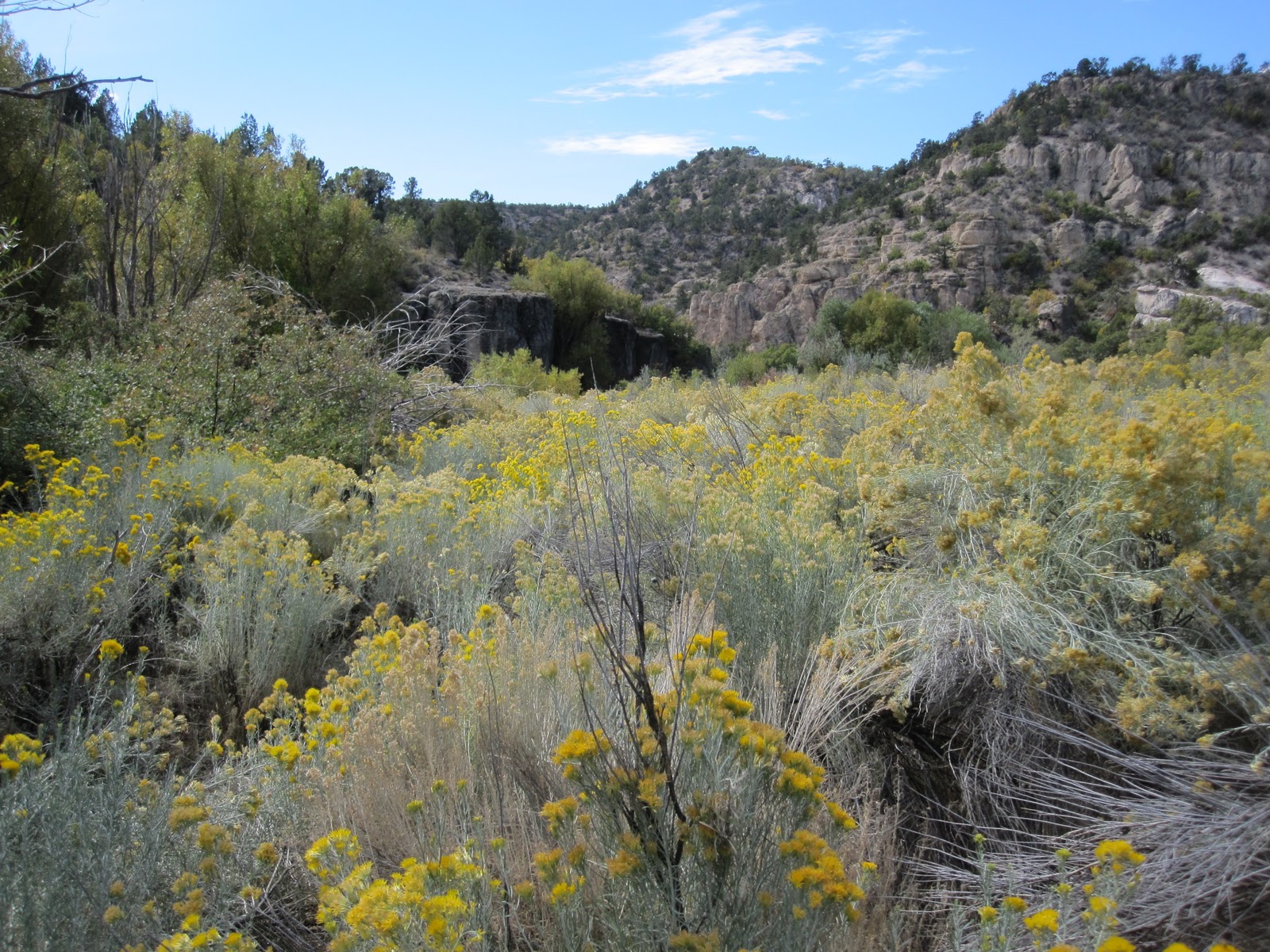
In October 2010, I drove to Motoqua, Utah with my brother, Chris, and cousins Russell Cannon, Bill Barnes and Ted Barnes. As we drove into the canyon, large green fields jumped out at us from amidst the desert landscape.
No water was running in Beaver Dam Wash,
but it is obvious they are tapping the underground water for use in the fields.
We were stopped from driving into Motoqua by a locked gate, but had a nice lunch in the shade of some large trees. We drove a short way up Beaver Dam Wash from Motoqua,
but had to cut it short due to time.
The day before, we talked to Ramon Mathews who owns the property below Beaver Dam State Park. He indicated that there used to be a large precipice in the Narrows, but that a very large flood a number of years ago had deposited large boulders and eliminated the steep drop-off.

ENDNOTES:
[1]  Rich

[2]  Cannon
[3]  Rich
[4]  Farrer
[5]  Bigler
[6]  Farrer
[7]  Bigler
[8]  Cannon
[9]  Farrer
[10]  Cannon
[11]  Bigler
[12]  Cannon
[13]  Bigler
[14]  Cannon
[15]  Bigler
[16]  Cannon
[17]  Farrer
[18]  Cannon
[19]  Bigler
[20]  Cannon
[21]  Bigler
[22]  George Brewerton carried a “large bowie-knife” with him on the Old Spanish Trail in 1848. (Brewerton, p. 40)
[23]  Cannon
[24]  Farrer
[25]  Bigler and Rich
[26]  Cannon
[27]  Rich
[28]  Landon, p. 103
[29]  Cannon
[30]  Bigler
[31]  Farrer
[32]  Rich
[33]  Bigler
[34]  Cannon
[35]  Rich
[36]  Cannon
[37]  Bigler
[38]  Bigler estimated 15 miles.
[39]  Landon, p. 104

Saturday, October 23, 2010

GQC: Tunnel Springs to Beaver Dam Wash (above the Narrows)

On Saturday, November 3, 1849, both the Flake and Smith companies, spent the morning in camp near Tunnel Springs in Headwaters Wash. They “laid by until nearly noon” to allow their “animals to rest and eat grass.” During this time, Henry Bigler “cut the three first letters” of his name “on a rock and the date.”[1]
In 1938, Charles Kelly discovered the Bigler initials “H.W.B.” and “1849” carved in white rock near Tunnel Springs. This definitively established where the Flake and Smith companies camped the evening of November 2nd and helped greatly in determining their route in 1849.[2] In October 2010, I went with my brother, Chris, and cousins Russell Cannon, Bill Barnes and Ted Barnes into Headwaters Wash to try and locate the Bigler initials. Below, I stand next to the initials.
We are all great grandsons of George Q. Cannon and Russ is a great great grandson of Charles Rich. Below, Ted, Bill, Russ and Chris near the initials.
We found the initials south east of Tunnel Springs in the white rocks on the other side of Headwaters Wash. Below, the white cliffs where the initials are, set back from the wash.
 The initials can be found be following the small dry stream, to the right of Russ, below, up from the wash to the white rocks, about 200 feet.
Around noon, the Flake and Smith companies continued west down Headwaters Wash[3] (below, a view of Headwaters Wash below Tunnel Springs, looking from the side of the wash above)
with the expectation of camping that evening in the valley mentioned by Captain Smith.[4] Another view down the wash from the center of the wash.
Some interesting rock formations west of Tunnel Springs in the vicinity of the old Bauer Ranch. This is near where a dirt road comes into Headwaters Wash, our route in.
White rocks near the old Bauer Ranch.
The valley Smith had told them about was supposed to extend westward, would have “water and feed,” and would allow them to “travel without having to cross mountains.” They crossed “the creek a number of times, and found some of the crossings rather miry.
The canyon was narrow and the mountains on each side towered up perpendicular and rocky. There were a number of caves in the sides.”[5]
On our visit in October 2010, we found no water in Headwaters Wash until Tunnel Springs. The water from Tunnel Springs and from a source on the south side of the wash combined to provide a small, very small moving stream, which in places was much more like a marsh than a stream.
I was wearing boots and at no time while walking through the stream did I have water go over the top of my boots. Travel near the stream, and in fact everywhere in the tight canyon, was difficult
 because of the dramatic increase in vegetation
due to the water.
We also noted the striking number of caves
in the rocks
in the walls of the canyon.
More Headwaters Wash pictures:
A small beaver dam.
Chew marks of a beaver.
After traveling down the canyon about two miles[6] the Flake and Smith companies “found the canyon impassable and were compelled to climb a mountain, the sides of which were covered with cedar. The ascent of” the “mountain was very difficult for” their “pack animals.” They “then traveled over some cedar ridges, and found” themselves “in a position where, to get any farther,” they had to “climb a steep rocky mountain. It was difficult for a man on foot to make the ascent” and the pack animals had an even more difficult time reaching the summit.[7] At the summit they “found Captain Smith’s company stopped” and “busily” engaged in “fixing the road to descend the mountain.”[8] The Flake company likely jumped in to assist. The descent was “more difficult and dangerous” than the climb. The road they made wound “round the mountain to a spur that sloped gradually to the creek; but, even then, great care had to be taken; one false step would have precipitated an animal and pack down the mountain without any prospect of escaping with life.” They “all reached the bottom of the mountain without accident.”[9] They were back at the creek they had originally left that morning, but it had “increased in size very much”[10] and “had become a beautiful stream.”[11]

Michael Landon, editor of The Journals of George Q. Cannon, Volume 1: To California in ’49 (Deseret Book, Salt Lake City: 1999), believes they left the canyon, to the east, just north of Schroeder Lake.[12] I believe they left the canyon to the west in the vicinity of Hamblin Ranch. Headwaters Wash continues south from Tunnel Springs for about three miles where it meets Pine Park Canyon in a “Y” junction and becomes Beaver Dam Wash. Schroeder Lake, a man-made lake which has recently been drained and the creek bed restored to its original form, was another mile down Beaver Dam Wash. Two miles below Tunnel Springs would still have been within Headwaters Wash. If they had gone out to the east, they would have run into Pine Park Canyon which is much steeper than Headwaters Wash and I believe impassable with horses. If they left the canyon past the junction of Pine Park Canyon, it would have been well beyond the stated two miles and they would have known the reason for the increase in the size of the creek. The creek coming out of Pine Park Canyon has much more water in it than the creek coming out of Headwaters Wash. Below, in Beaver Dam Wash, below the confluence of Headwaters Wash and Pine Park Canyon.
When they combine at the “Y” junction the creek increases in size.
A beaver dam in Beaver Dam Wash.
In October 2010, my cousin, Russ Cannon, and I hiked from Tunnel Springs down to Hamblin Ranch through Headwaters Wash. There was only one spot I could conceive of them leaving Headwaters Wash to the east, or really the south at that point,
and it was so steep I don’t believe the horses could have made it out. There did not appear to be any reasonable places to leave the wash to the west or north until just north of Hamblin Ranch, about two and a half miles south of Tunnel Springs, where it opens up to the west but is still quite hilly. Hamblin Ranch, on the topographical map, is no longer in existence, except for some piled up lumber. It is located about a half mile northwest of the “Y” junction of Headwaters Wash and Pine Park Canyon. If they left Headwater Wash there, they would have been unaware of the creek coming in from Pine Park Canyon and they would have traveled over a number of cedar ridges, in what is now Beaver Dam State Park. Below, the vicinity of Hamblin Ranch looking southeast to where Pine Park Canyon and Headwaters Wash meet.
Mountain lion tracks in the mud just above Hamblin Ranch.
We spent some time talking to Ramon Mathews, the owner of land just below Beaver Dam State Park. He indicated that when he was young, old-timers talked about finding evidence of a road being built on the west side of the canyon with evidence of trees being chopped down. That would be consistent with the Flake and Smith companies leaving the wash on the west side and re-entering Beaver Dam Wash from the west side below Beaver Dam State Park.

Five or six years ago, traveling back to California from a visit to Utah, I made a quick visit to Beaver Dam State Park, hoping to hike up Beaver Dam Wash and find the Bigler initials. I had not looked at a topo map and was going solely on what I interpreted of Landon’s description of the Bigler initials being about two miles north near a spring. With hindsight and much greater knowledge of the area from looking at topo maps and hiking down Headwaters Wash, I determined that I hiked up Pine Park Canyon instead. It was where the canyon was much more perpendicular and had much greater water flow.

Returning to the Flake and Smith companies, after entering Beaver Dam Wash, they “crossed” the “creek a great number of times” until they “arrived at a large bend with a tolerable supply of grass” on it.[13] “As there was no prospect” of them “reaching the valley” they were looking for, they “concluded it best to camp for the night.”[14] The area had an abundance of different types of trees, including “hickory, ash, maple, box elder and mesquite.” Nearby camp, they also found an “Indian wigwam.” Its “occupants had evidently run away upon hearing” their “approach, as a pot made of earthenware, containing some food, was on the fire.”[15] All of the Indians’ “effects,” were “in and about” the wigwam, including “corn cobs, pumpkin seed, specimens of stone coal”[16] and a “bow.” They were in Paiute “territory” which were known for their “depredations” and determined they “had to be very vigilant.”[17] Henry Bigler noted that he stood guard that night, likely a nervous evening for him knowing that Indians were nearby. In retrospect, George Cannon noted that they “found the Indians all through this country very shy; they would run away” from them “like rabbits, they were so scared.” He was “convinced that many of them had never seen white men before,” and their “appearance in their country terrified them.”[18] They traveled about 10 miles that day.[19] As the “day had been cloudy, and in the evening” they “were threatened with a storm,” George Cannon thought he "would prevent the water from running under" them "as it had during the last rain, by making a small trench" around their bed. However, it did not save him “from a drenching. It rained heavily all night”[20] and "all the water that ran of[f[ the robe ran inside the tranch under the bed." On the other hand, Henry Bigler and others of the company made “wigwams of willow by planting them in the ground and lashing the tops together and spreading blankets over them.” This “turned the rain first rate.”[21]

Ten miles travel during the day would put them a mile or so north of the Narrows in Beaver Dam Wash.

[1]  Bigler
[2]  Charles Kelly found Bigler’s initials cut in the volcanic ash wall of the canyon in September 1938. His account is in Desert Magazine, February, 1939 (49ers, p. 151, n. 16); The initials “H.W.B.” were found at the Irving Bauer ranch near the head of the Beaver Dam Wash. (Pioneers, p. 46) In October 2010, I talked with Ramon Mathews who lives just below Beaver Dam State Park. Irving Bauer was his great uncle.
[3]  Bigler
[4]  Farrer
[5]  Cannon
[6]  Rich
[7]  Cannon
[8]  Farrer
[9]  Cannon; Bigler stated, “one place where we came along today that one false step would plunge a horse hundreds of feet down the mountain without any possibility of saving life.”
[10]  Farrer
[11]  Rich
[12]  Landon, p. 102.
[13]  Farrer
[14]  Farrer
[15]  Cannon; The Cedar Southern Paiutes had pottery that was sun-dried and unfired. (Indian Handbook, p. 375)
[16]  Rich
[17]  Farrer
[18]  Cannon; the Southern Paiutes were “notably pacific.” (Indian Handbook, p. 381)
[19]  Rich; Bigler estimated 12 miles.
[20]  Cannon
[21]  Bigler

Wednesday, October 20, 2010

GQC: Shoal Creek to Tunnel Springs

This is a continuation of my retracing George Q. Cannon's 1849 journey.

On November 2, 1849, the Flake company woke in the morning to find snow on the mountains. They were on their way by 9:00 a.m.[1] They traveled up the side of the “dry bed” of Shoal Creek, which George Q. Cannon called “Dry Sandy,” for a mile and found where the Smith company had camped for the night. Below, a picture of Shoal Creek taken several years ago, although it had water in it.
A mile further, they reached “a small stream, impregnated with iron,” that entered into the dry bed of Shoal Creek and sank into the sand.[2] In general, the valley they were traveling through afforded “plenty of feed.” The mountains around them were “destitute of any timber,” but they did have cedar, scrub pine and sage brush.
After another eight miles they passed through a “fine patch of grass” and then found “a beautiful spring” to their left, perhaps Nephi Spring.[3] They continued up Shoal Creek through Nephi Draw in a northwesterly direction[4] another three miles to “a narrow pass in a canyon” and “found plenty of water which arose and sunk in about 300 yards.” Further “up the canyon” they found “a small valley surrounded by hills or low mountains.” They continued their “course” southwest for 1 ½ miles through White Rocks Draw and then went south through Jessie Tie Wash, “continuing up the bed” of a creek for ¾ mile. They “entered a narrow canyon” to their right, perhaps California Draw, “filled with cedar.” They “traveled up this canyon” about one mile and “then turned” their course south “over the dividing ridge of the Great Basin.” This is where “the water, instead of flowing into the Basin,…runs into the Pacific Ocean.”[5] “Considerable snow had fallen” on the ridge “during the night” and “some still continued on the ground.”[6] From the ridge, they could see mountains as far as the eyes could see.[7] George Cannon’s pack horse, “Croppy,” had “been gradually failing” for days. With the rigors of this days journey, Croppy could “not keep up with the company” and Cannon “was left behind”[8] near the dividing ridge.[9] Joseph Cain and Henry Bigler “would not leave” Cannon[10] and “endeavoured” to help him “drive” Croppy to camp. Over the dividing ridge they traveled to Headwaters Wash, “a large canyon running west southwest.” The picture below is of Headwaters Wash, near the top, looking back.
They followed Headwaters Wash until they came to what Cannon called the “Devil’s Offset.”[11]
“The trail which the company had made led directly to it;” but there “they had stopped; they had found it impossible to pass there, and they had scattered in every direction to find a better route.” Cannon, Cain and Bigler “were very much puzzled to tell which way they had gone. After searching some time” they found “their trail again. They had gone back about a quarter of a mile, and made a circuit over the hills to the southward for about three miles, and reached the same canyon about one hundred yards below the Offset.” It appears that they went south over Roundup Flat, entered Clay Canyon, then went northwest up Clay Canyon back into Headwater Wash below the “Devil’s Offset.”[12]  Below, Clay Canyon, from a ridge between Clay Canyon and Headwaters Wash.
Meanwhile, the balance of the company continued “down the canyon” [Headwaters Wash] for “some time.” Below, Headwaters Wash, as viewed from the land above, goes diagonally through the photo.
They eventually reached a “flat of about 50 acres of grass.” Below, a picture of a raised area now full of sage brush which would have been the area filled with grass. Extensive cattle grazing in the area have likely changed the grassland into now-thick sagebrush. Tunnel Springs is to the right and out of the picture.
Below, Russ Cannon standing among the thick sagebrush of what was the grassland in 1849.
At the “lower end” of the flat they “found some good springs” [Tunnel Springs] which “supplied” them “with plenty of good water.” Below, the small canyon in which Tunnel Springs is located, viewed from the west looking east, is in the center of the photo. 
Below, Bill Barnes and Ted Barnes, walking toward Tunnel Springs from the east to the west. The largest springs are located in the green trees in the center of the photo.
The main springs are located in a depression in the ground. Below, Bill Barnes pointing toward a spring.
There is no flowing water in Headwaters Wash until Tunnel Springs. The small flow of water in Headwaters Wash is from Tunnel Springs as well as an apparent spring across the wash coming in from a small canyon on the south side. Below, one of the springs in Tunnel Springs.
Further back in the side canyon there are some very small springs. Below, beautiful foliage in fall colors at the back of the side canyon.
They also found “an old corn cob” near “an Indian Lodge” and a fire “which had just been covered up.” They saw the Indians at a distance.[13] Because of the Indian and his farming activities, they named the creek, “Farm Creek.”[14] Just before dark, Cannon, Cain and Bigler, found their way back into Headwater Wash, via Roundup Flat and Clay Canyon. With the decreasing light, the trail made by those ahead of them was getting harder to follow. They “hoped to see the campfires at every point” they rounded as they were concerned that they might “lose the trail” in the dark and “wander out” of the way. About the time they were considering camping for the night, Henry Bigler, “who was ahead, shouted that he smelled the camp,” which ultimately was about a ½ mile distant. They arrived to find both the Smith and Flake companies camped together,[15] just as some members of the Flake company were preparing to go out and find them.[16] They had traveled 25 miles and all of the animals were “fatigued.”[17]

In October 2010, I drove into Clay Canyon with my brother, Chris, and three cousins, Russ Cannon, Bill Barnes and Ted Barnes. We were investigating part of the 1849 route. We are all great-grandsons of George Q. Cannon and Russ is also a great-great-grandson of Charles Rich. A dirt road goes almost the entire length of Clay Canyon, stopping just short of Headwaters Wash. I climbed the ridge separating Clay Canyon from Headwaters Wash and could see what must have been referred to as the Devil’s Offset.
I climbed down the ridge and hiked up through Headwaters Wash through the Devil’s Offset. It is a relatively short piece of the wash, but it goes down at a pretty good incline (or up, as I was doing it backwards) and is an obstacle course of large boulders and rocky outcroppings, with drops of three feet or more in a number of places.
It can be negotiated rather simply on foot, but would be a nightmare with horses.
Horseshoe Flat and Clay Canyon, by contrast, are quite flat and much more horse-friendly. This geography, proposed by Michael Landon, fits well with the journal entries.


[1] Bigler
[2] Cannon
[3] Hafen & Hafen identify this as being near the Terry ranch. (49ers, p. 202). Michael N. Landon, editor, The Journals of George Q. Cannon, Volume 1: To California in ’49 (Deseret Book, Salt Lake City: 1999), hereafter “Landon,” proposes a route for the Flake and Smith companies with some specificity. If his proposed route is correct, then the Spring would appear to be Nephi Spring in Nephi Draw. There is a Terry Spring several miles southeast of Nephi Spring, presumably the spring on the Terry ranch.
[4] Farrer indicates a southwest direction, but Hafen & Hafen question whether it was northwest. (49ers, p. 202) Landon indicates they went northwest up Nephi Draw. (p. 101)
[5] Cannon
[6] Farrer
[7] Rich
[8] Cannon
[9] Farrer
[10] Cannon
[11] Farrer
[12] Landon, p. 102.
[13] Farrer
[14] Rich
[15] Cannon
[16] Farrer
[17] Bigler; Farrer and Rich also confirm the 25 mile distance.