The Sonny Bono Salton Sea NWR (the "Refuge") is found in Southeastern California at the southern and southeastern end of the Salton Sea.
The
Salton Sink is a closed drainage area which separates the Coachella Valley from the Imperial Valley and has alternately been a lake and a dry lake bed as the channel of the Colorado River has changed off and on over time from the Gulf of California to the Salton Sink. 3,000 years ago the Salton Sink was covered by
Lake Cahuilla that was 105 miles long and 300 feet deep. In 1905, when the Salton Sink was dry, the Colorado River flooded through two dry arroyos creating the New River and the Alamo River and for two years these new rivers carried the entire flow of the Colorado River into the Salton Sink and created the Salton Sea. This flooding was eventually controlled by human intervention and the Colorado diverted back to the Gulf of California.
The resultant
Salton Sea, much smaller than the previous Lake Cahuilla, has a surface area of 343 square miles, but is still the largest lake in California. It is up to 35 miles long and 15 miles wide, has an average depth of 31 feet and a maximum depth of 51 feet. The lake surface is 236 feet below sea level and the low point of the lake floor is only 5 feet higher than Badwater, the low point of Death Valley NP. Three streams feed into it: (a) the
Whitewater River with headwaters in the San Gorgonio Wilderness of the San Bernardino Mountains feeds the northern end, mostly through the porous desert floor, but occasionally above ground during flooding; (b) the
Alamo River, which supported part of the Colorado River flow from 1905 to 1907, flows from the Mexicali Valley in Baja California through the Imperial Valley into the southern end and is mostly a ravine full of vegetation with a small water-course at the bottom; and (c) the
New River, which also supported part of the Colorado River flow from 1905 to 1907, flows from the Cerro Prieto Volcano southeast of Mexicali, through Mexicali and Calexico into the southeastern end and is now mostly agricultural runoff, municipal discharge and industrial wastewater and is severely polluted. The Salton Sea has no outlet and loses water only through evaporation. The dissolved salts left behind raise salinity and it now has a salinity 25% higher than the ocean.
The Refuge currently consists of about 2,200 acres and has two units separated by 18 miles. Each unit has managed wetlands, tree rows and agricultural fields. There are 826 acres of wetland flooded with water from the Imperial Irrigation District. Tree rows include honey mesquite, screwbean mesquite, blue palo verde, fairy duster, sweet acacia and desert ironwood. There are 869 acres of croplands which include alfalfa, wheat, rye grass, milo and sudan grass to provide forage for wintering geese and other migratory birds.
Unit 1, off Verdel Road at the south end of the Salton Sea, has the half-mile Michael Hardenberger Trail which goes to a freshwater pond that is a favorite nesting area for the endangered Yuma clapper rail. The New River enters the Salton Sea at this Unit.
 |
| Unit 1 |
 |
| An observation deck next to the parking area. |
 |
| Another observation deck, further north, viewed from the above observation deck. |
 |
| Reeds along the Hardenberger Trail. |
 |
| Freshwater pond. |
 |
| Blind at the freshwater pond. |
 |
| An observation deck which has been closed off due to lack of water. The first observation deck is in the left background. |
 |
| Sandhill cranes |
 |
| Ross's geese mix with snow geese. |
 |
| Blue morph snow goose. |
 |
| Ross's goose |
 |
| Great egret |
 |
| Black-necked stilt |
 |
| Great blue heron |
 |
| Green heron |
 |
| Northern shoveler |
Unit 2, which includes the visitor center, is at the southeastern side of the Salton Sea and has the two mile roundtrip Rock Hill Trail which goes to the top of Rock Hill. The Alamo River enters the Salton Sea at this Unit.
 |
| Snow geese dot a green field with the visitor center (back center), observation deck (back right) and a geothermal electricity plant pushing out steam (far back) behind them. |
 |
| More of the agriculture field further north of the visitor center. |
 |
| Tree rows and the Rock Hill Trail. |
 |
| Rock Hill in the background. |
 |
| Rock Hill |
 |
| View of the south end of the Salton Sea from Rock Hill. |
 |
| View of a more northern portion of the Salton Sea from Rock Hill. |
 |
| Snow covered mountains across the Salton Sea. |
 |
| Man-made islands in a freshwater pond provide safe nesting sites from marauding raccoons, coyotes and skunks. |
 |
| Snow geese |
 |
| Snow geese |
 |
| Snow goose |
 |
| Snow goose |
 |
| Blue morph snow goose |
 |
| Great egret |
 |
| White-crowned sparrow |
 |
| Northern mockingbird |
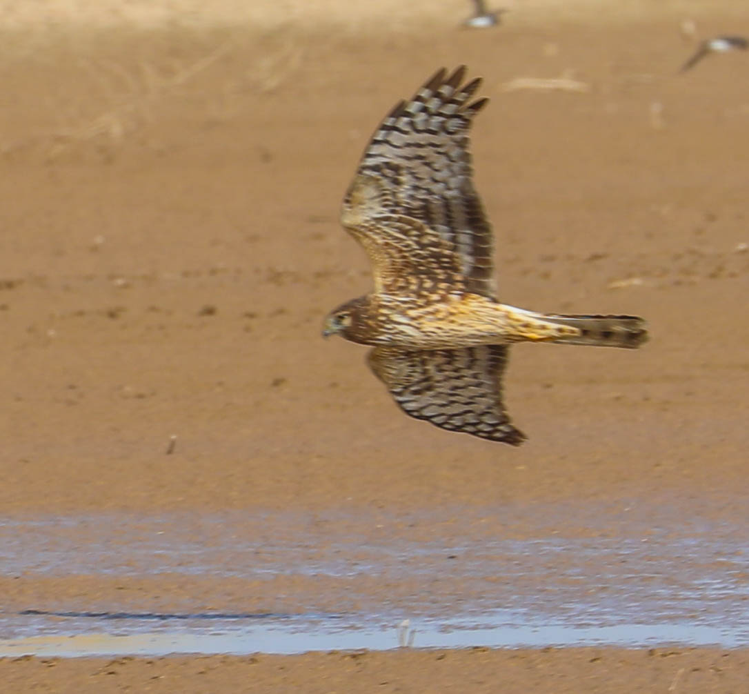
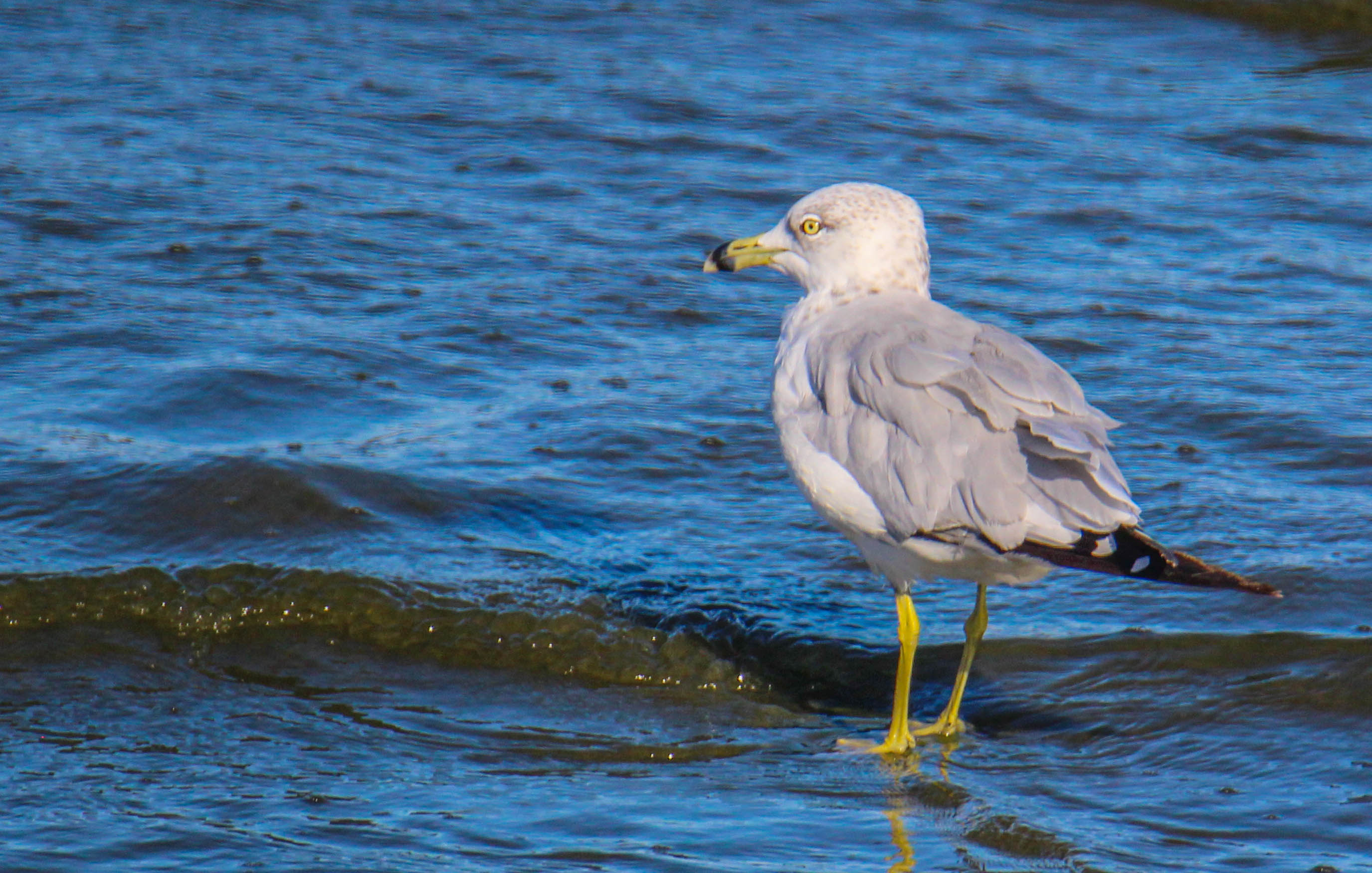
Additional wildlife I've seen since this first post:


I really can't believe I had never been here before. If we were out-of-state travelers, this would have been on our list. It reminds me a little of the Everglades. You have some wonderful photos. I think my favorite is the snow goose in flight.
ReplyDelete