On Saturday, November 3, 1849, both the Flake and Smith companies, spent the morning in camp near Tunnel Springs in Headwaters Wash. They “laid by until nearly noon” to allow their “animals to rest and eat grass.” During this time, Henry Bigler “cut the three first letters” of his name “on a rock and the date.”[1]

In 1938, Charles Kelly discovered the Bigler initials “H.W.B.” and “1849” carved in white rock near Tunnel Springs. This definitively established where the Flake and Smith companies camped the evening of November 2nd and helped greatly in determining their route in 1849.[2] In October 2010, I went with my brother, Chris, and cousins Russell Cannon, Bill Barnes and Ted Barnes into Headwaters Wash to try and locate the Bigler initials. Below, I stand next to the initials.

We are all great grandsons of George Q. Cannon and Russ is a great great grandson of Charles Rich. Below, Ted, Bill, Russ and Chris near the initials.

We found the initials south east of Tunnel Springs in the white rocks on the other side of Headwaters Wash. Below, the white cliffs where the initials are, set back from the wash.

The initials can be found be following the small dry stream, to the right of Russ, below, up from the wash to the white rocks, about 200 feet.

Around noon, the Flake and Smith companies continued west down Headwaters Wash[3] (below, a view of Headwaters Wash below Tunnel Springs, looking from the side of the wash above)

with the expectation of camping that evening in the valley mentioned by Captain Smith.[4] Another view down the wash from the center of the wash.

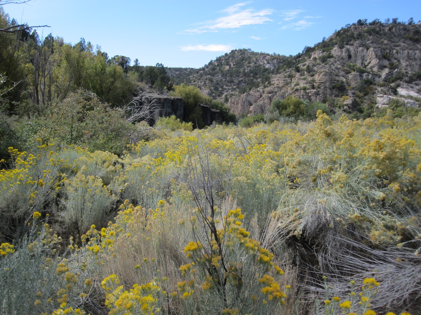
Some interesting rock formations west of Tunnel Springs in the vicinity of the old Bauer Ranch. This is near where a dirt road comes into Headwaters Wash, our route in.

White rocks near the old Bauer Ranch.

The valley Smith had told them about was supposed to extend westward, would have “water and feed,” and would allow them to “travel without having to cross mountains.” They crossed “the creek a number of times, and found some of the crossings rather miry.

The canyon was narrow and the mountains on each side towered up perpendicular and rocky. There were a number of caves in the sides.”[5]

On our visit in October 2010, we found no water in Headwaters Wash until Tunnel Springs. The water from Tunnel Springs and from a source on the south side of the wash combined to provide a small, very small moving stream, which in places was much more like a marsh than a stream. 

I was wearing boots and at no time while walking through the stream did I have water go over the top of my boots. Travel near the stream, and in fact everywhere in the tight canyon, was difficult
because of the dramatic increase in vegetation

due to the water.

We also noted the striking number of caves

in the rocks

in the walls of the canyon.

More Headwaters Wash pictures:

A small beaver dam.

Chew marks of a beaver.

After traveling down the canyon about two miles[6] the Flake and Smith companies “found the canyon impassable and were compelled to climb a mountain, the sides of which were covered with cedar. The ascent of” the “mountain was very difficult for” their “pack animals.” They “then traveled over some cedar ridges, and found” themselves “in a position where, to get any farther,” they had to “climb a steep rocky mountain. It was difficult for a man on foot to make the ascent” and the pack animals had an even more difficult time reaching the summit.[7] At the summit they “found Captain Smith’s company stopped” and “busily” engaged in “fixing the road to descend the mountain.”[8] The Flake company likely jumped in to assist. The descent was “more difficult and dangerous” than the climb. The road they made wound “round the mountain to a spur that sloped gradually to the creek; but, even then, great care had to be taken; one false step would have precipitated an animal and pack down the mountain without any prospect of escaping with life.” They “all reached the bottom of the mountain without accident.”[9] They were back at the creek they had originally left that morning, but it had “increased in size very much”[10] and “had become a beautiful stream.”[11]
Michael Landon, editor of The Journals of George Q. Cannon, Volume 1: To California in ’49 (Deseret Book, Salt Lake City: 1999), believes they left the canyon, to the east, just north of Schroeder Lake.[12] I believe they left the canyon to the west in the vicinity of Hamblin Ranch. Headwaters Wash continues south from Tunnel Springs for about three miles where it meets Pine Park Canyon in a “Y” junction and becomes Beaver Dam Wash. Schroeder Lake, a man-made lake which has recently been drained and the creek bed restored to its original form, was another mile down Beaver Dam Wash. Two miles below Tunnel Springs would still have been within Headwaters Wash. If they had gone out to the east, they would have run into Pine Park Canyon which is much steeper than Headwaters Wash and I believe impassable with horses. If they left the canyon past the junction of Pine Park Canyon, it would have been well beyond the stated two miles and they would have known the reason for the increase in the size of the creek. The creek coming out of Pine Park Canyon has much more water in it than the creek coming out of Headwaters Wash. Below, in Beaver Dam Wash, below the confluence of Headwaters Wash and Pine Park Canyon.

When they combine at the “Y” junction the creek increases in size.

A beaver dam in Beaver Dam Wash.

In October 2010, my cousin, Russ Cannon, and I hiked from Tunnel Springs down to Hamblin Ranch through Headwaters Wash. There was only one spot I could conceive of them leaving Headwaters Wash to the east, or really the south at that point,

and it was so steep I don’t believe the horses could have made it out. There did not appear to be any reasonable places to leave the wash to the west or north until just north of Hamblin Ranch, about two and a half miles south of Tunnel Springs, where it opens up to the west but is still quite hilly. Hamblin Ranch, on the topographical map, is no longer in existence, except for some piled up lumber. It is located about a half mile northwest of the “Y” junction of Headwaters Wash and Pine Park Canyon. If they left Headwater Wash there, they would have been unaware of the creek coming in from Pine Park Canyon and they would have traveled over a number of cedar ridges, in what is now Beaver Dam State Park. Below, the vicinity of Hamblin Ranch looking southeast to where Pine Park Canyon and Headwaters Wash meet.

Mountain lion tracks in the mud just above Hamblin Ranch.

We spent some time talking to Ramon Mathews, the owner of land just below Beaver Dam State Park. He indicated that when he was young, old-timers talked about finding evidence of a road being built on the west side of the canyon with evidence of trees being chopped down. That would be consistent with the Flake and Smith companies leaving the wash on the west side and re-entering Beaver Dam Wash from the west side below Beaver Dam State Park.
Five or six years ago, traveling back to California from a visit to Utah, I made a quick visit to Beaver Dam State Park, hoping to hike up Beaver Dam Wash and find the Bigler initials. I had not looked at a topo map and was going solely on what I interpreted of Landon’s description of the Bigler initials being about two miles north near a spring. With hindsight and much greater knowledge of the area from looking at topo maps and hiking down Headwaters Wash, I determined that I hiked up Pine Park Canyon instead. It was where the canyon was much more perpendicular and had much greater water flow.
Returning to the Flake and Smith companies, after entering Beaver Dam Wash, they “crossed” the “creek a great number of times” until they “arrived at a large bend with a tolerable supply of grass” on it.[13] “As there was no prospect” of them “reaching the valley” they were looking for, they “concluded it best to camp for the night.”[14] The area had an abundance of different types of trees, including “hickory, ash, maple, box elder and mesquite.” Nearby camp, they also found an “Indian wigwam.” Its “occupants had evidently run away upon hearing” their “approach, as a pot made of earthenware, containing some food, was on the fire.”[15] All of the Indians’ “effects,” were “in and about” the wigwam, including “corn cobs, pumpkin seed, specimens of stone coal”[16] and a “bow.” They were in Paiute “territory” which were known for their “depredations” and determined they “had to be very vigilant.”[17] Henry Bigler noted that he stood guard that night, likely a nervous evening for him knowing that Indians were nearby. In retrospect, George Cannon noted that they “found the Indians all through this country very shy; they would run away” from them “like rabbits, they were so scared.” He was “convinced that many of them had never seen white men before,” and their “appearance in their country terrified them.”[18] They traveled about 10 miles that day.[19] As the “day had been cloudy, and in the evening” they “were threatened with a storm,” George Cannon thought he "would prevent the water from running under" them "as it had during the last rain, by making a small trench" around their bed. However, it did not save him “from a drenching. It rained heavily all night”[20] and "all the water that ran of[f[ the robe ran inside the tranch under the bed." On the other hand, Henry Bigler and others of the company made “wigwams of willow by planting them in the ground and lashing the tops together and spreading blankets over them.” This “turned the rain first rate.”[21]
Ten miles travel during the day would put them a mile or so north of the Narrows in Beaver Dam Wash.
[1] Bigler
[2] Charles Kelly found Bigler’s initials cut in the volcanic ash wall of the canyon in September 1938. His account is in Desert Magazine, February, 1939 (49ers, p. 151, n. 16); The initials “H.W.B.” were found at the Irving Bauer ranch near the head of the Beaver Dam Wash. (Pioneers, p. 46) In October 2010, I talked with Ramon Mathews who lives just below Beaver Dam State Park. Irving Bauer was his great uncle.
[3] Bigler
[4] Farrer
[5] Cannon
[6] Rich
[7] Cannon
[8] Farrer
[9] Cannon; Bigler stated, “one place where we came along today that one false step would plunge a horse hundreds of feet down the mountain without any possibility of saving life.”
[10] Farrer
[11] Rich
[12] Landon, p. 102.
[13] Farrer
[14] Farrer
[15] Cannon; The Cedar Southern Paiutes had pottery that was sun-dried and unfired. (Indian Handbook, p. 375)
[16] Rich
[17] Farrer
[18] Cannon; the Southern Paiutes were “notably pacific.” (Indian Handbook, p. 381)
[19] Rich; Bigler estimated 12 miles.
[20] Cannon
[21] Bigler
This is a nice piece Bob. Thanks for all of the planning that went into this trip. I had a great time. It was fun to have a reunion with with the uncles as well.
ReplyDeleteHow awesome to follow in the footsteps of an ancestor! I envy you there.
ReplyDelete