Back to Borrego Palm Canyon (see http://cannundrum.blogspot.com/2009/03/borrego-palm-canyon-to-south-fork.html) with the young men to hike up to the South Fork waterfall. I found that my small digital camera had no memory card and I didn't want to carry my bulky Canon Eos around my neck, so I didn't take any pictures until reaching South Fork and then on the way back. Many of the pictures and the video on this post were taken by Larry.
We left Redlands about 4:20 a.m. and began to hike about 6:40 a.m. We quickly hiked the 1 1/2 miles to the main California fan palm grove up the canyon and did not see anyone else, unlike my Disneyland experience last month. The hike to the top of the first bend of the canyon above the grove is the most difficult hiking until South Fork. It is strenuous boulder hopping, climbing up, over, around and down rocks and crossing the stream. We went at a pretty good clip. Brian and Robby, below, near a small pool.
 Just above the pool, Garrett stands before some towering palms.
 Along the way, Brian's knees started to give him problems (he is a football player and they have taken a lot of abuse). He and Robby decided to stop and wait for us to return. The rest of us continued up canyon.
Below, I stand at a nice camping spot at the last grove of palm trees before South Fork.
 Spring colors were evident, but not overwhelming. They could be found, but they were scattered. We saw a few blooming beaver-tail cactus.
 Brittlebush
.JPG) Thistles
Thistles And yucca.
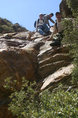
 For me, having done the rest of the canyon recently, the highlight of the day was the hike up the South Fork of Borrego Palm Canyon to the waterfall. Sources I have read indicate that the South Fork provides all of the water for the stream in the Middle Fork of the canyon, including the main palm tree grove. However, as with my last trip, there was water in the Middle Fork above the South Fork, surely due to the recent rains. Unlike the Middle Fork we had been hiking up, with occasional palm trees and sparse vegetation, the South Fork is choked with vegetation, to the point that it is difficult to get near the stream. The best way to maneuver through the canyon is to hug, or climb up, the sides of the canyon walls where possible. Below, Ryan and Garrett making their way along the side of the canyon.
 At one point, we were forced to forego an easier route for a more difficult one, as we encountered large quantities of poison oak. So we had to literally throw ourselves at the vegetation to cross to the other side of the canyon, breaking away vines that wrapped around our bodies and our packs. It was VERY slow going. We were able to circumvent the poison oak and find a route to the other side, then back again, then up the side of the canyon, avoiding most of the vegetation. The picture below surveys the portion of the South Fork we have just come through. We climbed around the left side.
 Larry was first to identify the waterfall in the distance beyond the vegetation.
 We maneuvered through the canyon some more, crossing sides a couple of times.
 As we got closer, it became more evident that Larry was right. I was surprised to see the waterfall so soon. I had read it was .4 or .7 miles up the South Fork. It seemed shorter than that in distance, although that short distance takes quite a while, given the difficulty of the hiking.
 Ryan, Larry and Garrett at the bottom of the waterfall.
 Larry took this video clip of Ryan, Garrett and I climbing up the right side of the bottom portion of the waterfall.
After climbing the bottom portion, we found another level with a shorter, but steeper climb. Larry, Ryan and Garrett stand where we climbed up the right side.


There we posed for a picture, with the rugged canyon and mountains behind.

Some beautiful country lay beyond us, but it will have to remain un-explored by us until another day (hopefully).

It was time for us to stop for lunch, then turn around and go back the way we had come. Below, Garrett and Larry share a family hike-lunch tradition: a sandwich of Ritz crackers, sliced salami and cheese spread. It is amazingly good and they generously shared their lunch with Ryan and me, who had less appealing lunches.
 It is almost always easier to climb up something, then to go back down it. It was true in this case. Ryan led the way down the upper level of the waterfall we had just come up.
Then it was time for the trickier middle section. Ryan, Garrett and Larry survey the terrain below to figure out the best way to go down.

Larry went first and slid into the waterfall, getting wet. He helped guide Garrett, then Ryan down.

It was down the opposite side of the waterfall we'd come up. With Larry's guidance, Garrett and Ryan avoided getting wet.

Next, it was my turn. I didn't like the way they went, so decided to go back down the way we'd come up. Larry videod my attempt.
Once below the middle section, it was time to go down the bottom section. Larry, Garrett and Ryan slide on their rear-ends down a section of rock.
Then they negotiated the rest of the way down...

fairly easily.
 Our way back down through South Fork was much easier. We knew the route and the most difficult passage, through the trees, was made easier as we just followed our same path, still visible. We made our way down canyon and found Brian and Robby resting at the main grove. It was not as bad, people-wise, as last time. It was Disneyland on a slow day. We got out about 3:00 p.m. and enjoyed some burgers at Carl's Jr., outside Palm Springs, on the way home.
 I was surprised to wake up the next morning very sore. The body takes a beating while hiking this type of country. I hope some day to be able to explore beyond the waterfall in South Fork, as well as to go further up the Middle Fork and into the North Fork. It is amazing, wild country. And so close to home.
No comments:
Post a Comment